Saint Martin de l'If
Located in Arrondissement de Rouen, Seine-Maritime Coordinates: 49°34′01″ N 0°49′51″ E
- Population
- 1,686
- 1.7K
- Elevation
- 129 m
- above sea level
- Local time
- UTC+01:00
- Europe/Paris · UTC+01:00
- Places inside
- 8
- listed under Saint Martin de l'If
- Airports
- DOL Deauville Normandie airport54 km
- BVA Beauvais-Tillé airport94 km
About Saint Martin de l'If
Saint Martin de l'If is a village. Location: Arrondissement de Rouen, Seine-Maritime. Population: 1,686. Elevation: 129 m. The best months to visit are June–September. The nearest airport is Deauville Normandie airport (54 km). Nearby sights include Brotonne Bridge and Abbaye de Saint-Wandrille.
Photos of Saint Martin de l'If
-
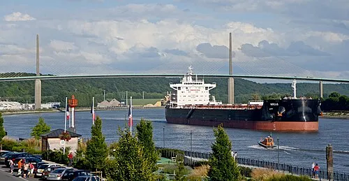
Brotonne Bridge Pline · CC BY-SA 3.0

Climate of Saint Martin de l'If
Best months for sightseeingBest months for sightseeing: June–September.
This month · November
A cold month
Day 10° · Night 5° · Rain 83 mm
- Hottest month
- August (day 21°)
- Coldest month
- February (night 2°)
- Wettest month
- November (83 mm)
- Driest month
- July (49 mm)
Bars: average monthly low and high temperature. Below: precipitation. Monthly averages for 1970–2000 at about 18 km resolution, adjusted for elevation. Highlighted months are mild and relatively dry. Source: WorldClim 2.1 (CC BY 4.0).
Show values as a table
| Month | Jan | Feb | Mar | Apr | May | Jun | Jul | Aug | Sep | Oct | Nov | Dec |
|---|---|---|---|---|---|---|---|---|---|---|---|---|
| Average high (°C) | 7° | 8° | 10° | 12° | 16° | 18° | 21° | 21° | 19° | 15° | 10° | 8° |
| Average low (°C) | 2° | 2° | 4° | 5° | 8° | 11° | 13° | 13° | 11° | 8° | 5° | 3° |
| Precipitation (mm) | 73 | 60 | 56 | 50 | 58 | 56 | 49 | 50 | 68 | 78 | 83 | 83 |
Other places to visit in this season: June July August September
How to get to Saint Martin de l'If
The nearest airport is Deauville Normandie airport (DOL), 54 km to the southwest as the crow flies. For international flights: Beauvais-Tillé airport (BVA) (94 km). The nearest large city is Rouen, 24 km to the southeast.
Airports
- Deauville Normandie airport (DOL) Deauville 54 kmsouthwest
- Beauvais-Tillé airport (BVA) Beauvais 94 kmeast
- Caen Carpiquet airport (CFR) Caen 103 kmsouthwest
Nearby large cities
- Rouen Population: 116.3K 24 kmsoutheast
- Le Havre Population: 186K 53 kmwest
- Caen Population: 110.6K 96 kmsouthwest
- Cergy-Pontoise Population: 183.4K 108 kmsoutheast
- Amiens Population: 143.1K 112 kmeast
Straight-line distances; road distances are longer. Airport data: OurAirports.
Day trips from Saint Martin de l'If
Within 100 km: 196 historic and cultural sites, 85 natural sites, 89 lakes, rivers and coasts.
0–25 km39 places
- La tourbière Lake 13 kmS
- Forêt Verte Natural site 20 kmSE
- Forêt du Trait Natural site 9 kmS
- Forêt de Saint-Arnoult Natural site 10 kmW
25–60 km129 places
- Biotropica Natural site 40 kmSE
- Grande Plage Beach 58 kmW
- Plage du Vasouy Beach 48 kmW
- Plage du Butin Beach 47 kmW
60–100 km202 places
- Plage de Fort-Mahon Beach 100 kmNE
- Juno Beach Beach 95 kmW
- Sword Beach Beach 89 kmW
- Plage de Riva Bella Beach 85 kmW
Straight-line distances.
Places in Saint Martin de l'If
8 placesBar: population relative to the most populous place in this list.
Cities & villages6
- Bois-Bance · Village
- Fréville · Village
- Le Mesnil · Village
- Le Pavillon · Village
- Les Héberts · Village
- Mont-de-l'If · Village
Nearby attractions & nature
Everything nearby-
Brotonne Bridge Landmark, Rives-en-Seine8 km SW
-
Abbaye de Saint-Wandrille Attraction, Rives-en-Seine6.2 km SW
-
Chateau de Louvetot Historic site, Louvetot7.6 km W
-
Prieuré Saint-Hyacinthe d'Yvetot Historic site, Yvetot8 km NW
-
Forêt du Trait Natural site, Seine-Maritime9.4 km S
-
Forêt de Saint-Arnoult Natural site, Seine-Maritime10 km W
Sources & licences
Data last updated: