Saint-Victor-et-Melvieu
Located in Arrondissement of Millau, Aveyron Coordinates: 44°03′04″ N 2°49′55″ E
- Population
- 371
- 371
- Elevation
- 630 m
- above sea level
- Local time
- UTC+01:00
- Europe/Paris · UTC+01:00
- Places inside
- 4
- listed under Saint-Victor-et-Melvieu
- Airports
- RDZ Rodez–Aveyron Airport48 km
- DCM Castres Mazamet Airport70 km
About Saint-Victor-et-Melvieu
Saint-Victor-et-Melvieu is a village. Location: Arrondissement of Millau, Aveyron. Population: 371. Elevation: 630 m. The best months to visit are June–September. The nearest airport is Rodez–Aveyron Airport (48 km). Nearby sights include Muze and Le Lévézou.
Climate of Saint-Victor-et-Melvieu
Best months for sightseeingBest months for sightseeing: June–September.
This month · November
A cold month
Day 10° · Night 3° · Rain 70 mm
- Hottest month
- July (day 25°)
- Coldest month
- January (night 0°)
- Wettest month
- October (86 mm)
- Driest month
- July (41 mm)
Bars: average monthly low and high temperature. Below: precipitation. Monthly averages for 1970–2000 at about 18 km resolution, adjusted for elevation. Highlighted months are mild and relatively dry. Source: WorldClim 2.1 (CC BY 4.0).
Show values as a table
| Month | Jan | Feb | Mar | Apr | May | Jun | Jul | Aug | Sep | Oct | Nov | Dec |
|---|---|---|---|---|---|---|---|---|---|---|---|---|
| Average high (°C) | 7° | 8° | 11° | 13° | 18° | 22° | 25° | 25° | 21° | 16° | 10° | 8° |
| Average low (°C) | 0° | 0° | 2° | 4° | 8° | 11° | 14° | 14° | 11° | 7° | 3° | 1° |
| Precipitation (mm) | 72 | 64 | 54 | 68 | 80 | 65 | 41 | 55 | 68 | 86 | 70 | 74 |
Other places to visit in this season: June July August September
How to get to Saint-Victor-et-Melvieu
The nearest airport is Rodez–Aveyron Airport (RDZ), 48 km to the northwest as the crow flies. The nearest large city is Montpellier, 97 km to the southeast.
Airports
- Rodez–Aveyron Airport (RDZ) Rodez/Marcillac 48 kmnorthwest
- Castres Mazamet Airport (DCM) Castres 70 kmsouthwest
- Béziers Vias airport (BZR) Béziers 91 kmsoutheast
Nearby large cities
- Montpellier Population: 248.3K 97 kmsoutheast
- Toulouse Population: 511.7K 122 kmsouthwest
- Nîmes Population: 148.2K 125 kmeast
- Perpignan Population: 110.7K 150 kmsouth
- Clermont-Ferrand Population: 147.9K 193 kmnorth
Straight-line distances; road distances are longer. Airport data: OurAirports.
Day trips from Saint-Victor-et-Melvieu
Within 100 km: 101 historic and cultural sites, 361 natural sites, 191 lakes, rivers and coasts.
0–25 km21 places
- Lac de Pareloup Lake 18 kmN
- Pyramide du Lagast Mountain 18 kmNW
- Bois des Ginestoux Natural site 25 kmSE
- Ruisseau le Vioulou River 17 kmN
25–60 km155 places
- Mont Trois Terres Mountain 46 kmSE
- Mont Saint-Amand Mountain 52 kmSE
- Mont de Roquelaure Mountain 50 kmN
- Roc des Pézouls Mountain 58 kmE
60–100 km477 places
- Plage du Lazaret Beach 100 kmSE
- Plage de la Corniche Beach 99 kmSE
- Plage des Quilles Beach 99 kmSE
- Étang de Thau Lake 97 kmSE
Straight-line distances.
Places in Saint-Victor-et-Melvieu
4 placesBar: population relative to the most populous place in this list.
Cities & villages3
- Mas de Landès · Village
- Melvieu · Village
- St. Victor · Village
Nearby attractions & nature
Everything nearby-
Muze River, Aveyron7.4 km E
-
Le Lévézou Mountain, Aveyron12 km N
-
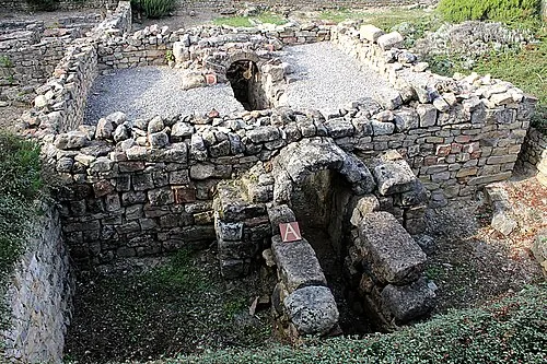 La Graufesenque Historic site, Millau21 km E
-
Eglise du Bon Pasteur Attraction, Saint-Affrique11 km S
-
Sorgues River, Aveyron11 km S
-
Cernon River, Aveyron13 km E
Sources & licences
Data last updated: