- Population
- 112,791
- 112.8K
- Elevation
- 559 m
- above sea level
- Local time
- UTC+01:00
- Europe/Paris · UTC+01:00
- Places inside
- 79
- listed under Arrondissement of Rodez
- Airports
- RDZ Rodez–Aveyron Airport27 km
- AUR Aurillac airport44 km
About Arrondissement of Rodez
Arrondissement of Rodez is a municipality. Location: Aveyron, Occitanie. Population: 112,791. Elevation: 559 m. The best months to visit are June–September. The nearest airport is Rodez–Aveyron Airport (27 km). Nearby sights include Bois de Bonneval and Plateau de la Viadène.
Photos of Arrondissement of Rodez
-
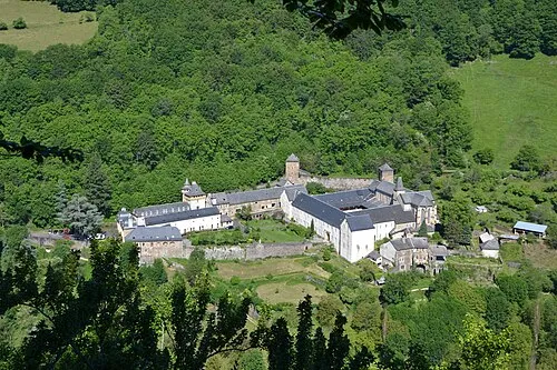
Bonneval Abbey Cd12cd · CC BY-SA 3.0

Climate of Arrondissement of Rodez
Best months for sightseeingBest months for sightseeing: June–September.
This month · November
A cold month
Day 11° · Night 3° · Rain 60 mm
- Hottest month
- July (day 25°)
- Coldest month
- January (night -1°)
- Wettest month
- October (79 mm)
- Driest month
- July (44 mm)
Bars: average monthly low and high temperature. Below: precipitation. Monthly averages for 1970–2000 at about 18 km resolution, adjusted for elevation. Highlighted months are mild and relatively dry. Source: WorldClim 2.1 (CC BY 4.0).
Show values as a table
| Month | Jan | Feb | Mar | Apr | May | Jun | Jul | Aug | Sep | Oct | Nov | Dec |
|---|---|---|---|---|---|---|---|---|---|---|---|---|
| Average high (°C) | 7° | 9° | 12° | 14° | 18° | 22° | 25° | 25° | 21° | 16° | 11° | 8° |
| Average low (°C) | -1° | 0° | 2° | 4° | 8° | 11° | 13° | 13° | 10° | 7° | 3° | 0° |
| Precipitation (mm) | 61 | 55 | 47 | 61 | 78 | 64 | 44 | 58 | 66 | 79 | 60 | 61 |
Other places to visit in this season: June July August September
How to get to Arrondissement of Rodez
The nearest airport is Rodez–Aveyron Airport (RDZ), 27 km to the southwest as the crow flies. The nearest large city is Clermont-Ferrand, 137 km to the north.
Airports
- Rodez–Aveyron Airport (RDZ) Rodez/Marcillac 27 kmsouthwest
- Aurillac airport (AUR) Aurillac 44 kmnorthwest
- Brive Souillac airport (BVE) Brive 112 kmnorthwest
Nearby large cities
- Clermont-Ferrand Population: 147.9K 137 kmnorth
- Montpellier Population: 248.3K 140 kmsoutheast
- Toulouse Population: 511.7K 149 kmsouthwest
- Nîmes Population: 148.2K 153 kmsoutheast
- Saint-Etienne Population: 176.3K 162 kmnortheast
Straight-line distances; road distances are longer. Airport data: OurAirports.
Day trips from Arrondissement of Rodez
Within 100 km: 163 historic and cultural sites, 340 natural sites, 195 lakes, rivers and coasts.
0–25 km66 places
- Lac de Maury Lake 12 kmNW
- Puy de l'Arbre Mountain 25 kmNW
- Mont de Roquelaure Mountain 10 kmSE
- Puy de Malavergne Mountain 16 kmE
25–60 km217 places
- Ancien îlot Gambetta Island 46 kmNW
- Lac de Pareloup Lake 41 kmS
- Lac de Grandval Lake 47 kmNE
- La Falzinde Mountain 57 kmNW
60–100 km415 places
- Lac de Montcineyre Lake 100 kmN
- Lac de Madic Lake 92 kmN
- Lac de la Landie Lake 95 kmN
- Étang Ferrier Lake 98 kmNW
Straight-line distances.
Arrondissement of Rodez and similar cities
Side by side with cities of similar size in the same country: population, elevation and climate.
| Measure | Arrondissement of Rodez | Mulhouse | Montreuil | Perpignan |
|---|---|---|---|---|
| Population | 112.8K | 111.4K | 111.2K | 110.7K |
| Elevation | 559 m | 238 m | 79 m | 43 m |
| Summer day (hottest month) | 25° | 25° | 25° | 29° |
| Winter night (coldest month) | -1° | -1° | 2° | 4° |
| Annual rainfall | 734 mm | 725 mm | 641 mm | 540 mm |
| Best months | Jun–Sep | May–Sep | May–Sep | May–Oct |
| Distance | — | 500 km | 478 km | 208 km |
Climate values are 1970–2000 monthly averages; straight-line distance.
Places in Arrondissement of Rodez
79 places- 1 Rodez 23.7K
- 2 Onet-le-Château 12.1K
- 3 Luc-la-Primaube 5.9K
- 4 Espalion 4.6K
- 5 Sévérac d'Aveyron 4.1K
- 6 Olemps 3.6K
- 7 Sébazac-Concourès 3.2K
- 8 Druelle Balsac 3.2K
- 9 Bozouls 3K
- 10 Salles-la-Source 2.3K
- 11 Le Monastère 2.2K
- 12 Saint Geniez d'Olt et d'Aubrac 2.2K
- 13 Laissac-Sévérac l'Église 2.1K
- 14 Sainte-Radegonde 1.8K
- 15 Marcillac-Vallon 1.7K
- 16 Valady 1.6K
- 17 Montrozier 1.6K
- 18 Argences en Aubrac 1.6K
- 19 Conques-en-Rouergue 1.5K
- 20 La Loubière 1.5K
- 21 Saint-Côme-d'Olt 1.4K
- 22 Laguiole 1.2K
- 23 Clairvaux-d'Aveyron 1.2K
- 24 Saint-Christophe-Vallon 1.1K
- 25 Rodelle 1.1K
- 26 Bertholène 1K
- 27 Palmas d'Aveyron 1K
- 28 Entraygues-sur-Truyère 964
- 29 Saint-Amans-des-Cots 709
- 30 Mur-de-Barrez 693
- 31 Saint-Laurent-d'Olt 641
- 32 Brommat 628
- 33 Castelnau-de-Mandailles 579
- 34 Gabriac 561
- 35 Mouret 560
- 36 Le Nayrac 546
- 37 Montpeyroux 546
- 38 Sébrazac 538
- 39 Nauviale 532
- 40 Saint-Chély-d'Aubrac 517
- 41 Taussac 504
- 42 Estaing 502
- 43 Lacroix-Barrez 502
- 44 Coubisou 462
- 45 Campuac 449
- 46 Saint-Hippolyte 443
- 47 Campagnac 431
- 48 Villecomtal 430
- 49 Sénergues 423
- 50 Golinhac 370
- 51 Sainte-Eulalie-d'Olt 367
- 52 Saint-Félix-de-Lunel 358
- 53 Thérondels 357
- 54 Muret-le-Château 346
- 55 Campouriez 322
- 56 Gaillac-d'Aveyron 322
- 57 Lassouts 318
- 58 Cantoin 303
- 59 Saint-Saturnin-de-Lenne 302
- 60 Saint-Martin-de-Lenne 295
Bar: population relative to the most populous place in this list.
Nearby attractions & nature
Everything nearby-
Bois de Bonneval Natural site, Aveyron4.6 km E
-
Plateau de la Viadène Natural site, Aveyron7.3 km N
-
Bois d'Aunac Natural site, Aveyron8 km NE
-
Ruisseau Boralde de la Poujade River, Aveyron7.5 km NE
-
Ruisseau le Boralde River, Aveyron10 km SE
-
Ruisseau Selvet River, Aveyron13 km N
-
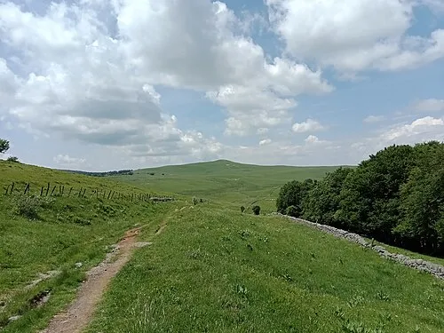 Puy de Gudette Mountain, Saint-Urcize21 km NE
-
Ruisseau le Mossau River, Aveyron14 km E
Other cities and towns in Aveyron
-
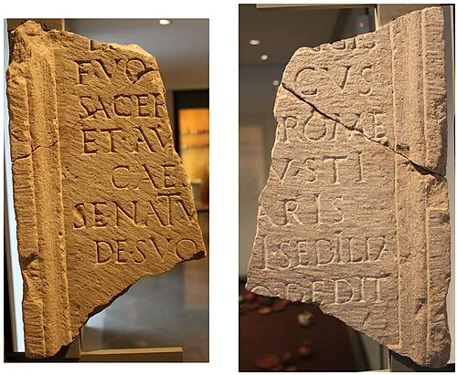 Rodez City, Rodez28 km SW
-
Arrondissement of Villefranche-de-Rouergue Municipality, Aveyron50 km SW
-
Arrondissement of Millau Municipality, Aveyron59 km S
-
Luc-la-Primaube Town, Luc-la-Primaube33 km SW
-
Decazeville Town, Decazeville39 km W
-
Millau Town, Millau59 km SE
Sources & licences
Data last updated: