- Population
- 87,266
- 87.3K
- Elevation
- 479 m
- above sea level
- Local time
- UTC+01:00
- Europe/Paris · UTC+01:00
- Places inside
- 96
- listed under Arrondissement of Villefranche-de-Rouergue
- Airports
- RDZ Rodez–Aveyron Airport25 km
- AUR Aurillac airport60 km
About Arrondissement of Villefranche-de-Rouergue
Arrondissement of Villefranche-de-Rouergue is a municipality. Location: Aveyron, Occitanie. Population: 87,266. Elevation: 479 m. The best months to visit are June–September. The nearest airport is Rodez–Aveyron Airport (25 km). Nearby sights include Ruisseau la Maresque and Ruisseau Alzou.
Climate of Arrondissement of Villefranche-de-Rouergue
Best months for sightseeingBest months for sightseeing: June–September.
This month · November
A cold month
Day 11° · Night 3° · Rain 64 mm
- Hottest month
- July (day 26°)
- Coldest month
- January (night 0°)
- Wettest month
- May (83 mm)
- Driest month
- July (47 mm)
Bars: average monthly low and high temperature. Below: precipitation. Monthly averages for 1970–2000 at about 18 km resolution, adjusted for elevation. Highlighted months are mild and relatively dry. Source: WorldClim 2.1 (CC BY 4.0).
Show values as a table
| Month | Jan | Feb | Mar | Apr | May | Jun | Jul | Aug | Sep | Oct | Nov | Dec |
|---|---|---|---|---|---|---|---|---|---|---|---|---|
| Average high (°C) | 8° | 9° | 12° | 15° | 19° | 23° | 26° | 26° | 22° | 17° | 11° | 8° |
| Average low (°C) | 0° | 0° | 2° | 4° | 8° | 11° | 13° | 13° | 10° | 7° | 3° | 0° |
| Precipitation (mm) | 64 | 62 | 52 | 66 | 83 | 69 | 47 | 58 | 68 | 75 | 64 | 68 |
Other places to visit in this season: June July August September
How to get to Arrondissement of Villefranche-de-Rouergue
The nearest airport is Rodez–Aveyron Airport (RDZ), 25 km to the east as the crow flies. The nearest large city is Toulouse, 104 km to the southwest.
Airports
- Rodez–Aveyron Airport (RDZ) Rodez/Marcillac 25 kmeast
- Aurillac airport (AUR) Aurillac 60 kmnorth
- Brive Souillac airport (BVE) Brive 91 kmnorthwest
Nearby large cities
- Toulouse Population: 511.7K 104 kmsouthwest
- Montpellier Population: 248.3K 161 kmsoutheast
- Clermont-Ferrand Population: 147.9K 171 kmnortheast
- Limoges Population: 141.2K 177 kmnorthwest
- Nîmes Population: 148.2K 185 kmeast
Straight-line distances; road distances are longer. Airport data: OurAirports.
Day trips from Arrondissement of Villefranche-de-Rouergue
Within 100 km: 139 historic and cultural sites, 202 natural sites, 201 lakes, rivers and coasts.
0–25 km10 places
- Rieux Vieux River 20 kmN
- Ruisseau la Roselle River 14 kmN
- Rieu Mort River 23 kmN
- Ruisseau la Maresque River 9 kmE
25–60 km104 places
- Lac de Pareloup Lake 50 kmE
- Lac de Maury Lake 51 kmNE
- La Falzinde Mountain 54 kmN
- Puy de l'Arbre Mountain 46 kmNE
60–100 km428 places
- Ancien îlot Gambetta Island 65 kmN
- Étang Ferrier Lake 99 kmN
- Lac de Grandval Lake 94 kmNE
- Puy Griou Mountain 89 kmNE
Straight-line distances.
Arrondissement of Villefranche-de-Rouergue and similar cities
Side by side with cities of similar size in the same country: population, elevation and climate.
| Measure | Arrondissement of Villefranche-de-Rouergue | Nanterre | Poitiers | Versailles |
|---|---|---|---|---|
| Population | 87.3K | 86.7K | 86K | 85.4K |
| Elevation | 479 m | 50 m | 118 m | 140 m |
| Summer day (hottest month) | 26° | 25° | 25° | 24° |
| Winter night (coldest month) | 0° | 2° | 2° | 1° |
| Annual rainfall | 776 mm | 632 mm | 694 mm | 646 mm |
| Best months | Jun–Sep | May–Sep | Jun–Sep | Jun–Sep |
| Distance | — | 502 km | 284 km | 492 km |
Climate values are 1970–2000 monthly averages; straight-line distance.
Places in Arrondissement of Villefranche-de-Rouergue
96 places- 1 Villefranche-de-Rouergue 11.9K
- 2 Decazeville 5K
- 3 Capdenac-Gare 4.4K
- 4 Aubin 3.5K
- 5 Baraqueville 3.2K
- 6 Firmi 2.3K
- 7 Naucelle 2K
- 8 Rignac 2K
- 9 Calmont 2K
- 10 Villeneuve 2K
- 11 Rieupeyroux 2K
- 12 Le Bas Ségala 1.6K
- 13 Cransac-les-Thermes 1.5K
- 14 Montbazens 1.4K
- 15 Viviez 1.3K
- 16 Livinhac-le-Haut 1.1K
- 17 Moyrazès 1.1K
- 18 Flagnac 1.1K
- 19 La Fouillade 1.1K
- 20 Martiel 1K
- 21 La Salvetat-Peyralès 973
- 22 Maleville 966
- 23 Cassagnes-Bégonhès 952
- 24 Quins 908
- 25 Colombiès 904
- 26 Manhac 877
- 27 Auzits 824
- 28 Sauveterre-de-Rouergue 810
- 29 Anglars-Saint-Félix 808
- 30 La Rouquette 774
- 31 Najac 771
- 32 Toulonjac 755
- 33 Causse-et-Diège 739
- 34 Lanuéjouls 730
- 35 Sainte-Croix 728
- 36 Asprières 726
- 37 Savignac 716
- 38 Sanvensa 658
- 39 Vailhourles 648
- 40 Roussennac 618
- 41 Mayran 611
- 42 Sainte-Juliette-sur-Viaur 591
- 43 Boussac 577
- 44 Camjac 576
- 45 Morlhon-le-Haut 561
- 46 Saint-Santin 560
- 47 Gramond 551
- 48 Castanet 533
- 49 Boisse-Penchot 522
- 50 Sonnac 519
- 51 Goutrens 516
- 52 Vaureilles 485
- 53 Salles-Courbatiès 480
- 54 Almont-les-Junies 471
- 55 Centrès 465
- 56 Monteils 461
- 57 Foissac 454
- 58 Drulhe 445
- 59 Lunac 435
- 60 Bouillac 432
Bar: population relative to the most populous place in this list.
Nearby attractions & nature
Everything nearby-
Ruisseau la Maresque River, Aveyron9.2 km E
-
Ruisseau Alzou River, Aveyron11 km W
-
Ruisseau la Roselle River, Aveyron14 km N
-
Rieux Vieux River, Aveyron20 km N
-
Rieu Mort River, Aveyron23 km N
-
Diège River, Aveyron23 km NW
-
Prieuré de Vic-lès-Capdenac Historic site, Capdenac23 km N
-
Lezert River, Aveyron24 km S
Other cities and towns in Aveyron
-
Villefranche-de-Rouergue Town, Villefranche-de-Rouergue11 km W
-
Arrondissement of Rodez Municipality, Aveyron50 km NE
-
Decazeville Town, Decazeville21 km N
-
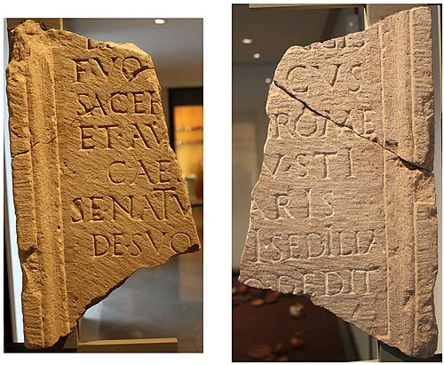 Rodez City, Rodez32 km E
-
Luc-la-Primaube Town, Luc-la-Primaube30 km E
-
Arrondissement of Millau Municipality, Aveyron69 km SE
Sources & licences
Data last updated: