Montagnac
Located in Saint-Saturnin-de-Lenne, Arrondissement of Rodez Coordinates: 44°24′08″ N 3°00′28″ E
- Elevation
- 767 m
- above sea level
- Local time
- UTC+01:00
- Europe/Paris · UTC+01:00
- Airports
- RDZ Rodez–Aveyron Airport42 km
- AUR Aurillac airport72 km
About Montagnac
Montagnac is a village. Location: Saint-Saturnin-de-Lenne, Arrondissement of Rodez. Elevation: 767 m. The best months to visit are June–September. The nearest airport is Rodez–Aveyron Airport (42 km). Nearby sights include Bois de Galinières and Prieuré de la Bénissons-Dieu-de-la-Falque.
Climate of Montagnac
Best months for sightseeingBest months for sightseeing: June–September.
This month · November
A cold month
Day 9° · Night 2° · Rain 66 mm
- Hottest month
- July (day 24°)
- Coldest month
- January (night -1°)
- Wettest month
- October (91 mm)
- Driest month
- July (38 mm)
Bars: average monthly low and high temperature. Below: precipitation. Monthly averages for 1970–2000 at about 18 km resolution, adjusted for elevation. Highlighted months are mild and relatively dry. Source: WorldClim 2.1 (CC BY 4.0).
Show values as a table
| Month | Jan | Feb | Mar | Apr | May | Jun | Jul | Aug | Sep | Oct | Nov | Dec |
|---|---|---|---|---|---|---|---|---|---|---|---|---|
| Average high (°C) | 6° | 7° | 10° | 12° | 17° | 20° | 24° | 24° | 20° | 15° | 9° | 7° |
| Average low (°C) | -1° | -1° | 1° | 3° | 7° | 10° | 12° | 12° | 10° | 6° | 2° | 0° |
| Precipitation (mm) | 70 | 60 | 50 | 63 | 73 | 57 | 38 | 55 | 65 | 91 | 66 | 66 |
Other places to visit in this season: June July August September
How to get to Montagnac
The nearest airport is Rodez–Aveyron Airport (RDZ), 42 km to the west as the crow flies. The nearest large city is Montpellier, 112 km to the southeast.
Airports
- Rodez–Aveyron Airport (RDZ) Rodez/Marcillac 42 kmwest
- Aurillac airport (AUR) Aurillac 72 kmnorthwest
- Castres Mazamet Airport (DCM) Castres 110 kmsouthwest
Nearby large cities
- Montpellier Population: 248.3K 112 kmsoutheast
- Nîmes Population: 148.2K 125 kmsoutheast
- Clermont-Ferrand Population: 147.9K 153 kmnorth
- Toulouse Population: 511.7K 154 kmsouthwest
- Saint-Etienne Population: 176.3K 158 kmnortheast
Straight-line distances; road distances are longer. Airport data: OurAirports.
Day trips from Montagnac
Within 100 km: 162 historic and cultural sites, 483 natural sites, 170 lakes, rivers and coasts.
0–25 km39 places
- Mont de Roquelaure Mountain 19 kmNW
- Puy de Malavergne Mountain 14 kmNW
- Puy de Lacalm Mountain 14 kmNW
- Montagnes d'Aubrac Mountain 21 kmN
25–60 km179 places
- Lac de Charpal Lake 52 kmNE
- Lac de Pareloup Lake 30 kmSW
- Lac de Grandval Lake 58 kmN
- Lac de Maury Lake 40 kmNW
60–100 km597 places
- Ancien îlot Gambetta Island 73 kmNW
- Lac d'Issarlès Lake 96 kmNE
- Lac du Bouchet Lake 84 kmNE
- Lac du Salagou Lake 88 kmS
Straight-line distances.
Nearby attractions & nature
Everything nearby-
Bois de Galinières Natural site, Aveyron6.9 km W
-
Prieuré de la Bénissons-Dieu-de-la-Falque Historic site, Saint Geniez d'Olt et d'Aubrac7.9 km NW
-
Puy de Campech Mountain, Sainte-Eulalie-d'Olt12 km NW
-
Ruisseau Olip River, Aveyron6.9 km SW
-
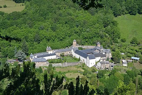 Bonneval Abbey Attraction, Le Cayrol25 km NW
-
Puy de Barry Mountain, Castelnau-de-Mandailles16 km NW
Sources & licences
Data last updated: