- Population
- 654
- 654
- Elevation
- 134 m
- above sea level
- Local time
- UTC+01:00
- Europe/Paris · UTC+01:00
- Places inside
- 7
- listed under Payrignac
- Airports
- BVE Brive Souillac airport33 km
- EGC Bergerac Dordogne-Périgord airport66 km
About Payrignac
Payrignac is a village. Location: Arrondissement of Gourdon, Lot. Population: 654. Elevation: 134 m. The best months to visit are May–September. The nearest airport is Brive Souillac airport (33 km). Nearby sights include Abbaye Nouvelle and Ruisseau de Bléou.
Climate of Payrignac
Best months for sightseeingBest months for sightseeing: May–September.
This month · November
Outside the best season
Day 13° · Night 5° · Rain 72 mm
- Hottest month
- July (day 27°)
- Coldest month
- January (night 2°)
- Wettest month
- May (89 mm)
- Driest month
- July (55 mm)
Bars: average monthly low and high temperature. Below: precipitation. Monthly averages for 1970–2000 at about 18 km resolution, adjusted for elevation. Highlighted months are mild and relatively dry. Source: WorldClim 2.1 (CC BY 4.0).
Show values as a table
| Month | Jan | Feb | Mar | Apr | May | Jun | Jul | Aug | Sep | Oct | Nov | Dec |
|---|---|---|---|---|---|---|---|---|---|---|---|---|
| Average high (°C) | 9° | 11° | 14° | 17° | 21° | 24° | 27° | 27° | 24° | 18° | 13° | 10° |
| Average low (°C) | 2° | 3° | 4° | 6° | 10° | 13° | 15° | 15° | 12° | 9° | 5° | 3° |
| Precipitation (mm) | 70 | 72 | 61 | 77 | 89 | 77 | 55 | 62 | 72 | 82 | 72 | 74 |
Other places to visit in this season: May June July August September
How to get to Payrignac
The nearest airport is Brive Souillac airport (BVE), 33 km to the north as the crow flies. The nearest large city is Limoges, 120 km to the north.
Airports
- Brive Souillac airport (BVE) Brive 33 kmnorth
- Bergerac Dordogne-Périgord airport (EGC) Bergerac 66 kmwest
- Aurillac airport (AUR) Aurillac 86 kmeast
Nearby large cities
- Limoges Population: 141.2K 120 kmnorth
- Toulouse Population: 511.7K 128 kmsouth
- Bordeaux Population: 265.3K 153 kmwest
- Clermont-Ferrand Population: 147.9K 178 kmnortheast
- Montpellier Population: 248.3K 239 kmsoutheast
Straight-line distances; road distances are longer. Airport data: OurAirports.
Day trips from Payrignac
Within 100 km: 119 historic and cultural sites, 64 natural sites, 197 lakes, rivers and coasts.
0–25 km20 places
- Pech de Dreuilles Mountain 8 kmE
- Bois de la Pannonie Natural site 22 kmE
- Les jardins de Marqueyssac Natural site 17 kmNW
- Vallée de la Dordogne Natural site 19 kmNW
25–60 km64 places
- Roche de Vic Mountain 53 kmNE
- Roc de Maille Mountain 51 kmNE
- Puy d'Yssandon Mountain 50 kmN
- Forêt de Liorac Natural site 58 kmW
60–100 km296 places
- Ancien îlot Gambetta Island 89 kmE
- Étang de Taysse Lake 72 kmNE
- Étang de Ruffaud Lake 74 kmNE
- Étang du Prévôt Lake 77 kmNE
Straight-line distances.
Places in Payrignac
7 placesBar: population relative to the most populous place in this list.
Cities & villages6
- Cougnac · Village
- Cournazac · Village
- Le Ségala · Village
- Les Vitarolles · Village
- Nadaillac · Village
- Roquedeval · Village
Nearby attractions & nature
Everything nearby-
Abbaye Nouvelle Historic site, Léobard6.2 km SW
-
Ruisseau de Bléou River, Lot5.9 km S
-
Pech de Dreuilles Mountain, Le Vigan-en-Quercy7.8 km E
-
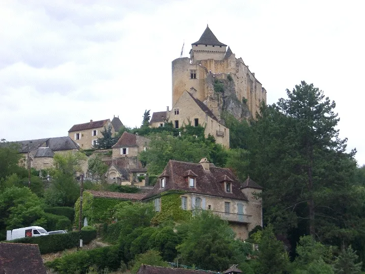 Château de Castelnaud-la-Chapelle Historic site, Castelnaud-la-Chapelle17 km NW
-
Russeau de Vitrac River, Dordogne12 km NW
-
Ruisseau la Lousse River, Dordogne11 km W
Sources & licences
Data last updated: