Bois de la Moussaye
Located in Mayenne department, Pays de la Loire Region Coordinates: 48°14′40″ N 0°12′14″ W
- Elevation
- 255 m
- above sea level
- Local time
- UTC+01:00
- Europe/Paris · UTC+01:00
- Airports
- CFR Caen Carpiquet airport105 km
- TUF Tours Val de Loire Airport114 km
About Bois de la Moussaye
Bois de la Moussaye is a natural site. Location: Mayenne department, Pays de la Loire Region. The best months to visit are June–August. The nearest airport is Caen Carpiquet airport (105 km). Nearby sights include Forêt de Sillé and Mont Rochard.
Climate of Bois de la Moussaye
Best months for sightseeingBest months for sightseeing: June–August.
This month · November
A cold month
Day 10° · Night 4° · Rain 79 mm
- Hottest month
- August (day 23°)
- Coldest month
- February (night 1°)
- Wettest month
- December (84 mm)
- Driest month
- August (45 mm)
Bars: average monthly low and high temperature. Below: precipitation. Monthly averages for 1970–2000 at about 18 km resolution, adjusted for elevation. Highlighted months are mild and relatively dry. Source: WorldClim 2.1 (CC BY 4.0).
Show values as a table
| Month | Jan | Feb | Mar | Apr | May | Jun | Jul | Aug | Sep | Oct | Nov | Dec |
|---|---|---|---|---|---|---|---|---|---|---|---|---|
| Average high (°C) | 7° | 8° | 11° | 13° | 17° | 20° | 23° | 23° | 20° | 15° | 10° | 8° |
| Average low (°C) | 1° | 1° | 3° | 4° | 8° | 10° | 12° | 12° | 10° | 7° | 4° | 2° |
| Precipitation (mm) | 81 | 71 | 59 | 56 | 66 | 52 | 51 | 45 | 68 | 73 | 79 | 84 |
How to get to Bois de la Moussaye
The nearest airport is Caen Carpiquet airport (CFR), 105 km to the north as the crow flies. The nearest large city is Le Mans, 41 km to the southeast.
Airports
- Caen Carpiquet airport (CFR) Caen 105 kmnorth
- Tours Val de Loire Airport (TUF) Tours, Indre-et-Loire 114 kmsoutheast
- Rennes-Saint-Jacques Airport (RNS) Saint-Jacques-de-la-Lande, Ille-et-Vilaine 116 kmwest
Nearby large cities
- Le Mans Population: 144.5K 41 kmsoutheast
- Angers Population: 168.3K 90 kmsouth
- Caen Population: 110.6K 105 kmnorth
- Rennes Population: 227.8K 110 kmwest
- Tours Population: 141.6K 116 kmsoutheast
Straight-line distances; road distances are longer. Airport data: OurAirports.
Day trips from Bois de la Moussaye
Within 100 km: 130 historic and cultural sites, 152 natural sites, 164 lakes, rivers and coasts.
0–25 km29 places
- Mont du Saule Mountain 18 kmNW
- Bois de Vaux Natural site 23 kmNE
- Bois des Vallons Natural site 25 kmSW
- Forêt de Sillé Natural site 8 kmSE
25–60 km114 places
- Dive River 42 kmE
- Étang Neuf Lake 60 kmW
- Étang de Montjean Lake 60 kmSW
- Étang de la Chaîne Lake 56 kmW
60–100 km303 places
- Cloche River 78 kmE
- Étang du Val Joyeux Lake 88 kmSE
- Étang de Saint-Aubin Lake 91 kmSW
- Étang de Rumien Lake 85 kmNE
Straight-line distances.
Nearest towns and villages
-
Saint-Germain-de-Coulamer Village, Arrondissement of Mayenne3.2 km NE
-
Saint-Germain-de-Coulamer Village, Saint-Germain-de-Coulamer3.2 km NE
-
Vimartin-sur-Orthe Village, Arrondissement of Mayenne3.8 km S
-
Saint-Martin-de-Connée Village, Vimartin-sur-Orthe3.5 km S
-
Saint-Pierre-sur-Orthe Village, Vimartin-sur-Orthe3.8 km S
-
Saint-Thomas-de-Courceriers Village, Arrondissement of Mayenne5.7 km NW
Nearby attractions & nature
Everything nearby-
Forêt de Sillé Natural site, Sarthe7.5 km SE
-
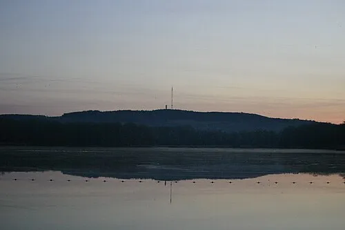 Mont Rochard Mountain, Sainte-Gemmes-le-Robert11 km W
-
Bois de Chemasson Natural site, Sarthe13 km NE
-
Vaudelle River, Sarthe12 km NE
-
Merdereau River, Sarthe12 km NE
-
Bois de la Petite Charnie Natural site, Sarthe18 km S
-
Orthe River, Sarthe13 km E
-
Bois d'Hermet Natural site, Mayenne department20 km W
Sources & licences
Data last updated: