Mayenne department
Located in Pays de la Loire Region, France Coordinates: 48°08′06″ N 0°40′00″ W
- Population
- 305,437
- 305.4K
- Elevation
- 122 m
- above sea level
- Local time
- UTC+01:00
- Europe/Paris · UTC+01:00
- Places inside
- 46
- listed under Mayenne department
- Airports
- RNS Rennes-Saint-Jacques Airport80 km
- CFR Caen Carpiquet airport117 km
About Mayenne department
Mayenne department is a district. Location: Pays de la Loire Region, France. Population: 305,437.
Mayenne (French: [majɛn] ) is a landlocked department in northwest France named after the river Mayenne. Mayenne is part of the administrative region of Pays de la Loire and is surrounded by the departments of Manche, Orne, Sarthe, Maine-et-Loire, and Ille-et-Vilaine. Mayenne is one of the original 83 departments created during the French Revolution on 4 March 1790. The northern two thirds correspond to the western part of the former province of Maine.
Source: Wikipedia · CC BY-SA 4.0
Photos of Mayenne department
-
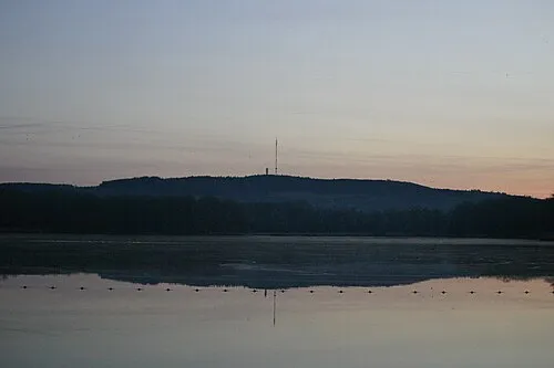
Mont Rochard Olivier Letourneux · CC BY 2.0

Places bordering Mayenne department
- Orne
- Ille-et-Vilaine
- Maine-et-Loire
- Sarthe
- Manche
Population of Mayenne department over time
| 2015 | 307,940 | |
|---|---|---|
| 2017 | 307,445 | |
| 2018 | 307,084 | |
| 2019 | 307,062 | |
| 2020 | 306,538 | |
| 2021 | 305,933 | |
| 2022 | 305,437 | |
| 2023 | 305,468 |
Censuses and official estimates; source: Wikidata.
Climate of Mayenne department
Best months for sightseeingBest months for sightseeing: June–September.
This month · November
A cold month
Day 11° · Night 4° · Rain 77 mm
- Hottest month
- August (day 24°)
- Coldest month
- January (night 2°)
- Wettest month
- December (79 mm)
- Driest month
- August (44 mm)
Bars: average monthly low and high temperature. Below: precipitation. Monthly averages for 1970–2000 at about 18 km resolution, adjusted for elevation. Highlighted months are mild and relatively dry. Source: WorldClim 2.1 (CC BY 4.0).
Show values as a table
| Month | Jan | Feb | Mar | Apr | May | Jun | Jul | Aug | Sep | Oct | Nov | Dec |
|---|---|---|---|---|---|---|---|---|---|---|---|---|
| Average high (°C) | 8° | 9° | 12° | 14° | 18° | 21° | 24° | 24° | 21° | 16° | 11° | 9° |
| Average low (°C) | 2° | 2° | 4° | 5° | 8° | 11° | 13° | 13° | 11° | 8° | 4° | 3° |
| Precipitation (mm) | 76 | 67 | 55 | 53 | 66 | 49 | 45 | 44 | 64 | 72 | 77 | 79 |
Other places to visit in this season: June July August September
How to get to Mayenne department
The nearest airport is Rennes-Saint-Jacques Airport (RNS), 80 km to the west as the crow flies. For international flights: Nantes Atlantique Airport (NTE) (130 km). The nearest large city is Le Mans, 66 km to the east.
Airports
- Rennes-Saint-Jacques Airport (RNS) Saint-Jacques-de-la-Lande, Ille-et-Vilaine 80 kmwest
- Caen Carpiquet airport (CFR) Caen 117 kmnorth
- Nantes Atlantique Airport (NTE) Nantes 130 kmsouthwest
Nearby large cities
- Le Mans Population: 144.5K 66 kmeast
- Angers Population: 168.3K 74 kmsouth
- Rennes Population: 227.8K 75 kmwest
- Caen Population: 110.6K 119 kmnorth
- Nantes Population: 325.1K 122 kmsouthwest
Straight-line distances; road distances are longer. Airport data: OurAirports.
Day trips from Mayenne department
Within 100 km: 126 historic and cultural sites, 139 natural sites, 189 lakes, rivers and coasts.
0–25 km28 places
- Étang de Montjean Lake 24 kmSW
- Étang de la Chaîne Lake 21 kmW
- Bois des Vallons Natural site 16 kmE
- Bois des Rougeries Natural site 19 kmE
25–60 km139 places
- Étang de Saint-Aubin Lake 58 kmSW
- Étang de Roches Lake 52 kmSW
- Étang du Rocher Lake 28 kmSW
- Étang de Paintourteau Lake 35 kmW
60–100 km287 places
- Dive River 78 kmE
- Mont-Saint-Michel Beach 84 kmNW
- Étang du Val Joyeux Lake 100 kmSE
- Étang de Trémigon Lake 88 kmNW
Straight-line distances.
Places in Mayenne department
46 places- 1 Arrondissement of Mayenne 117.5K
- 2 Arrondissement of Laval 114.9K
- 3 Arrondissement of Château-Gontier 73.1K
Bar: population relative to the most populous place in this list.
Cities & villages1
- L'Errie · Village
Mountains & nature22
- Bois de Belle Branche · Natural site
- Bois de Bergault · Natural site
- Bois de Buleu · Natural site
- Bois de Châtenay · Natural site
- Bois de la Moussaye · Natural site
- Bois de Misedon · Natural site
- Bois de Saint-Michel · Natural site
- Bois des Gravelles · Natural site
- Bois des Rougeries · Natural site
- Bois des Vallons · Natural site
- Bois d'Hermet · Natural site
- Forêt de Bourgon · Natural site
- Forêt de Craon · Natural site
- Forêt de Mayenne · Natural site
- Forêt de Monaye · Natural site
- Forêt de Multonne · Natural site
- Forêt de Pail · Natural site
- Foret de Pincé · Natural site
- Forêt de Valles · Natural site
- La Haie d'Anjou · Natural site
- Le Grand Bois · Natural site
- Taillis de L'Huisserie · Natural site
Lakes, rivers & coasts20
- Aisne · River
- Aron · River
- Colmont · River
- Deux Évailles · River
- Ernée · River
- Étang de la Chaîne · Lake
- Étang de Montjean · Lake
- Étang du Rocher · Lake
- Étang Neuf · Lake
- Jouanne · River
- Ouette · River
- Pelterie · River
- Ruisseau de la Gravelle · River
- Ruisseau de la Rongère · River
- Ruisseau de Panard · River
- Ruisseau de Vicoin · River
- Ruisseau du Gué-Chartier · River
- Treulon · River
- Uzure · River
- Varenne · River
Nature and heritage in Mayenne department
Sources & licences
Data last updated: · 2 independent sources