Foret de Pincé
Located in Mayenne department, Pays de la Loire Region Coordinates: 47°47′54″ N 0°21′01″ W
- Elevation
- 55 m
- above sea level
- Local time
- UTC+01:00
- Europe/Paris · UTC+01:00
- Airports
- TUF Tours Val de Loire Airport91 km
- RNS Rennes-Saint-Jacques Airport108 km
About Foret de Pincé
Foret de Pincé is a natural site. Location: Mayenne department, Pays de la Loire Region. The best months to visit are June–September. The nearest airport is Tours Val de Loire Airport (91 km). Nearby sights include Taude and Forêt de Malpaire.
Climate of Foret de Pincé
Best months for sightseeingBest months for sightseeing: June–September.
This month · November
A cold month
Day 12° · Night 5° · Rain 73 mm
- Hottest month
- August (day 25°)
- Coldest month
- January (night 2°)
- Wettest month
- December (76 mm)
- Driest month
- August (41 mm)
Bars: average monthly low and high temperature. Below: precipitation. Monthly averages for 1970–2000 at about 18 km resolution, adjusted for elevation. Highlighted months are mild and relatively dry. Source: WorldClim 2.1 (CC BY 4.0).
Show values as a table
| Month | Jan | Feb | Mar | Apr | May | Jun | Jul | Aug | Sep | Oct | Nov | Dec |
|---|---|---|---|---|---|---|---|---|---|---|---|---|
| Average high (°C) | 8° | 9° | 12° | 15° | 19° | 22° | 25° | 25° | 22° | 17° | 12° | 9° |
| Average low (°C) | 2° | 2° | 4° | 5° | 9° | 12° | 13° | 13° | 11° | 8° | 5° | 3° |
| Precipitation (mm) | 73 | 64 | 53 | 51 | 62 | 46 | 45 | 41 | 62 | 68 | 73 | 76 |
Other places to visit in this season: June July August September
How to get to Foret de Pincé
The nearest airport is Tours Val de Loire Airport (TUF), 91 km to the southeast as the crow flies. For international flights: Nantes Atlantique Airport (NTE) (119 km). The nearest large city is Angers, 39 km to the southwest.
Airports
- Tours Val de Loire Airport (TUF) Tours, Indre-et-Loire 91 kmsoutheast
- Rennes-Saint-Jacques Airport (RNS) Saint-Jacques-de-la-Lande, Ille-et-Vilaine 108 kmwest
- Nantes Atlantique Airport (NTE) Nantes 119 kmsouthwest
Nearby large cities
- Angers Population: 168.3K 39 kmsouthwest
- Le Mans Population: 144.5K 47 kmnortheast
- Tours Population: 141.6K 91 kmsoutheast
- Rennes Population: 227.8K 105 kmwest
- Nantes Population: 325.1K 111 kmsouthwest
Straight-line distances; road distances are longer. Airport data: OurAirports.
Day trips from Foret de Pincé
Within 100 km: 158 historic and cultural sites, 157 natural sites, 182 lakes, rivers and coasts.
0–25 km21 places
- Bois de Pêcheseul Natural site 15 kmE
- Forêt de Malpaire Natural site 7 kmSE
- Bois de L'Augonay Natural site 24 kmE
- La Haie d'Anjou Natural site 12 kmW
25–60 km138 places
- Étang du Val Joyeux Lake 58 kmSE
- Étang du Rocher Lake 50 kmNW
- Étang de Montjean Lake 48 kmNW
- Étang de la Chaîne Lake 60 kmNW
60–100 km338 places
- Dive River 72 kmNE
- Ile au Than Beach Beach 71 kmSE
- Île d'Arouix Island 99 kmSW
- Étang de Saint-Aubin Lake 63 kmW
Straight-line distances.
Nearest towns and villages
-
Pincé Village, Arrondissement of La Flèche2.3 km W
-
Pincé Village, Pincé2.3 km W
-
Précigné Village, Arrondissement of La Flèche4.1 km SE
-
Sablé-sur-Sarthe Village, Arrondissement of La Flèche4.8 km N
-
Courtillers Village, Arrondissement of La Flèche3.6 km E
-
Courtillers Village, Courtillers3.5 km E
Nearby attractions & nature
Everything nearby-
Taude River, Sarthe3.6 km NW
-
Forêt de Malpaire Natural site, Sarthe7.1 km SE
-
Vaige River, Sarthe4.4 km N
-
Erve River, Sarthe4.9 km N
-
Bois de Brice Natural site, Sarthe12 km NE
-
Bois de Belle Branche Natural site, Mayenne department12 km NW
-
La Haie d'Anjou Natural site, Mayenne department12 km W
-
Bois de Pêcheseul Natural site, Sarthe15 km E
More nature in France
-
Bois de Bergault Natural site, Mayenne department29 km NW
-
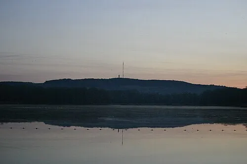 Mont Rochard Mountain, Sainte-Gemmes-le-Robert47 km N
-
Bois des Rougeries Natural site, Mayenne department34 km N
-
Bois des Vallons Natural site, Mayenne department35 km N
-
Le Grand Bois Natural site, Mayenne department37 km N
-
Forêt de Valles Natural site, Mayenne department31 km W
Sources & licences
Data last updated: