Pointe du Sablon
Located in Bouches-du-Rhône, Provence-Alpes-Côte d'Azur Region Coordinates: 43°23′01″ N 4°33′27″ E
- Elevation
- 0 m
- above sea level
- Local time
- UTC+01:00
- Europe/Paris · UTC+01:00
- Airports
- FNI Nîmes-Arles-Camargue Airport43 km
- MPL Montpellier-Méditerranée Airport53 km
About Pointe du Sablon
Pointe du Sablon is a natural site. Location: Bouches-du-Rhône, Provence-Alpes-Côte d'Azur Region. The best months to visit are May–September. The nearest airport is Nîmes-Arles-Camargue Airport (43 km). Nearby sights include Plage de Beauduc and Étang de Beauduc.
Climate of Pointe du Sablon
Best months for sightseeingBest months for sightseeing: May–September.
This month · November
Outside the best season
Day 14° · Night 8° · Rain 59 mm
- Hottest month
- July (day 29°)
- Coldest month
- January (night 4°)
- Wettest month
- October (110 mm)
- Driest month
- July (18 mm)
Bars: average monthly low and high temperature. Below: precipitation. Monthly averages for 1970–2000 at about 18 km resolution, adjusted for elevation. Highlighted months are mild and relatively dry. Source: WorldClim 2.1 (CC BY 4.0).
Show values as a table
| Month | Jan | Feb | Mar | Apr | May | Jun | Jul | Aug | Sep | Oct | Nov | Dec |
|---|---|---|---|---|---|---|---|---|---|---|---|---|
| Average high (°C) | 11° | 12° | 15° | 17° | 21° | 25° | 29° | 28° | 24° | 20° | 14° | 11° |
| Average low (°C) | 4° | 5° | 7° | 9° | 13° | 17° | 19° | 19° | 16° | 12° | 8° | 5° |
| Precipitation (mm) | 65 | 50 | 48 | 59 | 49 | 33 | 18 | 40 | 65 | 110 | 59 | 62 |
Other places to visit in this season: May June July August September
How to get to Pointe du Sablon
The nearest airport is Nîmes-Arles-Camargue Airport (FNI), 43 km to the north as the crow flies. For international flights: Montpellier-Méditerranée Airport (MPL) (53 km). The nearest large city is Nîmes, 53 km to the north.
Airports
- Nîmes-Arles-Camargue Airport (FNI) Nîmes/Garons 43 kmnorth
- Montpellier-Méditerranée Airport (MPL) Montpellier/Méditerranée 53 kmnorthwest
- Marseille Provence Airport (MRS) Marignane, Bouches-du-Rhône 53 kmeast
Nearby large cities
- Nîmes Population: 148.2K 53 kmnorth
- Montpellier Population: 248.3K 61 kmnorthwest
- Marseille Population: 877.2K 67 kmeast
- Aix-en-Provence Population: 146.8K 74 kmeast
- Toulon Population: 168.7K 115 kmeast
Straight-line distances; road distances are longer. Airport data: OurAirports.
Day trips from Pointe du Sablon
Within 100 km: 127 historic and cultural sites, 330 natural sites, 200 lakes, rivers and coasts.
0–25 km43 places
- Plage de Piemanson Beach 19 kmE
- Plage de Beauduc Beach 3 kmNE
- Île des Pilotes Island 18 kmNE
- Le Cassieu Island 11 kmN
25–60 km137 places
- Plage de Sainte-Croix Beach 42 kmE
- Plage des Laurons Beach 38 kmE
- Plage Napoléon Beach 26 kmE
- Plage de l'Espiguette Beach 38 kmW
60–100 km477 places
- Plages du Prado Beach 67 kmE
- Marseillan Plage Beach 82 kmW
- Plage de la Madrague Beach 95 kmE
- La Grande Plage Beach 89 kmE
Straight-line distances.
Nearest towns and villages
-
Beauduc Village, Arles3.6 km NE
-
Saintes-Maries-de-la-Mer Village, Arrondissement of Arles13 km NW
-
Saintes-Maries-de-la-Mer Village, Saintes-Maries-de-la-Mer13 km NW
-
Arrondissement of Arles Municipality, Bouches-du-Rhône30 km NE
-
Port-Saint-Louis-du-Rhône Village, Arrondissement of Istres20 km E
-
Petit Badon Village, Arles13 km NE
Nearby attractions & nature
Everything nearby-
Plage de Beauduc Beach, Arles3.2 km NE
-
Étang de Beauduc Lake, Bouches-du-Rhône4 km E
-
Étang du Grand Rascaillan Lake, Bouches-du-Rhône6.4 km NE
-
Étang du Vaisseau Lake, Bouches-du-Rhône6.7 km E
-
Golfe des Saintes-Maries Natural site, Provence-Alpes-Côte d'Azur Region6.4 km NW
-
Étang de Galabert Lake, Bouches-du-Rhône6.9 km NE
-
Étang Sainte-Anne Lake, Bouches-du-Rhône7.1 km SE
-
Étang du Fangassier Lake, Bouches-du-Rhône7.3 km NE
More nature in France
-
Île de Mornès Natural site, Bouches-du-Rhône15 km N
-
Parc Naturel Régional de Camargue Natural site, Bouches-du-Rhône15 km N
-
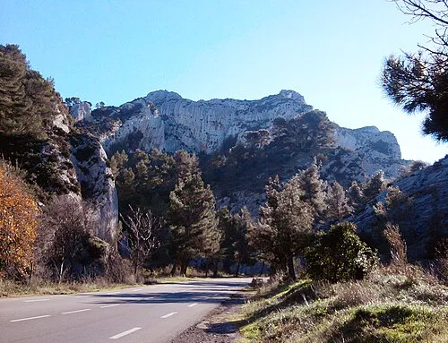 Mont Gaussier Mountain, Saint-Rémy-de-Provence48 km NE
-
Mont Paon Mountain, Fontvieille43 km N
-
Mont Valence Mountain, Fontvieille43 km N
-
Cap d'Aiguade Natural site, Bouches-du-Rhône34 km E
Sources & licences
Data last updated: