Provence-Alpes-Côte d'Azur Region
Local name: Provence-Alpes-Côte d'Azur
Located in France Coordinates: 43°55′00″ N 6°05′00″ E
- Population
- 5,170,312
- 5.2M
- Elevation
- 496 m
- above sea level
- Local time
- UTC+01:00
- Europe/Paris · UTC+01:00
- Places inside
- 166
- listed under Provence-Alpes-Côte d'Azur Region
- Airports
- MRS Marseille Provence Airport88 km
- TLN Toulon-Hyères Airport91 km
About Provence-Alpes-Côte d'Azur Region
Provence-Alpes-Côte d'Azur Region is a region. Location: France. Population: 5,170,312.
Provence-Alpes-Côte d'Azur (commonly shortened to PACA), sometimes known as Région Sud, is one of the eighteen administrative regions of France, located at the far southeastern point of the mainland. The main prefecture and largest city is Marseille, France's second largest city proper after Paris and the 2nd largest urban area when combined with Aix-en-Provence with over 1.9 million residents.
Source: Wikipedia · CC BY-SA 4.0
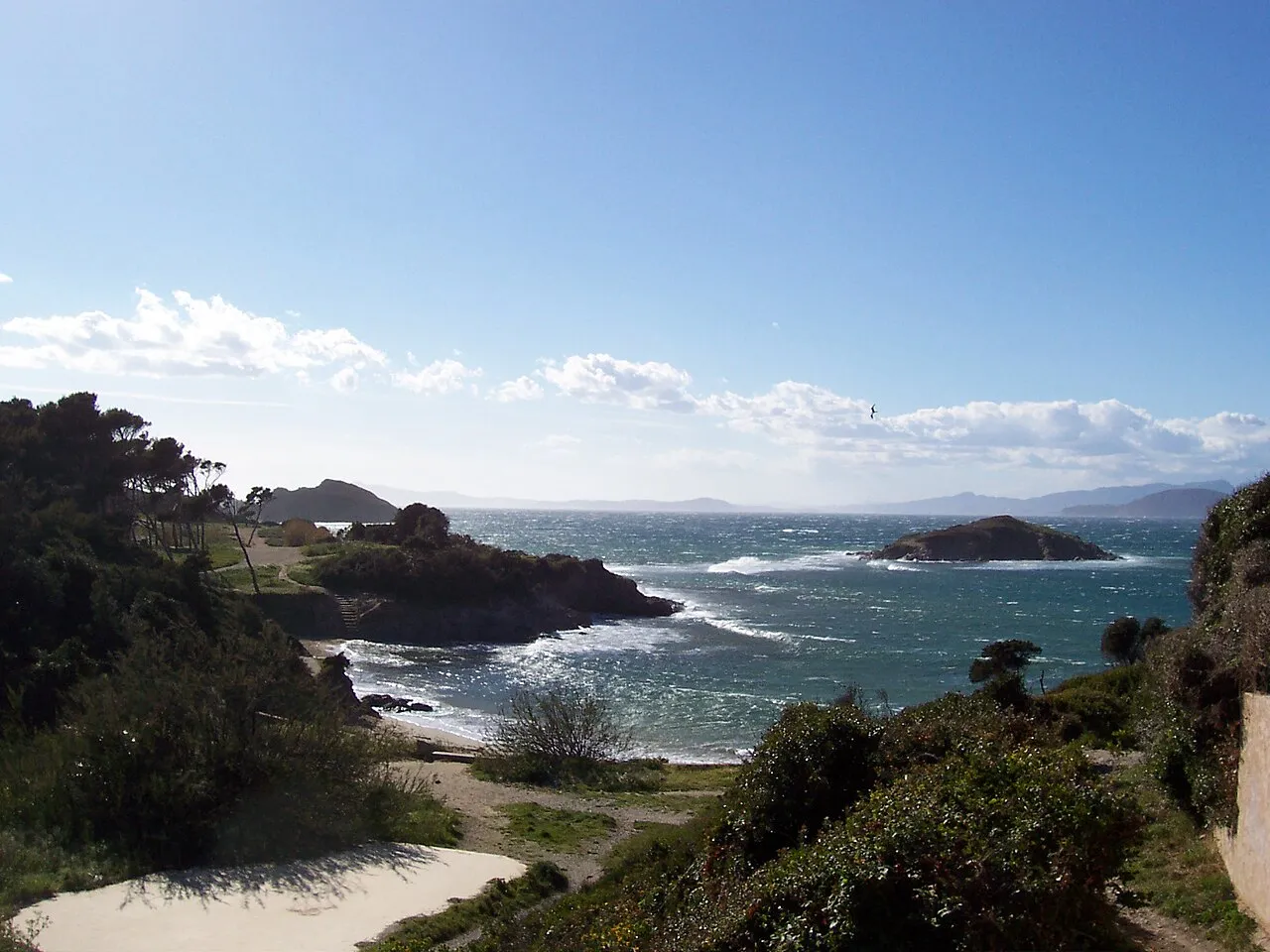
Photos of Provence-Alpes-Côte d'Azur Region
-

Einaz80 · CC BY-SA 4.0 -
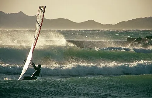
Plage du Prado Alpha du centaure · CC BY 2.0 -
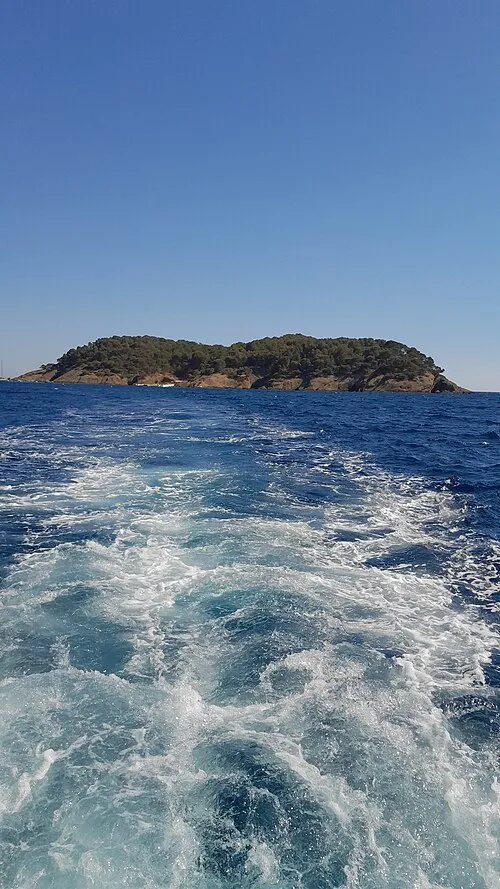
Île Verte Alexander Freitas · CC BY-SA 4.0 -
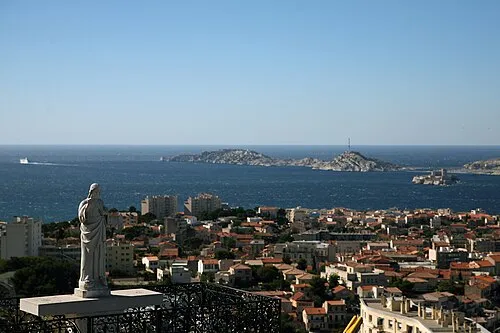
Île Pomègues Agris Robs · CC BY-SA 3.0 -
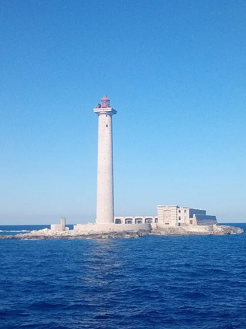
Planier Island Matieu Sokolovic · Public domain


Travel notes for Provence-Alpes-Côte d'Azur Region
From Wikivoyage
Provence-Alpes-Côte d'Azur (PACA) is the most popular holiday region in the south of France. It covers a large area from the Mediterranean Sea in the south up to the French Alps in the north and extends west to east along the coast from the river Rhône all the way to the Italian border. Its identity as a geographical region being a legacy of the Roman Empire, the Provence includes the French Riviera and is famous for its sunny weather, colourful countryside, long-standing traditions and local language (Provençal). The region's favourable climate makes the variety of available local produce second to none. Flowers, fruits and vegetables all grow in abundance, the sea's fish and shellfish stocks are rich and all this without forgetting those two most Provençal of industries: wine-making and perfumery.
Perhaps best known for the many fashionable resorts along the Côte d'Azur, the Provence's other main attractions include the Old Port of Marseille, the ancient cities of Aix-en-Provence and Avignon, as well as a plethora of sun-baked villages and mountaintop towns. So why not follow in the footsteps of Vincent van Gogh and see for yourself why Provence-Alpes-Côte d'Azur is such a special and inspirational destination?
Understand+
Provence-Alpes-Côte d'Azur covers all the original territory of Provence, together with what used to be the Italian-controlled County of Nice. The term "Provence" comes from the fact that this area - "Transalpine Gaul" - was the first part of what is now France to become a Roman province; it was from here that Julius Caesar launched his famous conquest of Gaul. The region's identity is associated closely with its history and culture. Although a bit stereotyped now (those lavender fields and hill villages that plaster postcards and guidebooks), contemporary Provençal life is rooted in a long heritage of lively regional culture and language.
This is a vast and beautiful region, and merits a long trip, not just a few days or a week. To truly appreciate this region, you must be the type of traveller who likes food, wine and local crafts. It is recommended that you plan your own itinerary, and make it flexible enough so you can linger at an outdoor café or appreciate a historic sight when the moment takes you. There is a joie de vivre attitude throughout the region which is contagious, especially after a picnic of cheese and sausage bought direct from local farmers, and two glasses of a good rosé.
Climate:
The low-lying parts of this region have a Mediterranean climate, so are generally dry and warm for most of the year, with more rain and wind over the usually brief winters. Summers here are hot and long, and the number of sunshine hours is very high all year round. The higher zones stretching up into the Alps have a mountain climate which, though still dry in summer, can be quite cool. This southernmost part of the Alps is the sunniest in the range, though winter snow is still common.
Read:
Get in+
By plane:
The two major airports for the region are Nice-Côte d'Azur and Marseille-Provence. Most transatlantic flights to France land at Paris Charles de Gaulle, from where it is possible to travel to the Provence either by catching a connecting flight, using a high speed train, or hiring a car and driving.
1 Nice Côte d'Azur Airport (NCE IATA). France's third busiest airport after the two in Paris welcomes flights from pretty much every major European airport and a handful of places further afield, such as Beirut (summer only), Doha, Dubai, Montreal Trudeau (summer only), New York JFK and Newark (summer only) and Tel Aviv Ben Gurion. (updated Dec 2017)
2 Marseille Provence Airport (MRS IATA). Has year round services from such European cities as Amsterdam Schiphol, Berlin Schönefeld, Brussels Capital, Frankfurt, London (Heathrow, Gatwick, Luton, Stansted), Istanbul IST, Madrid Barajas, Paris (Charles de Gaulle and Orly), Rome Fiumicino and Stockholm Arlanda. There are also year-round flights from cities in Francophone Africa such as Agadir, Algiers, Constantine, Dakar, Oran and Tunis.
3 Toulon-Hyères Airport (TLN IATA). The only year-round flights arrive from Brest, Charleroi, Paris Orly and CDG. There are summer connections from Copenhagen, Rotterdam and Southampton.
4 Avignon Provence Airport (AVN IATA). The only scheduled flights here go to Antwerp in the high season only. (updated Jul 2023)
By train:
Source: Wikivoyage · CC BY-SA 4.0 · abridged
Places bordering Provence-Alpes-Côte d'Azur Region
Population of Provence-Alpes-Côte d'Azur Region over time
| 2012 | 4,935,576 | |
|---|---|---|
| 2013 | 4,953,675 | |
| 2014 | 4,983,438 | |
| 2015 | 5,007,977 | |
| 2017 | 5,030,890 | |
| 2018 | 5,052,832 | |
| 2019 | 5,081,101 | |
| 2020 | 5,098,666 | |
| 2021 | 5,127,840 | |
| 2022 | 5,170,312 | |
| 2023 | 5,218,960 |
Censuses and official estimates; source: Wikidata.
Climate of Provence-Alpes-Côte d'Azur Region
Best months for sightseeingBest months for sightseeing: May–June, September.
This month · November
Outside the best season
Day 13° · Night 4° · Rain 80 mm
- Hottest month
- July (day 29°)
- Coldest month
- January (night 1°)
- Wettest month
- October (100 mm)
- Driest month
- July (34 mm)
Bars: average monthly low and high temperature. Below: precipitation. Monthly averages for 1970–2000 at about 18 km resolution, adjusted for elevation. Highlighted months are mild and relatively dry. Source: WorldClim 2.1 (CC BY 4.0).
Show values as a table
| Month | Jan | Feb | Mar | Apr | May | Jun | Jul | Aug | Sep | Oct | Nov | Dec |
|---|---|---|---|---|---|---|---|---|---|---|---|---|
| Average high (°C) | 10° | 11° | 14° | 16° | 21° | 25° | 29° | 29° | 24° | 19° | 13° | 10° |
| Average low (°C) | 1° | 1° | 3° | 5° | 9° | 12° | 15° | 15° | 12° | 8° | 4° | 1° |
| Precipitation (mm) | 67 | 56 | 57 | 72 | 67 | 55 | 34 | 58 | 70 | 100 | 80 | 71 |
How to get to Provence-Alpes-Côte d'Azur Region
The nearest airport is Marseille Provence Airport (MRS), 88 km to the southwest as the crow flies. The nearest large city is Aix-en-Provence, 67 km to the southwest.
Airports
- Marseille Provence Airport (MRS) Marignane, Bouches-du-Rhône 88 kmsouthwest
- Toulon-Hyères Airport (TLN) Hyères, Var 91 kmsouth
- Avignon Caumont airport (AVN) Avignon 95 kmwest
Nearby large cities
- Aix-en-Provence Population: 146.8K 67 kmsouthwest
- Toulon Population: 168.7K 89 kmsouth
- Marseille Population: 877.2K 89 kmsouthwest
- Nice Population: 342.7K 98 kmeast
- Nîmes Population: 148.2K 139 kmwest
Straight-line distances; road distances are longer. Airport data: OurAirports.
Places in Provence-Alpes-Côte d'Azur Region
166 placesCities & villages15
- Carros le Neuf · Village
- Cavalière · Village
- Château de Fruchier · Village
- Colline · Village
- Espéro-Pax · Village
- La Bréguière · Village
- La Fresquière · Village
- La Galle · Village
- La Garonnette-Plage · Village
- La Rivière · Village
- La Rode · Village
- Le Mardaric · Village
- Le Pinet · Village
- Le Revest · Village
- Les Amandiers · Village
Mountains & nature16
- Cap Subeyran · Natural site
- Cap Taillat · Natural site
- Cima di Collalunga · Mountain
- Cima di Corboraut · Mountain
- Cima Missun · Mountain
- Forêt Communale de la Seyne · Natural site
- Forêt Domaniale des Calanques · Natural site
- Giens Peninsula · Natural site
- Glacier de la Girose · Natural site
- Golfe de Fos · Natural site
- Golfe de Fréjus · Natural site
- Golfe de Giens · Natural site
- Golfe de la Napoule · Natural site
- Golfe de Marseille · Natural site
- Golfe des Saintes-Maries · Natural site
- Le Fourchat · Mountain
Lakes, rivers & coasts29
- Île Aragnon · Island
- Île Calseraigne · Island
- Île de Bagaud · Island
- Île de Jarre · Island
- Île de Jarron · Island
- Île de la Tour Fondue · Island
- Île de la Tradelière · Island
- Île de l'Erevine · Island
- Île de Riou · Island
- Île des Embiez · Island
- Île des Vielles · Island
- Île du Grand Gaou · Island
- Île du Grand Ribaud · Island
- Île du Levant · Island
- Île du Petit Rouveau · Island
- Île Longue · Island
- Île Pomègues · Island
- Île Ratonneau · Island
- Île Rousse · Island
- Île Sainte-Marguerite · Island
- Île Saint-Honorat · Island
- Îles de Lérins · Island
- Îles d'Hyères · Island
- Île Verte · Island
- Lac de Serre-Ponçon · Lake
- Lac des Sarailles · Lake
- La Redonne · Island
- Le Grand Congloué · Island
- Le Petit Congloué · Island
Largest cities and towns
-
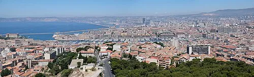 Marseille City, Marseille877.2K
-
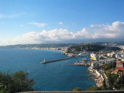 Nice City, Nice342.7K
-
Aix-en-Provence Village, Arrondissement of Aix-en-Provence143K
-
Arrondissement of Marseille Municipality, Bouches-du-Rhône1.1M
-
Marseille Village, Arrondissement of Marseille862.2K
-
Arrondissement of Toulon Municipality, Var594.5K
-
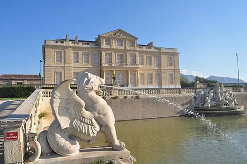 Marseille 08 Town, Marseille78.8K
-
Arrondissement of Aix-en-Provence Municipality, Bouches-du-Rhône464.4K
Nature and heritage in Provence-Alpes-Côte d'Azur Region
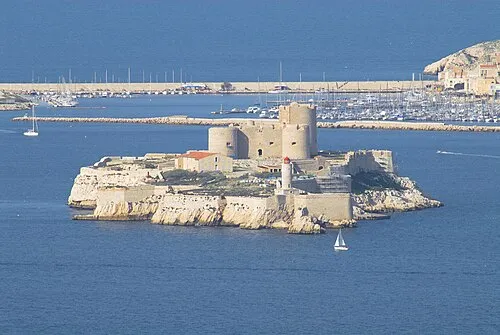
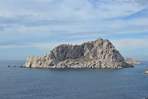
Other regions in France
-
 Var District, Provence-Alpes-Côte d'Azur Region54 km S
-
 Alpes-Maritimes District, Provence-Alpes-Côte d'Azur Region90 km E
-
 Vaucluse District, Provence-Alpes-Côte d'Azur Region74 km W
-
 Isère District, Auvergne-Rhône-Alpes140 km N
-
 Drôme District, Auvergne-Rhône-Alpes114 km NW
-
 Alpes-de-Haute-Provence District, Provence-Alpes-Côte d'Azur Region25 km NE
Sources & licences
Data last updated: · 2 independent sources