Var
Located in Provence-Alpes-Côte d'Azur Region, France Coordinates: 43°27′31″ N 6°17′29″ E
- Population
- 1,108,364
- 1.1M
- Elevation
- 174 m
- above sea level
- Local time
- UTC+01:00
- Europe/Paris · UTC+01:00
- Places inside
- 112
- listed under Var
- Airports
- TLN Toulon-Hyères Airport42 km
- NCE Nice-Côte d'Azur Airport78 km
About Var
Var is a district. Location: Provence-Alpes-Côte d'Azur Region, France. Population: 1,108,364.
Var (French: [vaʁ] ; Occitan: [ˈbaɾ]) is a department in the Provence-Alpes-Côte d'Azur region in southeastern France. It is bordered on the east by the Alpes-Maritimes department; to the west by Bouches-du-Rhône; to the north of the river Verdon by the Alpes-de-Haute-Provence department; and to the south by the Mediterranean Sea. It had a population of 1,119,307 in 2023.
Source: Wikipedia · CC BY-SA 4.0
At a glance
- Built
- 1790
- Area
- 5,973 km²
Source: Wikidata
Places bordering Var
- Alpes-de-Haute-Provence
- Alpes-Maritimes
- Bouches-du-Rhône
- Vaucluse
Population of Var over time
| 2015 | 1,048,652 | |
|---|---|---|
| 2017 | 1,058,740 | |
| 2018 | 1,067,697 | |
| 2019 | 1,076,711 | |
| 2020 | 1,085,189 | |
| 2021 | 1,095,337 | |
| 2022 | 1,108,364 | |
| 2023 | 1,119,307 |
Censuses and official estimates; source: Wikidata.
Climate of Var
Best months for sightseeingBest months for sightseeing: May–July, September.
This month · November
Outside the best season
Day 15° · Night 7° · Rain 86 mm
- Hottest month
- August (day 28°)
- Coldest month
- January (night 3°)
- Wettest month
- October (106 mm)
- Driest month
- July (14 mm)
Bars: average monthly low and high temperature. Below: precipitation. Monthly averages for 1970–2000 at about 18 km resolution, adjusted for elevation. Highlighted months are mild and relatively dry. Source: WorldClim 2.1 (CC BY 4.0).
Show values as a table
| Month | Jan | Feb | Mar | Apr | May | Jun | Jul | Aug | Sep | Oct | Nov | Dec |
|---|---|---|---|---|---|---|---|---|---|---|---|---|
| Average high (°C) | 12° | 12° | 15° | 17° | 21° | 24° | 28° | 28° | 24° | 20° | 15° | 12° |
| Average low (°C) | 3° | 4° | 5° | 8° | 11° | 15° | 17° | 17° | 15° | 11° | 7° | 4° |
| Precipitation (mm) | 78 | 67 | 57 | 65 | 54 | 39 | 14 | 42 | 62 | 106 | 86 | 76 |
Other places to visit in this season: May June July September
How to get to Var
The nearest airport is Toulon-Hyères Airport (TLN), 42 km to the south as the crow flies. For international flights: Nice-Côte d'Azur Airport (NCE) (78 km). The nearest large city is Toulon, 47 km to the southwest.
Airports
- Toulon-Hyères Airport (TLN) Hyères, Var 42 kmsouth
- Nice-Côte d'Azur Airport (NCE) Nice, Alpes-Maritimes 78 kmeast
- Marseille Provence Airport (MRS) Marignane, Bouches-du-Rhône 87 kmwest
Nearby large cities
- Toulon Population: 168.7K 47 kmsouthwest
- Aix-en-Provence Population: 146.8K 69 kmwest
- Marseille Population: 877.2K 76 kmwest
- Nice Population: 342.7K 83 kmeast
- Nîmes Population: 148.2K 162 kmwest
Straight-line distances; road distances are longer. Airport data: OurAirports.
Places in Var
112 places- 1 Arrondissement of Toulon 594.5K
- 2 Arrondissement of Draguignan 323.2K
- 3 Arrondissement of Brignoles 190.7K
Bar: population relative to the most populous place in this list.
Mountains & nature49
- Anse de Cavalière · Natural site
- Baie de Bon-Porté · Natural site
- Baie de la Garonne · Natural site
- Bois Communal de Pourrières · Natural site
- Bois Communaux de Ginasservis · Natural site
- Bois de Bagnols · Natural site
- Bois de Blaques · Natural site
- Bois de Bouis · Natural site
- Bois de Callian · Natural site
- Bois de Correns · Natural site
- Bois de Coste Rousse · Natural site
- Bois de Garéoult · Natural site
- Bois de la Cabre d'Or · Natural site
- Bois de la Colle · Natural site
- Bois de la Gaillarde · Natural site
- Bois de la Gardiole · Natural site
- Bois de la Lare · Natural site
- Bois de la Pigne · Natural site
- Bois de L'Éouvière · Natural site
- Bois de l'Ermite · Natural site
- Bois de Malvoisin · Natural site
- Bois de Montauroux · Natural site
- Bois de Mont Major · Natural site
- Bois de Palayson · Natural site
- Bois de Pélenq · Natural site
- Bois de Peyloubier · Natural site
- Bois de Prannes · Natural site
- Bois de Prignonet · Natural site
- Bois de Queiraud · Natural site
- Bois de Sanary · Natural site
- Bois de Siouné · Natural site
- Bois des Plaines · Natural site
- Bois Domanial de Cadarache · Natural site
- Bois du Bessillon · Natural site
- Bois du Défens · Natural site
- Bois du Défens · Natural site
- Bois du Puy · Natural site
- Bois du Rouquan · Natural site
- Bois du Val · Natural site
- Bois Pifforan · Natural site
- Cap Brun · Natural site
- Cap du Dramont · Natural site
- Cap Sardineau · Natural site
- Cap Sicié · Natural site
- Forêt Communale de la Garde-Freinet · Natural site
- Forêt Communale de Pierrefeu · Natural site
- Forêt Communale des Arcs · Natural site
- Forêt Communale de Six-Fours · Natural site
- Forêt Communale d'Ollioules · Natural site
Lakes, rivers & coasts8
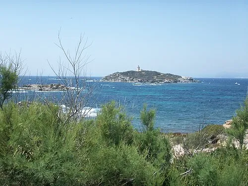
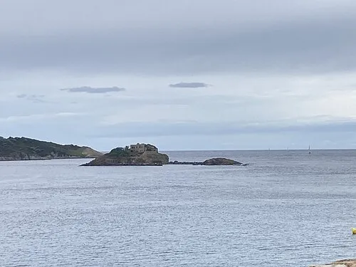
Nature and heritage in Var
Sources & licences
Data last updated: · 2 independent sources