Alpes-de-Haute-Provence
Located in Provence-Alpes-Côte d'Azur Region, France Coordinates: 44°05′54″ N 6°15′55″ E

- Population
- 167,179
- 167.2K
- Elevation
- 898 m
- above sea level
- Local time
- UTC+01:00
- Europe/Paris · UTC+01:00
- Places inside
- 95
- listed under Alpes-de-Haute-Provence
- Airports
- NCE Nice-Côte d'Azur Airport91 km
- AVN Avignon Caumont airport111 km
About Alpes-de-Haute-Provence
Alpes-de-Haute-Provence is a district. Location: Provence-Alpes-Côte d'Azur Region, France. Population: 167,179.
Alpes-de-Haute-Provence (sometimes abbreviated as AHP; French pronunciation: [alp də ot pʁɔvɑ̃s] ; Occitan: Aups d'Auta Provença; lit. 'Alps of Upper Provence'), formerly until 1970 known as Basses-Alpes (French pronunciation: [basz‿alp], lit. 'Lower Alps'), is a department in the Provence-Alpes-Côte d'Azur region of France, bordering Alpes-Maritimes and Italy to the east, Var to the south, Vaucluse to the west, Drôme and Hautes-Alpes to the north.
Source: Wikipedia · CC BY-SA 4.0
At a glance
- Built
- 1790
- Area
- 6,925 km²
- Official website
- alpes-de-haute-provence.gouv.fr
Source: Wikidata
Photos of Alpes-de-Haute-Provence
-

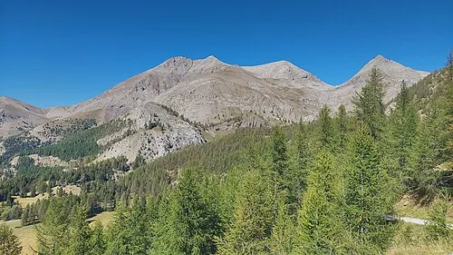
HelBoo · CC0 -
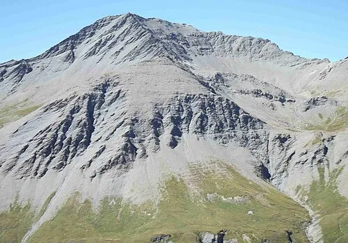
Mont Pelat Harald Hetzner · CC0 -
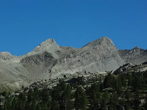
Testa di Malacosta F Ceragioli · CC BY-SA 4.0 -
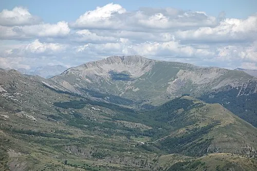
Les Trois Évêchés Sébastien Thébault · CC BY-SA 3.0 -
Les Monges Christian Pinatel de Salvator · CC BY-SA 3.0


Travel notes for Alpes-de-Haute-Provence
From Wikivoyage
Alpes-de-Haute-Provence is a department in the French region Provence-Alpes-Côte d'Azur, and is on the French border with Italy. The area's scenery provides the background to many activities and sights.
Understand+
The department can be divided into two parts: the west and the south of the department are Provençal, while the north-east is more mountainous (Val d'Allos and Ubaye valley).
Source: Wikivoyage · CC BY-SA 4.0 · abridged
Places bordering Alpes-de-Haute-Provence
- Hautes-Alpes
- Drôme
- Vaucluse
- Var
- Alpes-Maritimes
- Piedmont
Population of Alpes-de-Haute-Provence over time
| 1872 | 139,132 | |
|---|---|---|
| 1876 | 136,166 | |
| 1886 | 129,404 | |
| 2015 | 161,799 | |
| 2017 | 163,915 | |
| 2018 | 164,068 | |
| 2019 | 164,308 | |
| 2020 | 165,451 | |
| 2021 | 166,077 | |
| 2022 | 167,179 | |
| 2023 | 168,054 |
Censuses and official estimates; source: Wikidata.
Climate of Alpes-de-Haute-Provence
Best months for sightseeingBest months for sightseeing: June–September.
This month · November
A cold month
Day 11° · Night 2° · Rain 93 mm
- Hottest month
- July (day 26°)
- Coldest month
- January (night -2°)
- Wettest month
- October (108 mm)
- Driest month
- July (39 mm)
Bars: average monthly low and high temperature. Below: precipitation. Monthly averages for 1970–2000 at about 18 km resolution, adjusted for elevation. Highlighted months are mild and relatively dry. Source: WorldClim 2.1 (CC BY 4.0).
Show values as a table
| Month | Jan | Feb | Mar | Apr | May | Jun | Jul | Aug | Sep | Oct | Nov | Dec |
|---|---|---|---|---|---|---|---|---|---|---|---|---|
| Average high (°C) | 7° | 8° | 11° | 14° | 18° | 22° | 26° | 26° | 22° | 16° | 11° | 8° |
| Average low (°C) | -2° | -1° | 1° | 3° | 7° | 10° | 13° | 13° | 10° | 6° | 2° | -1° |
| Precipitation (mm) | 75 | 62 | 61 | 76 | 74 | 63 | 39 | 59 | 76 | 108 | 93 | 81 |
Other places to visit in this season: June July August September
How to get to Alpes-de-Haute-Provence
The nearest airport is Nice-Côte d'Azur Airport (NCE), 91 km to the southeast as the crow flies. The nearest large city is Aix-en-Provence, 91 km to the southwest.
Airports
- Nice-Côte d'Azur Airport (NCE) Nice, Alpes-Maritimes 91 kmsoutheast
- Avignon Caumont airport (AVN) Avignon 111 kmwest
- Toulon-Hyères Airport (TLN) Hyères, Var 112 kmsouth
Nearby large cities
- Aix-en-Provence Population: 146.8K 91 kmsouthwest
- Nice Population: 342.7K 92 kmsoutheast
- Toulon Population: 168.7K 112 kmsouth
- Marseille Population: 877.2K 114 kmsouthwest
- Grenoble Population: 158.6K 128 kmnorth
Straight-line distances; road distances are longer. Airport data: OurAirports.
Day trips from Alpes-de-Haute-Provence
Within 100 km: 147 historic and cultural sites, 1,373 natural sites, 283 lakes, rivers and coasts.
0–25 km98 places
- Montagne de Vachière Mountain 21 kmNE
- Sommet de la Sapée Mountain 13 kmSE
- La Roche Percée Mountain 10 kmSW
- La Faye Mountain 24 kmNW
25–60 km490 places
- Clapes River 30 kmN
- Lakes of Vens Lake 59 kmNE
- Lacs de Ténibres Lake 60 kmE
- Lacs Marie Lake 58 kmE
60–100 km1,215 places
- Siagne River 84 kmSE
- Plage du Grand Boucharel Beach 88 kmSE
- Plage de la Galiote Beach 87 kmSE
- Plage de Saint-Aygulf Beach 86 kmSE
Straight-line distances.
Places in Alpes-de-Haute-Provence
95 places- 1 Arrondissement of Forcalquier 99.3K
- 2 Arrondissement de Digne-les-Bains 47.3K
- 3 Arrondissement de Castellane 11.4K
- 4 Arrondissement of Barcelonnette 7.7K
Bar: population relative to the most populous place in this list.
Mountains & nature26
- Bois d'Asson · Natural site
- Bois de Colle de Breis · Natural site
- Bois de la Fayée · Natural site
- Bois de la Lauze · Natural site
- Bois de la Montagne · Natural site
- Bois de la Roquette · Natural site
- Bois de la Silve · Natural site
- Bois de l'Eyssilloun · Natural site
- Bois de Malassoque · Natural site
- Bois de Monier · Natural site
- Bois de Peynier · Natural site
- Bois des Seignus · Natural site
- Bois du Cracq · Natural site
- Bois du Défends · Natural site
- Bois Noir · Natural site
- Combe de Chavalet · Natural site
- Forêt de Cruis · Natural site
- Forêt de Vinon · Natural site
- Forêt Domaniale de Valbelle · Natural site
- Gapençais · Mountain
- Gorges du Verdon · Natural site
- Le Grand Bois · Natural site
- Montagne de Lure · Mountain
- Montagnes des Têtes · Mountain
- Monts du Cheval-Blanc · Mountain
- Plateau de Saint-Christol · Natural site
Lakes, rivers & coasts30
- Artuby · River
- Asse · River
- Bès · River
- Bléone · River
- Buëch River · River
- Clapes · River
- Colostre · River
- Estoublaisse · River
- Galabre · River
- Grand Riou de la Blanche · River
- Issole · River
- Jabron · River
- Lac de Castillon · Lake
- Lac de Derrière la Croix · Lake
- Lac de la Reculaïa · Lake
- Lac de Longet · Lake
- Lac d'Oronaye · Lake
- Lac du Lauzanier · Lake
- Lac Premier · Lake
- Lacs de Marinet · Lake
- Lacs de Roure · Lake
- Lacs des Hommes · Lake
- Lane · River
- Largue · River
- Lauzon · River
- Laye · River
- Laye · River
- Moussou · River
- Ravin de Bussing · River
- Ravin de Laval · River
Nature and heritage in Alpes-de-Haute-Provence
Other regions in Provence-Alpes-Côte d'Azur Region
-
 Var District, Provence-Alpes-Côte d'Azur Region71 km S
-
 Alpes-Maritimes District, Provence-Alpes-Côte d'Azur Region78 km E
-
 Vaucluse District, Provence-Alpes-Côte d'Azur Region89 km W
-
 Hautes-Alpes District, Provence-Alpes-Côte d'Azur Region65 km N
-
 Bouches-du-Rhône District, Provence-Alpes-Côte d'Azur Region93 km SW
Sources & licences
Data last updated: · 2 independent sources