Var
Located in Provence-Alpes-Côte d'Azur Region, France Coordinates: 43°27′31″ N 6°17′29″ E

- Population
- 1,108,364
- 1.1M
- Elevation
- 174 m
- above sea level
- Local time
- UTC+01:00
- Europe/Paris · UTC+01:00
- Places inside
- 112
- listed under Var
- Airports
- TLN Toulon-Hyères Airport42 km
- NCE Nice-Côte d'Azur Airport78 km
About Var
Var is a district. Location: Provence-Alpes-Côte d'Azur Region, France. Population: 1,108,364.
Var (French: [vaʁ] ; Occitan: [ˈbaɾ]) is a department in the Provence-Alpes-Côte d'Azur region in southeastern France. It is bordered on the east by the Alpes-Maritimes department; to the west by Bouches-du-Rhône; to the north of the river Verdon by the Alpes-de-Haute-Provence department; and to the south by the Mediterranean Sea. It had a population of 1,119,307 in 2023.
Source: Wikipedia · CC BY-SA 4.0
At a glance
- Built
- 1790
- Area
- 5,973 km²
Source: Wikidata
Photos of Var
-
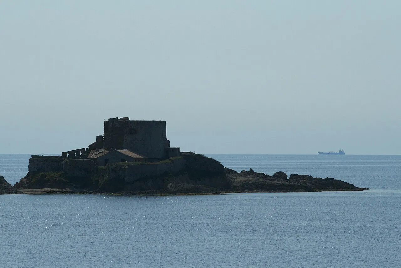
Île du Petit Langoustier Remi Jouan · CC BY-SA 3.0 -
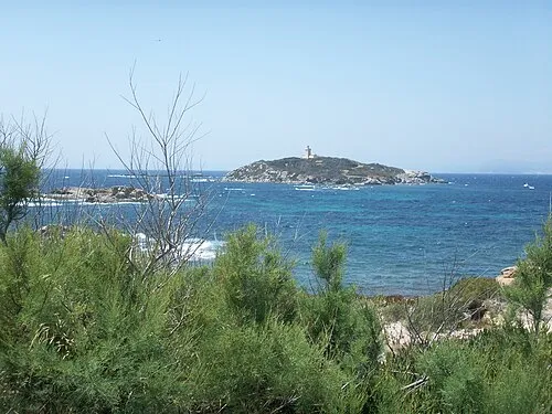
Île du Grand Rouveau Flobio83 · Public domain -
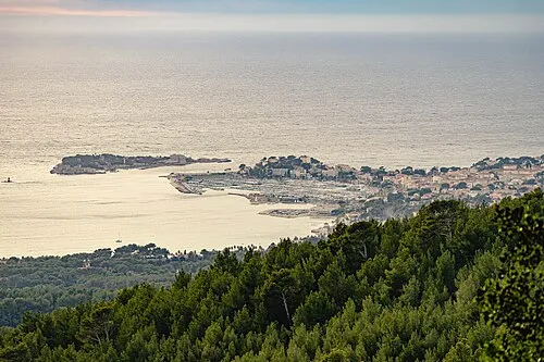
Île de Bandol Adltbc92 · CC BY-SA 3.0 -
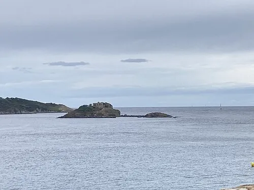
Île du Ribaudon Ruthven · CC BY-SA 3.0 -
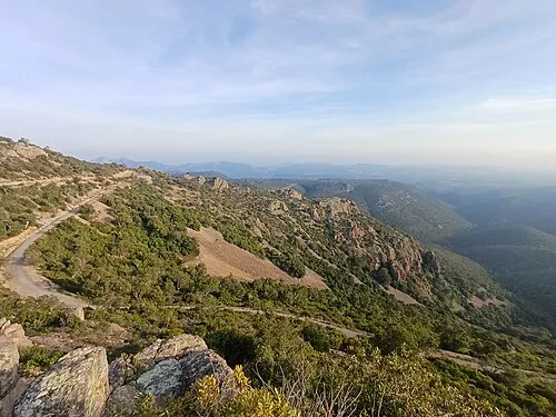
Sommet de Malavelette Wlofab · CC BY-SA 4.0


Travel notes for Var
From Wikivoyage
Var is a département in the Provence-Alpes-Côte d'Azur region on the Mediterranean coast of France. Var is known for the harbour of Toulon, the main port of the French Navy, for its seaside resorts, the most famous of which is Saint-Tropez, for some fine examples of Romanesque and other medieval architecture, such as Le Thoronet Abbey and the Fréjus Cathedral, for its wines, particularly the wines of Bandol, as well as for its motorsport race track Circuit Paul Ricard, located in Le Castellet.
Understand+
The principal industry of Var is tourism, thanks largely to the big summer influx of tourists to the South of France and the Mediterranean coast in particular, but also inland to the Verdon River Canyon and hilltop villages and vineyards.
Tourist information:
Visit Var website
Source: Wikivoyage · CC BY-SA 4.0 · abridged
Places bordering Var
- Alpes-de-Haute-Provence
- Alpes-Maritimes
- Bouches-du-Rhône
- Vaucluse
Population of Var over time
| 2015 | 1,048,652 | |
|---|---|---|
| 2017 | 1,058,740 | |
| 2018 | 1,067,697 | |
| 2019 | 1,076,711 | |
| 2020 | 1,085,189 | |
| 2021 | 1,095,337 | |
| 2022 | 1,108,364 | |
| 2023 | 1,119,307 |
Censuses and official estimates; source: Wikidata.
Climate of Var
Best months for sightseeingBest months for sightseeing: May–July, September.
This month · November
Outside the best season
Day 15° · Night 7° · Rain 86 mm
- Hottest month
- August (day 28°)
- Coldest month
- January (night 3°)
- Wettest month
- October (106 mm)
- Driest month
- July (14 mm)
Bars: average monthly low and high temperature. Below: precipitation. Monthly averages for 1970–2000 at about 18 km resolution, adjusted for elevation. Highlighted months are mild and relatively dry. Source: WorldClim 2.1 (CC BY 4.0).
Show values as a table
| Month | Jan | Feb | Mar | Apr | May | Jun | Jul | Aug | Sep | Oct | Nov | Dec |
|---|---|---|---|---|---|---|---|---|---|---|---|---|
| Average high (°C) | 12° | 12° | 15° | 17° | 21° | 24° | 28° | 28° | 24° | 20° | 15° | 12° |
| Average low (°C) | 3° | 4° | 5° | 8° | 11° | 15° | 17° | 17° | 15° | 11° | 7° | 4° |
| Precipitation (mm) | 78 | 67 | 57 | 65 | 54 | 39 | 14 | 42 | 62 | 106 | 86 | 76 |
Other places to visit in this season: May June July September
How to get to Var
The nearest airport is Toulon-Hyères Airport (TLN), 42 km to the south as the crow flies. For international flights: Nice-Côte d'Azur Airport (NCE) (78 km). The nearest large city is Toulon, 47 km to the southwest.
Airports
- Toulon-Hyères Airport (TLN) Hyères, Var 42 kmsouth
- Nice-Côte d'Azur Airport (NCE) Nice, Alpes-Maritimes 78 kmeast
- Marseille Provence Airport (MRS) Marignane, Bouches-du-Rhône 87 kmwest
Nearby large cities
- Toulon Population: 168.7K 47 kmsouthwest
- Aix-en-Provence Population: 146.8K 69 kmwest
- Marseille Population: 877.2K 76 kmwest
- Nice Population: 342.7K 83 kmeast
- Nîmes Population: 148.2K 162 kmwest
Straight-line distances; road distances are longer. Airport data: OurAirports.
Day trips from Var
Within 100 km: 172 historic and cultural sites, 789 natural sites, 211 lakes, rivers and coasts.
0–25 km58 places
- Montagne des Ubacs Mountain 5 kmS
- Puy de la Signe Mountain 15 kmNE
- Montagne du Serré Mountain 12 kmNW
- Sommet du Peynier Mountain 20 kmE
25–60 km417 places
- Siagne River 54 kmE
- Plage du Grand Boucharel Beach 36 kmE
- Plage de la Galiote Beach 36 kmE
- Plage de Saint-Aygulf Beach 36 kmE
60–100 km697 places
- Plages du Prado Beach 78 kmW
- Plage Petite Afrique Beach 89 kmE
- Plage des Fourmis Beach 88 kmE
- Neptune Plage Beach 82 kmE
Straight-line distances.
Places in Var
112 placesCities & villages1
- Porquerolles · Village
Mountains & nature18
- Forêt de Janas · Natural site
- Forêt des Maures · Natural site
- Forêt Domaniale de l'Estérel · Natural site
- Forêt Domaniale des Morières · Natural site
- Forêt Domaniale du Dom · Natural site
- Forêt Royale · Natural site
- Golfe de Saint-Tropez · Natural site
- Grand Plan de Canjuers · Natural site
- Le Gros Bois · Natural site
- Monts des Maures · Mountain
- Parc National de Port-Cros · Natural site
- Plan de Canjuers · Natural site
- Rocs de la Caïre · Mountain
- Rouet Bois du · Natural site
- Source d'Argens · Natural site
- Vallon de Gratteloup · Natural site
- Vallon du Revest · Natural site
- Vallon Sourd · Natural site
Lakes, rivers & coasts33
- Gapeau · River
- Grimaud · River
- Île de Bandol · Island
- Île de Beaumont · Island
- Île de Port-Cros · Island
- Île d'Or · Island
- Île du Petit Langoustier · Island
- Îlot de Léoube · Island
- Issole · River
- Lac de Saint-Cassien · Lake
- Las · River
- Môle · River
- Nartuby · River
- Réal Collobrier · River
- Réal Martin · River
- Reppe · River
- Reyran · River
- Riou Blanc · River
- Ruisseau de la Verne · River
- Ruisseau de Pennafort · River
- Ruisseau des Écrevisses · River
- Ruisseau du Périer · River
- Ruisseau l'Eau Salée · River
- Ruisseau le Blavet · River
- Ruisseau le Couloubrier · River
- Ruisseau le Fournel · River
- Ruisseau le Mourrefrey · River
- Ruisseau le Réal d'Or · River
- Ruisseau le Ritort · River
- Torrent le Destel · River
- Vallon de Saint-Daumas · River
- Vallon du Val · River
- Verdon · River
Nature and heritage in Var
Other regions in Provence-Alpes-Côte d'Azur Region
-
 Alpes-Maritimes District, Provence-Alpes-Côte d'Azur Region89 km NE
-
 Vaucluse District, Provence-Alpes-Côte d'Azur Region109 km NW
-
 Alpes-de-Haute-Provence District, Provence-Alpes-Côte d'Azur Region71 km N
-
 Bouches-du-Rhône District, Provence-Alpes-Côte d'Azur Region70 km W
-
 Hautes-Alpes District, Provence-Alpes-Côte d'Azur Region136 km N
Sources & licences
Data last updated: · 2 independent sources