Sandhofen
Located in Mannheim, Stadtkreis Mannheim Coordinates: 49°32′35″ N 8°26′59″ E

- Elevation
- 95 m
- above sea level
- Local time
- UTC+01:00
- Europe/Berlin · UTC+01:00
- Airports
- MHG Mannheim-City Airport9 km
- FRA Frankfurt Main Airport54 km
About Sandhofen
Sandhofen is a neighbourhood. Location: Mannheim, Stadtkreis Mannheim.
Sandhofen is a northern borough (Stadtbezirk) of Mannheim, Baden-Württemberg, Germany. The US Army is present in Sandhofen with Coleman Airfield and Coleman Barracks. The US Army's only military prison in Europe was located at Coleman. All US Army helicopter maintenance for Europe and the Middle East was once performed at Coleman. Coleman is currently used for storage and maintenance of military vehicles.
Source: Wikipedia · CC BY-SA 4.0
At a glance
- Area
- 26.7 km²
Source: Wikidata
Photos of Sandhofen
-

Arniegraphie · CC BY-SA 4.0 -

Oberlausitzerin64 · CC BY-SA 4.0 -

Immanuel Giel · CC BY 3.0 -

Immanuel Giel · CC0 -

Martin Hawlisch · CC BY-SA 3.0


Climate of Sandhofen
Best months for sightseeingBest months for sightseeing: May–September.
This month · November
A cold month
Day 8° · Night 3° · Rain 51 mm
- Hottest month
- July (day 25°)
- Coldest month
- January (night -1°)
- Wettest month
- July (74 mm)
- Driest month
- February (36 mm)
Bars: average monthly low and high temperature. Below: precipitation. Monthly averages for 1970–2000 at about 18 km resolution, adjusted for elevation. Highlighted months are mild and relatively dry. Source: WorldClim 2.1 (CC BY 4.0).
Show values as a table
| Month | Jan | Feb | Mar | Apr | May | Jun | Jul | Aug | Sep | Oct | Nov | Dec |
|---|---|---|---|---|---|---|---|---|---|---|---|---|
| Average high (°C) | 4° | 6° | 11° | 15° | 20° | 23° | 25° | 25° | 21° | 14° | 8° | 5° |
| Average low (°C) | -1° | -1° | 2° | 5° | 9° | 13° | 14° | 14° | 11° | 7° | 3° | 1° |
| Precipitation (mm) | 37 | 36 | 42 | 42 | 70 | 67 | 74 | 48 | 51 | 51 | 51 | 48 |
Other places to visit in this season: May June July August September
How to get to Sandhofen
The nearest airport is Mannheim-City Airport (MHG), 9 km to the southeast as the crow flies. For international flights: Frankfurt Main Airport (FRA) (54 km). The nearest large city is Mannheim, 6 km to the south.
Airports
- Mannheim-City Airport (MHG) Mannheim 9 kmsoutheast
- Frankfurt Main Airport (FRA) Frankfurt am Main 54 kmnorth
- Karlsruhe Baden-Baden Airport (FKB) Rheinmünster 89 kmsouth
Nearby large cities
- Mannheim Population: 308K 6 kmsouth
- Ludwigshafen am Rhein Population: 163.2K 7 kmsouth
- Heidelberg Population: 143.3K 23 kmsoutheast
- Darmstadt Population: 167K 39 kmnorth
- Mainz Population: 222.9K 50 kmnorth
Straight-line distances; road distances are longer. Airport data: OurAirports.
Day trips from Sandhofen
Within 100 km: 1,061 historic and cultural sites, 4,006 natural sites, 833 lakes, rivers and coasts.
0–25 km381 places
- Friesenheimer Insel Island 3 kmS
- Neckarinsel Island 22 kmSE
- Otterstadter Altrhein Lake 17 kmS
- Angelhofer Altrhein Lake 20 kmS
25–60 km1,719 places
- Elsenz River 30 kmSE
- Modau River 30 kmN
- Petersaue Island 55 kmN
- Mariannenaue Island 59 kmNW
60–100 km3,800 places
- Umpfer River 93 kmE
- Aar River 97 kmN
- Rüdesheimer Aue Island 61 kmNW
- Pfaffensee Lake 100 kmSE
Straight-line distances.
Nearby attractions & nature
Everything nearby-
Mannheim-Sandhofen Concentration Camp Historic site, Mannheim2 km NE
-
Altrhein Lake, Baden-Wurttemberg2 km SE
-
Friesenheimer Insel Island, Baden-Wurttemberg2.9 km S
-
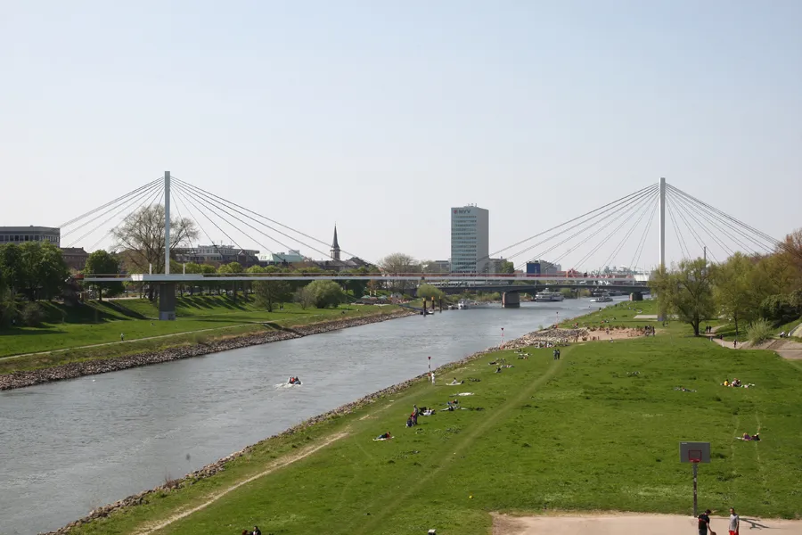 Neckarsteg Landmark, Mannheim6 km S
-
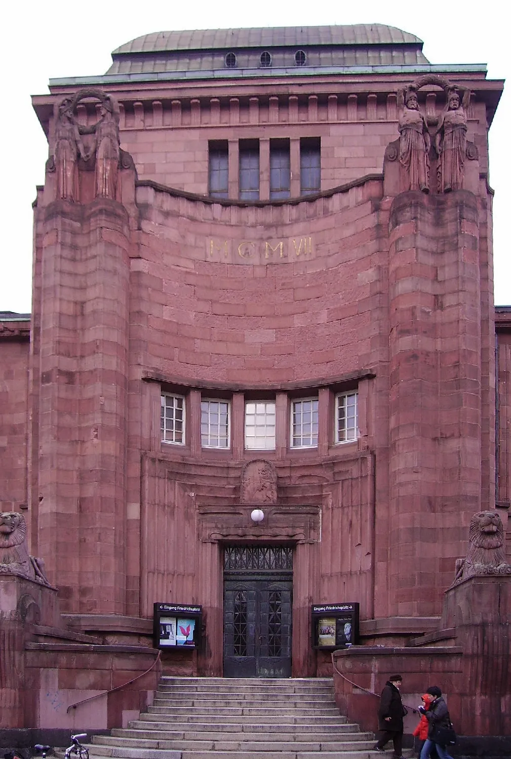 Mannheim Art Gallery Museum, Mannheim7 km S
-
200 Meter Kamin der BASF-Werke Landmark, Ludwigshafen am Rhein3.6 km S
Other cities and towns in Mannheim
-
 Luzenberg Village, Mannheim3.6 km SE
-
Gartenstadt Village, Mannheim3.9 km E
-
Käfertal Neighbourhood, Mannheim5.8 km SE
-
Vogelstang Neighbourhood, Mannheim7.7 km SE
-
Lindenhof Village, Mannheim8 km S
-
 Neckarau Neighbourhood, Mannheim9.8 km S
Sources & licences
Data last updated: · 2 independent sources