Alb-Donau-Kreis
Located in Tübingen Region, Baden-Wurttemberg Coordinates: 48°25′04″ N 9°50′15″ E
- Population
- 202,354
- 202.4K
- Elevation
- 670 m
- above sea level
- Local time
- UTC+01:00
- Europe/Berlin · UTC+01:00
- Places inside
- 55
- listed under Alb-Donau-Kreis
- Airports
- STR Stuttgart Airport55 km
- FMM Memmingen Allgau Airport56 km
About Alb-Donau-Kreis
Alb-Donau-Kreis is a municipality. Location: Tübingen Region, Baden-Wurttemberg. Population: 202,354. Elevation: 670 m. The best months to visit are June–August. The nearest airport is Stuttgart Airport (55 km). Nearby sights include Borgerhau and Schlag.
Photos of Alb-Donau-Kreis
-
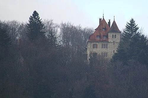
Schloß Neusteußlingen Dr. Eugen Lehle · CC BY-SA 3.0

Climate of Alb-Donau-Kreis
Best months for sightseeingBest months for sightseeing: June–August.
This month · November
A cold month
Day 5° · Night -1° · Rain 62 mm
- Hottest month
- July (day 22°)
- Coldest month
- January (night -5°)
- Wettest month
- June (102 mm)
- Driest month
- February (49 mm)
Bars: average monthly low and high temperature. Below: precipitation. Monthly averages for 1970–2000 at about 18 km resolution, adjusted for elevation. Highlighted months are mild and relatively dry. Source: WorldClim 2.1 (CC BY 4.0).
Show values as a table
| Month | Jan | Feb | Mar | Apr | May | Jun | Jul | Aug | Sep | Oct | Nov | Dec |
|---|---|---|---|---|---|---|---|---|---|---|---|---|
| Average high (°C) | 1° | 2° | 7° | 11° | 17° | 19° | 22° | 22° | 17° | 11° | 5° | 2° |
| Average low (°C) | -5° | -4° | -1° | 2° | 6° | 10° | 11° | 11° | 7° | 4° | -1° | -3° |
| Precipitation (mm) | 50 | 49 | 49 | 62 | 82 | 102 | 94 | 83 | 67 | 62 | 62 | 59 |
How to get to Alb-Donau-Kreis
The nearest airport is Stuttgart Airport (STR), 55 km to the northwest as the crow flies. The nearest large city is Ulm, 12 km to the east.
Airports
- Stuttgart Airport (STR) Stuttgart 55 kmnorthwest
- Memmingen Allgau Airport (FMM) Memmingen 56 kmsoutheast
- Bodensee Airport Friedrichshafen (FDH) Friedrichshafen 86 kmsouth
Nearby large cities
- Ulm Population: 120.5K 12 kmeast
- Reutlingen Population: 112.6K 48 kmwest
- Stuttgart Population: 612.7K 63 kmnorthwest
- Augsburg Population: 301.1K 79 kmeast
- Heilbronn Population: 120.7K 92 kmnorthwest
Straight-line distances; road distances are longer. Airport data: OurAirports.
Day trips from Alb-Donau-Kreis
Within 100 km: 893 historic and cultural sites, 3,323 natural sites, 869 lakes, rivers and coasts.
0–25 km362 places
- Lauter River 5 kmE
- Blautopf Lake 4 kmW
- Weißenberg Mountain 22 kmSE
- Wallenstetten Mountain 24 kmSW
25–60 km1,622 places
- Lauter River 45 kmNW
- Zeller See Lake 48 kmS
- Steeger See Lake 53 kmS
- Stadtsee Lake 55 kmS
60–100 km3,101 places
- Hessental Concentration Camp Historic site 77 kmN
- Mainau Island 92 kmSW
- Dominikanerinsel Konstanz Island 97 kmSW
- Emmishofenweiher Lake 99 kmSW
Straight-line distances.
Alb-Donau-Kreis and similar cities
Side by side with cities of similar size in the same country: population, elevation and climate.
| Measure | Alb-Donau-Kreis | Hagen | Rostock | Kassel |
|---|---|---|---|---|
| Population | 202.4K | 199K | 198.3K | 197.2K |
| Elevation | 670 m | 111 m | 18 m | 164 m |
| Summer day (hottest month) | 22° | 23° | 22° | 23° |
| Winter night (coldest month) | -5° | -1° | -2° | -2° |
| Annual rainfall | 821 mm | 980 mm | 596 mm | 752 mm |
| Best months | Jun–Aug | Jun–Aug | Jun–Aug | Jun–Aug |
| Distance | — | 369 km | 651 km | 323 km |
Climate values are 1970–2000 monthly averages; straight-line distance.
Places in Alb-Donau-Kreis
55 places- 1 Ehingen (Donau) 27.8K
- 2 Blaustein 16.6K
- 3 Langenau 15.3K
- 4 Erbach an der Donau 14.1K
- 5 Blaubeuren 12.7K
- 6 Laichingen 12.4K
- 7 Dornstadt 9.2K
- 8 Dietenheim 6.8K
- 9 Schelklingen 6.6K
- 10 Munderkingen 5.4K
- 11 Lonsee 5.2K
- 12 Illerkirchberg 5K
- 13 Allmendingen 4.9K
- 14 Amstetten 4.2K
- 15 Illerrieden 3.4K
- 16 Staig 3.3K
- 17 Westerheim 3.1K
- 18 Heroldstatt 2.9K
- 19 Beimerstetten 2.5K
- 20 Oberdischingen 2.3K
- 21 Bernstadt 2.3K
- 22 Rottenacker 2.3K
- 23 Öpfingen 2.3K
- 24 Balzheim 2.1K
- 25 Westerstetten 2.1K
- 26 Merklingen 2.1K
- 27 Berghülen 2.1K
- 28 Nellingen 2K
- 29 Altheim (Alb) 1.8K
- 30 Oberstadion 1.6K
- 31 Hüttisheim 1.5K
- 32 Schnürpflingen 1.4K
- 33 Weidenstetten 1.4K
- 34 Obermarchtal 1.3K
- 35 Rammingen 1.3K
- 36 Asselfingen 1K
- 37 Griesingen 1K
- 38 Unterstadion 909
- 39 Untermarchtal 840
- 40 Neenstetten 827
- 41 Emerkingen 816
- 42 Setzingen 752
- 43 Ballendorf 696
- 44 Lauterach 586
- 45 Altheim 582
- 46 Öllingen 542
- 47 Nerenstetten 379
- 48 Breitingen 354
- 49 Rechtenstein 293
- 50 Hausen am Bussen 283
- 51 Holzkirch 283
- 52 Grundsheim 203
- 53 Unterwachingen 195
- 54 Emeringen 176
- 55 Börslingen 168
Bar: population relative to the most populous place in this list.
Nearby attractions & nature
Everything nearby-
Borgerhau Natural site, Baden-Wurttemberg1.8 km N
-
Schlag Natural site, Baden-Wurttemberg3.3 km NW
-
Flinsenlauh Natural site, Baden-Wurttemberg3.3 km NW
-
Ach River, Baden-Wurttemberg3.4 km SW
-
Klingensteiner Wald Natural site, Baden-Wurttemberg3.9 km SE
-
Kiesental Natural site, Baden-Wurttemberg4.9 km E
-
Blautopf Lake, Baden-Wurttemberg4 km W
-
Lautertal Natural site, Baden-Wurttemberg5.7 km N
Sources & licences
Data last updated: