Landkreis Schweinfurt
Located in Lower Franconia, Bavaria Coordinates: 50°00′24″ N 10°15′09″ E
- Population
- 113,608
- 113.6K
- Elevation
- 222 m
- above sea level
- Local time
- UTC+01:00
- Europe/Berlin · UTC+01:00
- Places inside
- 42
- listed under Landkreis Schweinfurt
- Airports
- NUE Nuremberg Airport82 km
- ERF Erfurt-Weimar Airport119 km
About Landkreis Schweinfurt
Landkreis Schweinfurt is a municipality. Location: Lower Franconia, Bavaria. Population: 113,608. Elevation: 222 m. The best months to visit are May–September. The nearest airport is Nuremberg Airport (82 km). Nearby sights include Kapitelwald and Spitalholz.
Climate of Landkreis Schweinfurt
Best months for sightseeingBest months for sightseeing: May–September.
This month · November
A cold month
Day 7° · Night 1° · Rain 56 mm
- Hottest month
- July (day 24°)
- Coldest month
- February (night -3°)
- Wettest month
- July (69 mm)
- Driest month
- February (43 mm)
Bars: average monthly low and high temperature. Below: precipitation. Monthly averages for 1970–2000 at about 18 km resolution, adjusted for elevation. Highlighted months are mild and relatively dry. Source: WorldClim 2.1 (CC BY 4.0).
Show values as a table
| Month | Jan | Feb | Mar | Apr | May | Jun | Jul | Aug | Sep | Oct | Nov | Dec |
|---|---|---|---|---|---|---|---|---|---|---|---|---|
| Average high (°C) | 3° | 4° | 9° | 14° | 19° | 22° | 24° | 24° | 19° | 13° | 7° | 4° |
| Average low (°C) | -2° | -3° | 1° | 3° | 8° | 11° | 12° | 12° | 9° | 5° | 1° | -1° |
| Precipitation (mm) | 52 | 43 | 46 | 44 | 55 | 68 | 69 | 53 | 50 | 55 | 56 | 64 |
Other places to visit in this season: May June July August September
How to get to Landkreis Schweinfurt
The nearest airport is Nuremberg Airport (NUE), 82 km to the southeast as the crow flies. The nearest large city is Würzburg, 32 km to the southwest.
Airports
- Nuremberg Airport (NUE) Nuremberg 82 kmsoutheast
- Erfurt-Weimar Airport (ERF) Erfurt 119 kmnortheast
- Frankfurt Main Airport (FRA) Frankfurt am Main 121 kmwest
Nearby large cities
- Würzburg Population: 133.7K 32 kmsouthwest
- Erlangen Population: 102.7K 71 kmsoutheast
- Fürth Population: 132K 79 kmsoutheast
- Nuremberg Population: 515.5K 86 kmsoutheast
- Offenbach Population: 119.2K 107 kmwest
Straight-line distances; road distances are longer. Airport data: OurAirports.
Day trips from Landkreis Schweinfurt
Within 100 km: 1,250 historic and cultural sites, 4,719 natural sites, 854 lakes, rivers and coasts.
0–25 km424 places
- Badsee Lake 15 kmSE
- Sennfelder See Lake 4 kmN
- Schwappacher See Lake 14 kmE
- Schwanensee Lake 8 kmSE
25–60 km2,333 places
- Uzbach River 52 kmS
- Wolfsee Lake 43 kmS
- Unterer Herrnsee Lake 56 kmSE
- Tränksee Lake 31 kmS
60–100 km4,066 places
- Waldstadion Weismain Landmark 72 kmE
- Spitzelberg Mountain 100 kmSE
- Stollenberg Mountain 98 kmSE
- Umpfer River 64 kmSW
Straight-line distances.
Landkreis Schweinfurt and similar cities
Side by side with cities of similar size in the same country: population, elevation and climate.
| Measure | Landkreis Schweinfurt | Reutlingen | Remscheid | Bremerhaven |
|---|---|---|---|---|
| Population | 113.6K | 112.6K | 117.1K | 118.6K |
| Elevation | 222 m | 374 m | 351 m | 2 m |
| Summer day (hottest month) | 24° | 23° | 21° | 21° |
| Winter night (coldest month) | -3° | -2° | -2° | 0° |
| Annual rainfall | 655 mm | 906 mm | 1,153 mm | 726 mm |
| Best months | May–Sep | Jun–Sep | Jun–Aug | Jun–Aug |
| Distance | — | 185 km | 253 km | 411 km |
Climate values are 1970–2000 monthly averages; straight-line distance.
Places in Landkreis Schweinfurt
42 places- 1 Werneck, Markt 10.1K
- 2 Niederwerrn 8.3K
- 3 Schonungen 7.6K
- 4 Dittelbrunn 7.5K
- 5 Gerolzhofen 6.8K
- 6 Gochsheim 6.1K
- 7 Kolitzheim 5.7K
- 8 Bergrheinfeld 5.3K
- 9 Röthlein 4.4K
- 10 Poppenhausen 4.4K
- 11 Grettstadt 4.3K
- 12 Sennfeld 4.2K
- 13 Stadtlauringen, Markt 4.1K
- 14 Schwebheim 4.1K
- 15 Üchtelhausen 3.8K
- 16 Grafenrheinfeld 3.4K
- 17 Wasserlosen 3.4K
- 18 Euerbach 2.9K
- 19 Waigolshausen 2.7K
- 20 Geldersheim 2.5K
- 21 Sulzheim 2K
- 22 Donnersdorf 2K
- 23 Schwanfeld 1.7K
- 24 Oberschwarzach, Markt 1.4K
- 25 Dingolshausen 1.3K
- 26 Michelau i.Steigerwald 1.2K
- 27 Wipfeld 982
- 28 Frankenwinheim 979
- 29 Lülsfeld 768
Bar: population relative to the most populous place in this list.
Mountains & nature11
- Banzer Rangen · Mountain
- Dürrberg · Mountain
- Geiersberg · Mountain
- Hubertus Brunnen · Natural site
- Murrleins-Brunnen · Natural site
- Murrleinsnest · Mountain
- Sägbrunnen · Natural site
- Schamberg · Mountain
- Stollberg · Mountain
- Vollburg · Mountain
- Wildbrunnen · Natural site
Heritage & sights2
- Aussichtsturm Zabelstein · Landmark
- Ruine Zabelstein · Historic site
Nearby attractions & nature
Everything nearby-
Kapitelwald Natural site, Bavaria1.3 km W
-
Spitalholz Natural site, Bavaria1.4 km NW
-
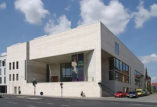 Museum Georg Schäfer Museum, Schweinfurt4.3 km N
-
Froschbach River, Bavaria2.2 km SE
-
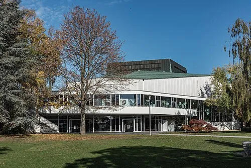 Theater der Stadt Schweinfurt Attraction, Schweinfurt4.7 km NW
-
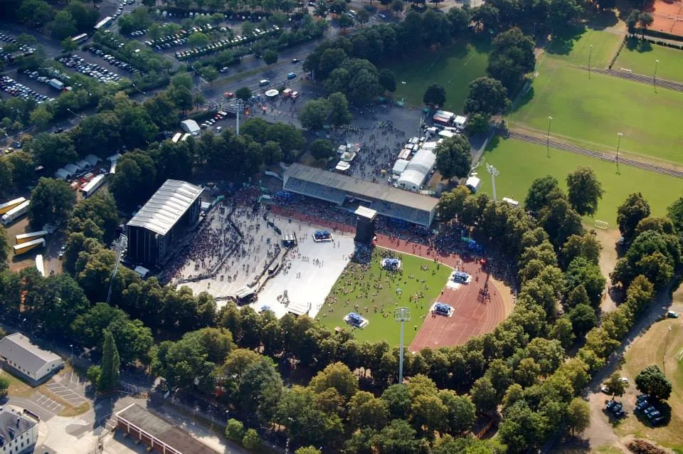 Willy-Sachs-Stadion Landmark, Schweinfurt6.1 km NW
-
Oberholz Natural site, Bavaria3.8 km E
-
Fichtel and Sachs bunker Museum, Schweinfurt4 km NW
Sources & licences
Data last updated: