Untermichelbach
Located in Wittelshofen, Landkreis Ansbach Coordinates: 49°03′59″ N 10°28′02″ E
- Elevation
- 437 m
- above sea level
- Local time
- UTC+01:00
- Europe/Berlin · UTC+01:00
- Airports
- NUE Nuremberg Airport65 km
- STR Stuttgart Airport100 km
About Untermichelbach
Untermichelbach is a village. Location: Wittelshofen, Landkreis Ansbach. Elevation: 437 m. The best months to visit are June–September. The nearest airport is Nuremberg Airport (65 km). Nearby sights include Kastell Ruffenhofen and Hesselberg.
Photos of Untermichelbach
-
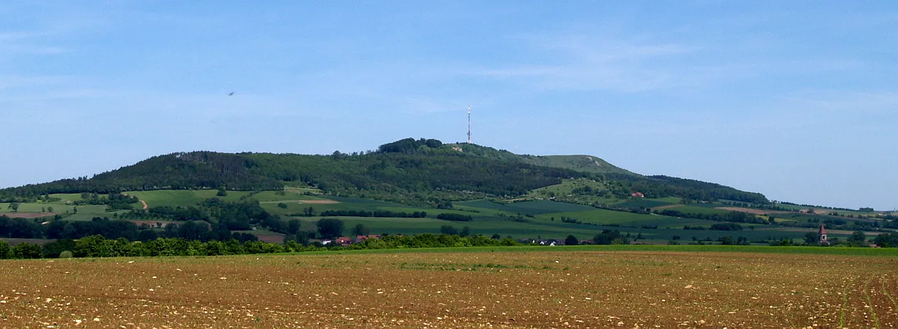
Hesselberg Kreuzschnabel · CC BY-SA 3.0

Climate of Untermichelbach
Best months for sightseeingBest months for sightseeing: June–September.
This month · November
A cold month
Day 6° · Night 1° · Rain 64 mm
- Hottest month
- August (day 24°)
- Coldest month
- January (night -4°)
- Wettest month
- June (83 mm)
- Driest month
- February (56 mm)
Bars: average monthly low and high temperature. Below: precipitation. Monthly averages for 1970–2000 at about 18 km resolution, adjusted for elevation. Highlighted months are mild and relatively dry. Source: WorldClim 2.1 (CC BY 4.0).
Show values as a table
| Month | Jan | Feb | Mar | Apr | May | Jun | Jul | Aug | Sep | Oct | Nov | Dec |
|---|---|---|---|---|---|---|---|---|---|---|---|---|
| Average high (°C) | 2° | 4° | 8° | 13° | 18° | 21° | 23° | 24° | 19° | 13° | 6° | 3° |
| Average low (°C) | -4° | -3° | 0° | 3° | 7° | 10° | 12° | 12° | 8° | 4° | 1° | -2° |
| Precipitation (mm) | 59 | 56 | 58 | 56 | 72 | 83 | 78 | 68 | 56 | 65 | 64 | 72 |
Other places to visit in this season: June July August September
How to get to Untermichelbach
The nearest airport is Nuremberg Airport (NUE), 65 km to the northeast as the crow flies. The nearest large city is Fürth, 59 km to the northeast.
Airports
- Nuremberg Airport (NUE) Nuremberg 65 kmnortheast
- Stuttgart Airport (STR) Stuttgart 100 kmsouthwest
- Memmingen Allgau Airport (FMM) Memmingen 121 kmsouth
Nearby large cities
- Fürth Population: 132K 59 kmnortheast
- Nuremberg Population: 515.5K 62 kmnortheast
- Erlangen Population: 102.7K 70 kmnortheast
- Ingolstadt Population: 120.7K 78 kmsoutheast
- Ulm Population: 120.5K 82 kmsouthwest
Straight-line distances; road distances are longer. Airport data: OurAirports.
Day trips from Untermichelbach
Within 100 km: 1,391 historic and cultural sites, 3,078 natural sites, 721 lakes, rivers and coasts.
0–25 km197 places
- Kreutweiher Lake 9 kmNE
- Klarweiher Lake 10 kmE
- Altmühlsee Lake 20 kmE
- Hahnenkammsee Lake 22 kmSE
25–60 km1,089 places
- Hessental Concentration Camp Historic site 51 kmW
- Zusam River 46 kmSE
- Uzbach River 57 kmN
- Rosenweiher Lake 59 kmNE
60–100 km3,904 places
- Spitzelberg Mountain 90 kmNE
- Stollenberg Mountain 87 kmNE
- Deckersberg Mountain 86 kmNE
- Umpfer River 76 kmNW
Straight-line distances.
Nearby attractions & nature
Everything nearby-
Kastell Ruffenhofen Historic site, Wittelshofen2.4 km SE
-
Hesselberg Mountain, Ehingen4.3 km E
-
Sendeturm Hesselberg Landmark, Gerolfingen4.3 km E
-
Sinbronn Pfarrkirche St. Peter Attraction, Dinkelsbühl5.7 km W
-
Weiltinger Forst Natural site, Bavaria6.3 km SW
-
Saulach Natural site, Bavaria6.6 km N
Sources & licences
Data last updated: