- Elevation
- 670 m
- above sea level
- Local time
- UTC+01:00
- Europe/Berlin · UTC+01:00
- Airports
- MUC Munich Airport55 km
- INN Innsbruck Airport77 km
About Ried
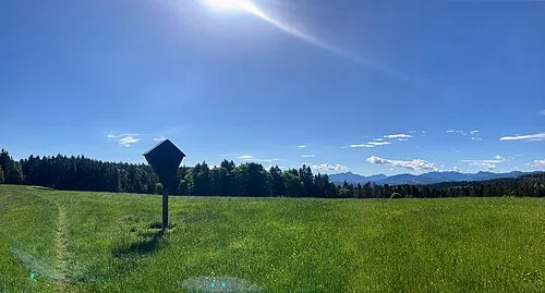
Ried is a village. Location: Weyarn, Landkreis Miesbach. Elevation: 670 m. The best months to visit are May–September. The nearest airport is Munich Airport (55 km). Nearby sights include Seehamer See and Großen Bach.
Climate of Ried
Best months for sightseeingBest months for sightseeing: May–September.
This month · November
A cold month
Day 6° · Night -1° · Rain 87 mm
- Hottest month
- July (day 22°)
- Coldest month
- January (night -5°)
- Wettest month
- July (150 mm)
- Driest month
- January (64 mm)
Bars: average monthly low and high temperature. Below: precipitation. Monthly averages for 1970–2000 at about 18 km resolution, adjusted for elevation. Highlighted months are mild and relatively dry. Source: WorldClim 2.1 (CC BY 4.0).
Show values as a table
| Month | Jan | Feb | Mar | Apr | May | Jun | Jul | Aug | Sep | Oct | Nov | Dec |
|---|---|---|---|---|---|---|---|---|---|---|---|---|
| Average high (°C) | 2° | 4° | 8° | 12° | 17° | 20° | 22° | 22° | 18° | 13° | 6° | 3° |
| Average low (°C) | -5° | -4° | -1° | 2° | 7° | 10° | 12° | 12° | 8° | 4° | -1° | -4° |
| Precipitation (mm) | 64 | 65 | 78 | 88 | 108 | 144 | 150 | 141 | 99 | 72 | 87 | 77 |
Other places to visit in this season: May June July August September
How to get to Ried
The nearest airport is Munich Airport (MUC), 55 km to the north as the crow flies. The nearest large city is Munich, 37 km to the northwest.
Airports
- Munich Airport (MUC) Munich 55 kmnorth
- Innsbruck Airport (INN) Innsbruck 77 kmsouthwest
- Salzburg Airport (SZG) Salzburg 87 kmeast
Nearby large cities
- Munich Population: 1.5M 37 kmnorthwest
- Innsbruck Population: 132.5K 75 kmsouthwest
- Salzburg Population: 157.2K 90 kmeast
- Augsburg Population: 301.1K 90 kmnorthwest
- Ingolstadt Population: 120.7K 105 kmnorth
Straight-line distances; road distances are longer. Airport data: OurAirports.
Day trips from Ried
Within 100 km: 498 historic and cultural sites, 3,379 natural sites, 1,109 lakes, rivers and coasts.
0–25 km340 places
- Tegernsee Lake Lake 18 kmSW
- Stein See Lake 18 kmN
- Spitzingsee Lake 22 kmS
- Soinsee Lake 25 kmS
25–60 km1,465 places
- Bayerisches Oberland Mountain 42 kmSW
- Frauenchiemsee Island 44 kmE
- Schloss Hirschberg am Haarsee Historic site 47 kmW
- Herreninsel Island 42 kmE
60–100 km3,181 places
- Fürlegsee Lake 100 kmSE
- Wildsee Lake 78 kmSW
- Eissee Lake 97 kmSE
- Brandlsee Lake 99 kmSE
Straight-line distances.
Nearby attractions & nature
Everything nearby-
Seehamer See Lake, Bavaria1.6 km SE
-
Großen Bach River, Upper Bavaria2.7 km SE
-
Weyarner Lindl Mountain, Weyarn4 km W
-
Leitzach River, Bavaria3.4 km N
-
Sonderdilching, kath. Filialkirche St. Michael Attraction, Weyarn5.4 km NW
-
 Fentberg Mountain, Valley4.6 km SW
Sources & licences
Data last updated: