Forchheim Castle
Located in Forchheim, Landkreis Forchheim Coordinates: 49°43′13″ N 11°03′20″ E
- Local time
- UTC+01:00
- Europe/Berlin · UTC+01:00
- Elevation
- 258 m
- above sea level
- Airports
- NUE Nuremberg Airport25 km
- ERF Erfurt-Weimar Airport140 km
About Forchheim Castle
Forchheim Castle is a historic site. Location: Forchheim, Landkreis Forchheim.
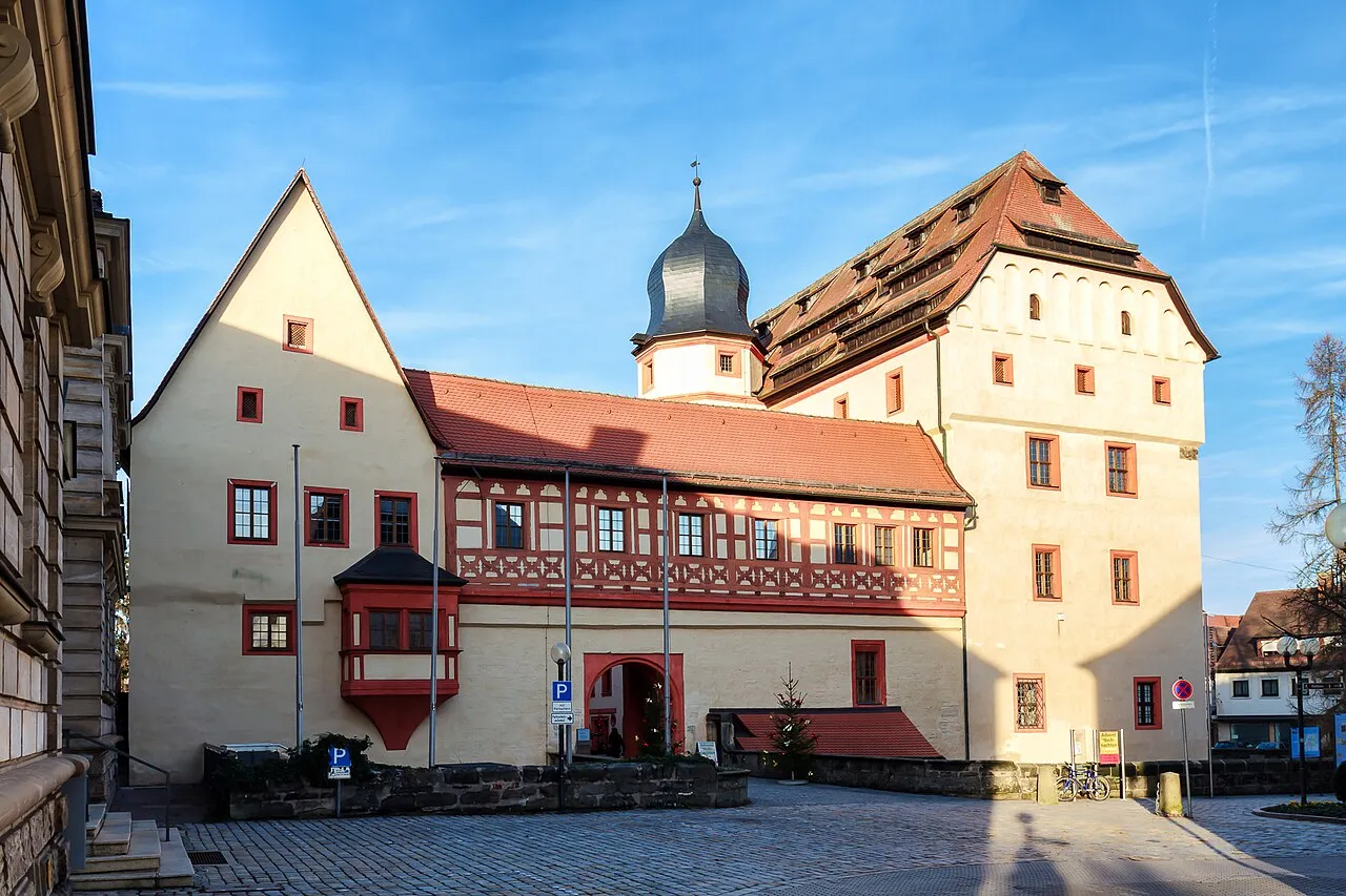
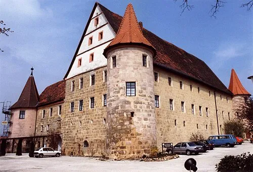
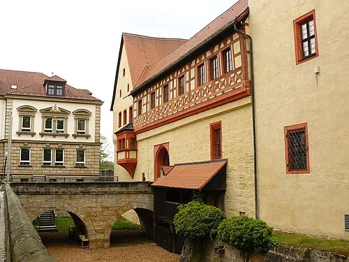
The castle in Forchheim (German: Burg in Forchheim), also referred to as a royal palace or Kaiserpfalz, was an important urban castle under the bishops of Bamberg in the town of Forchheim in the south German state of Bavaria. The castle was built in the late 14th century. After comprehensive archaeological and architectural-historical investigation it has become one of the best researched castles of this period in Central Europe. Today it houses the Archaeological Museum of Upper Franconia.
Source: Wikipedia · CC BY-SA 4.0
At a glance
- Built
- 14th century
- Heritage designation
- architectural heritage monument in Bavaria
Source: Wikidata
Photos of Forchheim Castle
-

GFreihalter · CC BY-SA 4.0 -

Ermell · CC BY-SA 4.0 -
Schloss Wiesenthau MacElch · CC BY-SA 3.0 -
Archäologiemuseum Oberfranken Altaileopard · Public domain


Climate of Forchheim Castle
Best months for sightseeingBest months for sightseeing: May–September.
This month · November
A cold month
Day 7° · Night 1° · Rain 59 mm
- Hottest month
- July (day 24°)
- Coldest month
- January (night -3°)
- Wettest month
- June (81 mm)
- Driest month
- February (48 mm)
Bars: average monthly low and high temperature. Below: precipitation. Monthly averages for 1970–2000 at about 18 km resolution, adjusted for elevation. Highlighted months are mild and relatively dry. Source: WorldClim 2.1 (CC BY 4.0).
Show values as a table
| Month | Jan | Feb | Mar | Apr | May | Jun | Jul | Aug | Sep | Oct | Nov | Dec |
|---|---|---|---|---|---|---|---|---|---|---|---|---|
| Average high (°C) | 3° | 5° | 9° | 14° | 19° | 22° | 24° | 24° | 19° | 13° | 7° | 4° |
| Average low (°C) | -3° | -3° | 0° | 3° | 8° | 11° | 13° | 12° | 9° | 5° | 1° | -1° |
| Precipitation (mm) | 59 | 48 | 56 | 50 | 62 | 81 | 81 | 58 | 60 | 63 | 59 | 70 |
Other places to visit in this season: May June July August September
How to get to Forchheim Castle
The nearest airport is Nuremberg Airport (NUE), 25 km to the south as the crow flies. The nearest large city is Erlangen, 15 km to the south.
Airports
- Nuremberg Airport (NUE) Nuremberg 25 kmsouth
- Erfurt-Weimar Airport (ERF) Erfurt 140 kmnorth
- Karlovy Vary Airport (KLV) Karlovy Vary 144 kmnortheast
Nearby large cities
- Erlangen Population: 102.7K 15 kmsouth
- Fürth Population: 132K 28 kmsouth
- Nuremberg Population: 515.5K 30 kmsouth
- Würzburg Population: 133.7K 80 kmwest
- Regensburg Population: 151.4K 109 kmsoutheast
Straight-line distances; road distances are longer. Airport data: OurAirports.
Day trips from Forchheim Castle
Within 100 km: 1,329 historic and cultural sites, 3,976 natural sites, 787 lakes, rivers and coasts.
0–25 km581 places
- Welles Weiher Lake 15 kmSW
- Unterer Herrnsee Lake 11 kmW
- Stephansweiher Lake 20 kmSW
- Oberer Herrnsee Lake 11 kmW
25–60 km2,026 places
- Waldstadion Weismain Landmark 43 kmN
- Spitzelberg Mountain 34 kmSE
- Stollenberg Mountain 33 kmSE
- Deckersberg Mountain 39 kmSE
60–100 km3,485 places
- Umpfer River 98 kmW
- Uzbach River 67 kmW
- Unterer Markweiher Lake 94 kmSE
- Thundorfer Weiher Lake 91 kmSE
Straight-line distances.
Nearby attractions & nature
Everything nearby-
Archäologiemuseum Oberfranken Museum, Forchheim<0.1 km N
-
Sal Gate Tower Historic site, Forchheim<0.1 km N
-
Sattlertorstrasse Bastion Historic site, Forchheim0.1 km NW
-
St. Vitus Bastion Historic site, Forchheim0.1 km S
-
Festung Forchheim Historic site, Forchheim0.3 km N
-
St. Valentine Bastion Historic site, Forchheim0.3 km N
-
St. Peter Bastion Historic site, Forchheim0.5 km NE
-
Nuremberg Gate Historic site, Forchheim0.6 km SE
Nearest towns and villages
-
Forchheim Town, Forchheim0.4 km SE
-
 Wimmelbach Village, Hausen3.7 km SW
-
Burk Village, Forchheim1.1 km SW
-
Buckenhofen Village, Forchheim1.2 km NW
Sources & licences
Data last updated: · 2 independent sources