Kreisfreie Stadt Brandenburg an der Havel
Local name: Brandenburg an der Havel
Located in Brandenburg, Germany Coordinates: 52°24′50″ N 12°33′13″ E
- Population
- 74,113
- 74.1K
- Elevation
- 30 m
- above sea level
- Local time
- UTC+01:00
- Europe/Berlin · UTC+01:00
- Places inside
- 1
- listed under Kreisfreie Stadt Brandenburg an der Havel
- Airports
- BER Berlin Brandenburg Airport65 km
- LEJ Leipzig/Halle Airport113 km
About Kreisfreie Stadt Brandenburg an der Havel
Kreisfreie Stadt Brandenburg an der Havel is a municipality. Location: Brandenburg, Germany. Population: 74,113. Elevation: 30 m.
Brandenburg an der Havel (German pronunciation: [ˈbʁandn̩bʊʁk ʔan deːɐ̯ ˈhaːfl̩] ) is a town in the federal state of Brandenburg, Germany, which served as the capital of the Margraviate of Brandenburg until it was replaced by Berlin in 1417. With a population of 73,945 (as of 2025), it is located on the banks of the River Havel. The town of Brandenburg provided the name for the medieval Bishopric of Brandenburg, the Margraviate of Brandenburg and the current state of Brandenburg.
Source: Wikipedia · CC BY-SA 4.0
Population of Kreisfreie Stadt Brandenburg an der Havel over time
| 2013 | 71,032 | |
|---|---|---|
| 2015 | 71,574 | |
| 2016 | 71,664 | |
| 2017 | 71,886 | |
| 2018 | 72,124 | |
| 2019 | 72,124 | |
| 2020 | 72,040 | |
| 2021 | 72,461 | |
| 2022 | 73,609 | |
| 2023 | 73,921 | |
| 2024 | 74,113 | |
| 2025 | 73,945 |
Censuses and official estimates; source: Wikidata.
Climate of Kreisfreie Stadt Brandenburg an der Havel
Best months for sightseeingBest months for sightseeing: May–September.
This month · November
A cold month
Day 7° · Night 2° · Rain 43 mm
- Hottest month
- July (day 24°)
- Coldest month
- January (night -2°)
- Wettest month
- June (64 mm)
- Driest month
- February (35 mm)
Bars: average monthly low and high temperature. Below: precipitation. Monthly averages for 1970–2000 at about 18 km resolution, adjusted for elevation. Highlighted months are mild and relatively dry. Source: WorldClim 2.1 (CC BY 4.0).
Show values as a table
| Month | Jan | Feb | Mar | Apr | May | Jun | Jul | Aug | Sep | Oct | Nov | Dec |
|---|---|---|---|---|---|---|---|---|---|---|---|---|
| Average high (°C) | 3° | 4° | 8° | 14° | 19° | 22° | 24° | 24° | 19° | 13° | 7° | 4° |
| Average low (°C) | -2° | -2° | 1° | 4° | 8° | 11° | 13° | 13° | 10° | 6° | 2° | -1° |
| Precipitation (mm) | 40 | 35 | 42 | 37 | 53 | 64 | 55 | 53 | 45 | 39 | 43 | 49 |
Other places to visit in this season: May June July August September
How to get to Kreisfreie Stadt Brandenburg an der Havel
The nearest airport is Berlin Brandenburg Airport (BER), 65 km to the east as the crow flies. The nearest large city is Potsdam, 35 km to the east.
Airports
- Berlin Brandenburg Airport (BER) Berlin 65 kmeast
- Leipzig/Halle Airport (LEJ) Schkeuditz 113 kmsouth
- Dresden Airport (DRS) Dresden 165 kmsoutheast
Nearby large cities
- Potsdam Population: 184.8K 35 kmeast
- Berlin Population: 3.4M 60 kmeast
- Magdeburg Population: 244.3K 70 kmsouthwest
- Halle Population: 237.9K 111 kmsouth
- Leipzig Population: 505K 120 kmsouth
Straight-line distances; road distances are longer. Airport data: OurAirports.
Day trips from Kreisfreie Stadt Brandenburg an der Havel
Within 100 km: 585 historic and cultural sites, 1,917 natural sites, 1,207 lakes, rivers and coasts.
0–25 km328 places
- Mittelbruch Island 2 kmE
- Buhnenwerder Island 6 kmW
- Köhninge Island 9 kmE
- Ketziner Havelinseln Island 19 kmE
25–60 km1,148 places
- Schlachtensee Lake 45 kmE
- Valentinswerder Island 49 kmE
- Scharfenberg Island 50 kmE
- Freibad Tegelsee Beach 50 kmE
60–100 km2,233 places
- Sarre River 93 kmSW
- Ehle River 62 kmW
- Ehle River 90 kmSW
- Dahme River River 69 kmE
Straight-line distances.
Kreisfreie Stadt Brandenburg an der Havel and similar cities
Side by side with cities of similar size in the same country: population, elevation and climate.
| Measure | Kreisfreie Stadt Brandenburg an der Havel | Detmold | Arnsberg | Bayreuth |
|---|---|---|---|---|
| Population | 74.1K | 73.7K | 74.9K | 72.9K |
| Elevation | 30 m | 135 m | 295 m | 338 m |
| Summer day (hottest month) | 24° | 22° | 21° | 23° |
| Winter night (coldest month) | -2° | -1° | -2° | -3° |
| Annual rainfall | 555 mm | 969 mm | 1,046 mm | 810 mm |
| Best months | May–Sep | Jun–Aug | Jun–Aug | Jun–Aug |
| Distance | — | 257 km | 328 km | 283 km |
Climate values are 1970–2000 monthly averages; straight-line distance.
Places in Kreisfreie Stadt Brandenburg an der Havel
1 placeBar: population relative to the most populous place in this list.
Nearby attractions & nature
Everything nearby-
Mittelbruch Island, Brandenburg1.9 km E
-
Bruchgraben River, Brandenburg2.5 km SE
-
Neujahrsgraben River, Brandenburg2.7 km SE
-
Steinbruch Island, Brandenburg3.8 km E
-
Schmertzker Heide Natural site, Brandenburg3.5 km S
-
Plane River, Brandenburg4.2 km SW
-
Quenz Lake Lake, Brandenburg4.7 km W
-
Emster River, Brandenburg4.8 km NE
Other cities and towns in Brandenburg
-
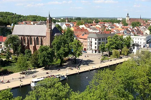 Brandenburg an der Havel Town, Brandenburg an der Havel0.4 km NW
-
Landkreis Potsdam-Mittelmark Municipality, Brandenburg23 km S
-
Landkreis Havelland Municipality, Brandenburg27 km N
-
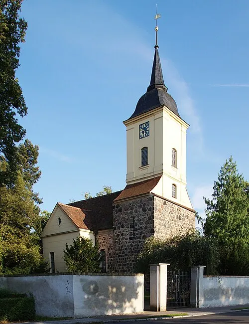 Groß Kreutz Town, Groß Kreutz (Havel)16 km E
-
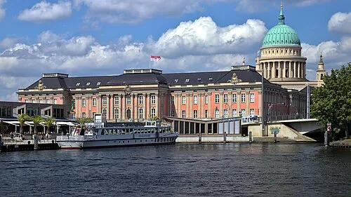 Potsdam City, Potsdam35 km E
-
Kreisfreie Stadt Potsdam Municipality, Brandenburg35 km E
Sources & licences
Data last updated: · 2 independent sources