Slawischer Burgwall
Located in Ketzin, Landkreis Havelland Coordinates: 52°30′23″ N 12°51′56″ E
- Elevation
- 34 m
- above sea level
- Airports
- BER Berlin Brandenburg Airport46 km
- LEJ Leipzig/Halle Airport128 km
About Slawischer Burgwall
Slawischer Burgwall is a historic site. Location: Ketzin, Landkreis Havelland. The best months to visit are May–September. The nearest airport is Berlin Brandenburg Airport (46 km). Nearby sights include Mühlberg and Kapellberg.
Photos of Slawischer Burgwall
-
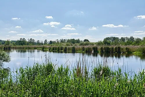
Mittelbruch Leonhard Lenz · CC0 -
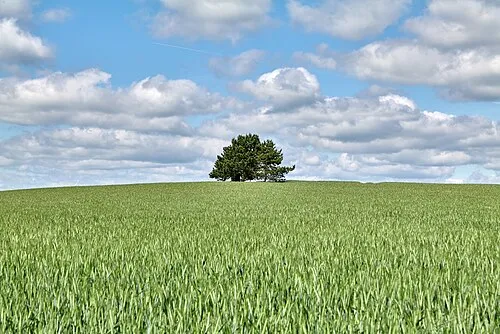
Breiter Berg Leonhard Lenz · CC0


Climate of Slawischer Burgwall
Best months for sightseeingBest months for sightseeing: May–September.
This month · November
A cold month
Day 7° · Night 2° · Rain 40 mm
- Hottest month
- July (day 24°)
- Coldest month
- January (night -2°)
- Wettest month
- June (64 mm)
- Driest month
- February (32 mm)
Bars: average monthly low and high temperature. Below: precipitation. Monthly averages for 1970–2000 at about 18 km resolution, adjusted for elevation. Highlighted months are mild and relatively dry. Source: WorldClim 2.1 (CC BY 4.0).
Show values as a table
| Month | Jan | Feb | Mar | Apr | May | Jun | Jul | Aug | Sep | Oct | Nov | Dec |
|---|---|---|---|---|---|---|---|---|---|---|---|---|
| Average high (°C) | 3° | 4° | 8° | 13° | 19° | 22° | 24° | 24° | 19° | 13° | 7° | 4° |
| Average low (°C) | -2° | -2° | 0° | 3° | 8° | 11° | 13° | 13° | 9° | 5° | 2° | -1° |
| Precipitation (mm) | 40 | 32 | 39 | 37 | 50 | 64 | 50 | 52 | 43 | 37 | 40 | 52 |
Other places to visit in this season: May June July August September
How to get to Slawischer Burgwall
The nearest airport is Berlin Brandenburg Airport (BER), 46 km to the east as the crow flies. The nearest large city is Potsdam, 18 km to the southeast.
Airports
- Berlin Brandenburg Airport (BER) Berlin 46 kmeast
- Leipzig/Halle Airport (LEJ) Schkeuditz 128 kmsouth
- Rostock-Laage Airport (RLG) Laage 162 kmnorth
Nearby large cities
- Potsdam Population: 184.8K 18 kmsoutheast
- Berlin Population: 3.4M 37 kmeast
- Magdeburg Population: 244.3K 94 kmsouthwest
- Halle Population: 237.9K 129 kmsouthwest
- Leipzig Population: 505K 134 kmsouth
Straight-line distances; road distances are longer. Airport data: OurAirports.
Day trips from Slawischer Burgwall
Within 100 km: 583 historic and cultural sites, 2,009 natural sites, 1,596 lakes, rivers and coasts.
0–25 km425 places
- Schlachtensee Lake 25 kmE
- Strandbad Wannsee Beach 22 kmE
- Mittelbruch Island 22 kmSW
- Kälberwerder Island 20 kmE
25–60 km1,232 places
- Valentinswerder Island 26 kmE
- Scharfenberg Island 27 kmE
- Dahme River River 48 kmE
- Freibad Tegelsee Beach 27 kmE
60–100 km2,531 places
- Ehle River 85 kmSW
- Strandbad Beach 93 kmNE
- Der Raatz Island 67 kmNE
- Großer Horst Island 76 kmN
Straight-line distances.
Nearby attractions & nature
Everything nearby-
Mühlberg Mountain, Ketzin0.8 km S
-
Kapellberg Mountain, Ketzin1 km E
-
Hohensberg Mountain, Ketzin1.7 km NE
-
Breiter Berg Mountain, Ketzin2.4 km S
-
Kiekelberg Mountain, Ketzin2.8 km SE
-
Elfenberg Mountain, Ketzin2.2 km E
-
Thyrowberg Mountain, Ketzin3.3 km NW
-
Paretz Dorfkirche Attraction, Ketzin4.2 km S
Nearest towns and villages
Sources & licences
Data last updated: