Senftenberg
Local name: Zły Komorow
Located in Landkreis Oberspreewald-Lausitz, Brandenburg Coordinates: 51°31′10″ N 14°00′03″ E

- Population
- 23,466
- 23.5K
- Elevation
- 104 m
- above sea level
- Local time
- UTC+01:00
- Europe/Berlin · UTC+01:00
- Places inside
- 19
- listed under Senftenberg
- Airports
- DRS Dresden Airport46 km
- BER Berlin Brandenburg Airport100 km
About Senftenberg
Senftenberg is a village. Location: Landkreis Oberspreewald-Lausitz, Brandenburg. Population: 23,466. Elevation: 104 m.
Senftenberg (German, pronounced [ˈzɛnftn̩ˌbɛʁk] ) or Zły Komorow (Lower Sorbian, pronounced [ˈzwɨ ˈkɔmɔrɔw]) is a town in Lower Lusatia, Brandenburg, in eastern Germany, capital of the Oberspreewald-Lausitz district.
Source: Wikipedia · CC BY-SA 4.0
Photos of Senftenberg
-
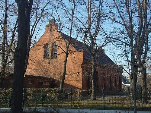
Early Camp Senftenberg Z thomas · CC BY 3.0

Places bordering Senftenberg
- Lauta
- Elsterheide
Twin towns and sister cities of Senftenberg
- Veszprém· Hungary
Source: Wikidata. Only places with a page on this site are shown.
Population of Senftenberg over time
| 1995 | 27,336 | |
|---|---|---|
| 2000 | 24,740 | |
| 2005 | 28,774 | |
| 2010 | 26,530 | |
| 2015 | 24,625 | |
| 2017 | 24,558 | |
| 2019 | 24,275 | |
| 2021 | 23,232 | |
| 2022 | 23,405 | |
| 2023 | 23,282 | |
| 2024 | 23,466 | |
| 2025 | 23,147 |
Censuses and official estimates; source: Wikidata.
Climate of Senftenberg
Best months for sightseeingBest months for sightseeing: May–September.
This month · November
A cold month
Day 7° · Night 2° · Rain 50 mm
- Hottest month
- July (day 24°)
- Coldest month
- January (night -3°)
- Wettest month
- July (76 mm)
- Driest month
- April (34 mm)
Bars: average monthly low and high temperature. Below: precipitation. Monthly averages for 1970–2000 at about 18 km resolution, adjusted for elevation. Highlighted months are mild and relatively dry. Source: WorldClim 2.1 (CC BY 4.0).
Show values as a table
| Month | Jan | Feb | Mar | Apr | May | Jun | Jul | Aug | Sep | Oct | Nov | Dec |
|---|---|---|---|---|---|---|---|---|---|---|---|---|
| Average high (°C) | 3° | 4° | 8° | 13° | 19° | 22° | 24° | 24° | 19° | 14° | 7° | 4° |
| Average low (°C) | -3° | -2° | 1° | 4° | 8° | 12° | 13° | 13° | 10° | 6° | 2° | -1° |
| Precipitation (mm) | 43 | 38 | 46 | 34 | 55 | 56 | 76 | 70 | 53 | 40 | 50 | 47 |
Other places to visit in this season: May June July August September
How to get to Senftenberg
The nearest airport is Dresden Airport (DRS), 46 km to the south as the crow flies. The nearest large city is Dresden, 55 km to the south.
Airports
- Dresden Airport (DRS) Dresden 46 kmsouth
- Berlin Brandenburg Airport (BER) Berlin 100 kmnorth
- Leipzig/Halle Airport (LEJ) Schkeuditz 123 kmwest
Nearby large cities
- Dresden Population: 564.9K 55 kmsouth
- Chemnitz Population: 247.2K 107 kmsouthwest
- Leipzig Population: 505K 115 kmwest
- Potsdam Population: 184.8K 117 kmnorthwest
- Berlin Population: 3.4M 119 kmnorth
Straight-line distances; road distances are longer. Airport data: OurAirports.
Day trips from Senftenberg
Within 100 km: 261 historic and cultural sites, 1,701 natural sites, 693 lakes, rivers and coasts.
0–25 km129 places
- Wiesenteich Lake 13 kmE
- Wergteich Lake 20 kmNE
- Weißiger Großteich Lake 22 kmS
- Weißer Seeteich Lake 23 kmE
25–60 km833 places
- Buschteich Lake 33 kmE
- Obersee Lake 33 kmE
- Meierei-See Lake 56 kmN
- Winkelteich Lake 35 kmE
60–100 km1,693 places
- Erzgebirge Mountain 71 kmS
- Pirna-Sonnenstein Mountain 63 kmS
- Vosí vrch Mountain 75 kmS
- Lutzke River 68 kmNE
Straight-line distances.
Places in Senftenberg
19 placesSenftenberg
Population: 29K


-
Cities & villages12
- Großkoschen · Village
- Hosena · Village
- Jüttendorf · Village
- Kleinkoschen · Village
- Niemtsch · Village
- Peickwitz · Village
- Rauno · Village
- Reppist · Village
- Rosendorf · Village
- Sedlitz · Village
- Sorno · Village
- Thamm · Village
Heritage & sights1
- Großkoschen Concentration Camp · Historic site
Nearby attractions & nature
Everything nearby-
Lake Senftenberg Lake, Brandenburg2.4 km SE
-
Speicherbecken Niemtsch Lake, Brandenburg2.5 km SE
-
Mühlgraben River, Brandenburg4.8 km E
-
Schwarzer Busch Natural site, Germany5.9 km E
-
Barras Natural site, Brandenburg6 km S
-
Unterer Landgraben River, Brandenburg6.7 km NE
Other cities and towns in Landkreis Oberspreewald-Lausitz
-
 Meuro Village, Schipkau5.9 km NW
-
Drochow Village, Schipkau7.5 km NW
-
 Klettwitz Village, Schipkau7.9 km W
-
 Freienhufen Village, Großräschen7.7 km N
Sources & licences
Data last updated: · 2 independent sources