Early Camp Brandenburg
Located in Nuthe-Urstromtal, Landkreis Teltow-Fläming Coordinates: 52°07′53″ N 13°12′59″ E
- Local time
- UTC+01:00
- Europe/Berlin · UTC+01:00
- Elevation
- 47 m
- above sea level
- Airports
- BER Berlin Brandenburg Airport32 km
- LEJ Leipzig/Halle Airport104 km
About Early Camp Brandenburg
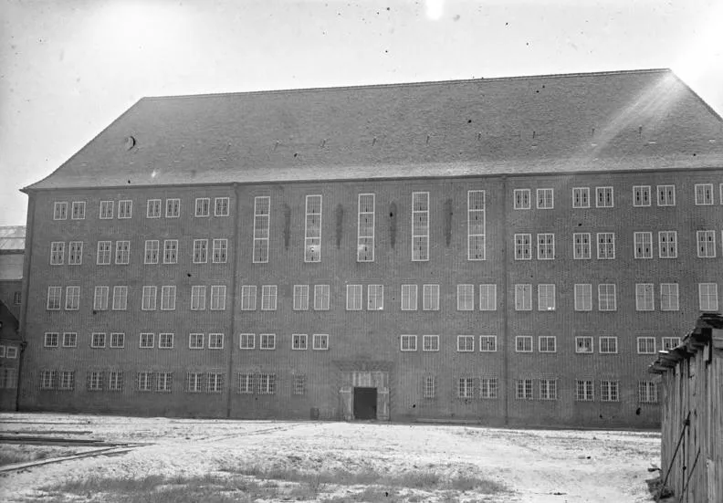
Early Camp Brandenburg is a historic site. Location: Nuthe-Urstromtal, Landkreis Teltow-Fläming.
The Brandenburg killing centre (German: NS-Tötungsanstalt Brandenburg), officially known as the Brandenburg an der Havel State Welfare Institute (Landes-Pflegeanstalt Brandenburg a. H.), was a killing centre established in 1939 as part of the Nazi "involuntary euthanasia" programme, known after the war as Aktion T4. Nearly 10,000 people were murdered there during its operation, primarily those with mental and physical disabilities. They were deemed as "lives unworthy of life" by Nazi Germany.
Source: Wikipedia · CC BY-SA 4.0
At a glance
- Heritage designation
- architectural heritage monument
Source: Wikidata
Photos of Early Camp Brandenburg
-

Zartesbitter · CC BY 4.0 -

Zartesbitter · CC BY 4.0 -

Gregor Rom · CC BY-SA 4.0


Climate of Early Camp Brandenburg
Best months for sightseeingBest months for sightseeing: May–August.
This month · November
A cold month
Day 7° · Night 2° · Rain 43 mm
- Hottest month
- July (day 25°)
- Coldest month
- January (night -3°)
- Wettest month
- July (65 mm)
- Driest month
- April (33 mm)
Bars: average monthly low and high temperature. Below: precipitation. Monthly averages for 1970–2000 at about 18 km resolution, adjusted for elevation. Highlighted months are mild and relatively dry. Source: WorldClim 2.1 (CC BY 4.0).
Show values as a table
| Month | Jan | Feb | Mar | Apr | May | Jun | Jul | Aug | Sep | Oct | Nov | Dec |
|---|---|---|---|---|---|---|---|---|---|---|---|---|
| Average high (°C) | 3° | 5° | 9° | 14° | 20° | 23° | 25° | 24° | 19° | 14° | 7° | 4° |
| Average low (°C) | -3° | -2° | 0° | 3° | 8° | 11° | 13° | 12° | 9° | 5° | 2° | -1° |
| Precipitation (mm) | 39 | 34 | 37 | 33 | 53 | 55 | 65 | 59 | 48 | 35 | 43 | 45 |
How to get to Early Camp Brandenburg
The nearest airport is Berlin Brandenburg Airport (BER), 32 km to the northeast as the crow flies. The nearest large city is Potsdam, 31 km to the north.
Airports
- Berlin Brandenburg Airport (BER) Berlin 32 kmnortheast
- Leipzig/Halle Airport (LEJ) Schkeuditz 104 kmsouthwest
- Dresden Airport (DRS) Dresden 117 kmsouth
Nearby large cities
- Potsdam Population: 184.8K 31 kmnorth
- Berlin Population: 3.4M 46 kmnorth
- Leipzig Population: 505K 106 kmsouthwest
- Magdeburg Population: 244.3K 108 kmwest
- Halle Population: 237.9K 112 kmsouthwest
Straight-line distances; road distances are longer. Airport data: OurAirports.
Day trips from Early Camp Brandenburg
Within 100 km: 513 historic and cultural sites, 1,745 natural sites, 1,211 lakes, rivers and coasts.
0–25 km172 places
- Wolziger See Lake 19 kmE
- Vordersee Lake 12 kmW
- Teufels-See Lake 23 kmNW
- Siethener See Lake 17 kmN
25–60 km1,198 places
- Schlachtensee Lake 35 kmN
- Valentinswerder Island 48 kmN
- Scharfenberg Island 49 kmN
- Dahme River River 43 kmNE
60–100 km2,099 places
- Lutzke River 99 kmE
- Werder Island 96 kmN
- Insel im Bützsee Island 81 kmN
- Wulfswerder Island 98 kmNW
Straight-line distances.
Nearby attractions & nature
Everything nearby-
Steinerfließ River, Brandenburg2.4 km SW
-
Königsgraben River, Brandenburg2.6 km SW
-
Staatsforst Kummersdorf Natural site, Brandenburg3.5 km E
-
Spitzberg Mountain, Nuthe-Urstromtal5.3 km W
-
Eiserbach River, Brandenburg3.8 km S
-
Mürtelberg Mountain, Luckenwalde6.3 km SW
-
Forst Woltersdorf Natural site, Brandenburg5.8 km SE
-
Glau Concentration Camp Historic site, Trebbin13 km N
Nearest towns and villages
-
 Woltersdorf Village, Nuthe-Urstromtal2.2 km S
-
 Liebätz Village, Nuthe-Urstromtal2.4 km NW
-
 Ruhlsdorf Village, Nuthe-Urstromtal3.1 km W
-
Scharfenbrück Village, Nuthe-Urstromtal2.2 km SE
Sources & licences
Data last updated: · 2 independent sources