Kreisfreie Stadt Krefeld
Located in Düsseldorf District, North Rhine-Westphalia Coordinates: 51°20′41″ N 6°35′10″ E
- Population
- 231,406
- 231.4K
- Elevation
- 37 m
- above sea level
- Local time
- UTC+01:00
- Europe/Berlin · UTC+01:00
- Places inside
- 1
- listed under Kreisfreie Stadt Krefeld
- Airports
- DUS Düsseldorf Airport14 km
- NRN Weeze (Niederrhein) Airport42 km
About Kreisfreie Stadt Krefeld
Kreisfreie Stadt Krefeld is a municipality. Location: Düsseldorf District, North Rhine-Westphalia. Population: 231,406. Elevation: 37 m. The best months to visit are June–September. The nearest airport is Düsseldorf Airport (14 km). Nearby sights include Schönwasser and Schloß Pesch.
Photos of Kreisfreie Stadt Krefeld
-
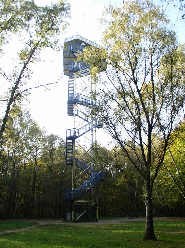
Hülser Berg Johannes1024 · CC BY-SA 3.0 -
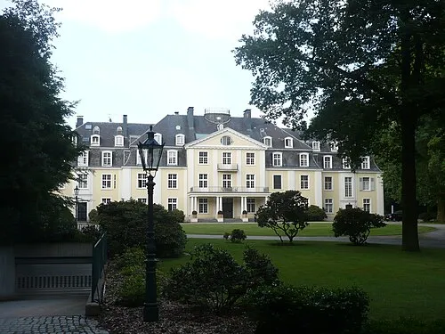
Schloß Pesch Tetris L · CC BY-SA 3.0 -
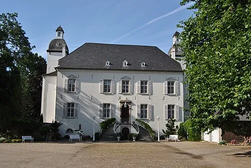
Schloß Lauersfort kaʁstn Disk / Cat · CC BY-SA 3.0 de


Climate of Kreisfreie Stadt Krefeld
Best months for sightseeingBest months for sightseeing: June–September.
This month · November
A cold month
Day 9° · Night 4° · Rain 68 mm
- Hottest month
- July (day 24°)
- Coldest month
- February (night 1°)
- Wettest month
- June (77 mm)
- Driest month
- April (48 mm)
Bars: average monthly low and high temperature. Below: precipitation. Monthly averages for 1970–2000 at about 18 km resolution, adjusted for elevation. Highlighted months are mild and relatively dry. Source: WorldClim 2.1 (CC BY 4.0).
Show values as a table
| Month | Jan | Feb | Mar | Apr | May | Jun | Jul | Aug | Sep | Oct | Nov | Dec |
|---|---|---|---|---|---|---|---|---|---|---|---|---|
| Average high (°C) | 5° | 7° | 10° | 14° | 19° | 21° | 24° | 24° | 19° | 15° | 9° | 7° |
| Average low (°C) | 1° | 1° | 3° | 5° | 9° | 12° | 14° | 14° | 11° | 7° | 4° | 2° |
| Precipitation (mm) | 65 | 50 | 64 | 48 | 65 | 77 | 69 | 63 | 66 | 61 | 68 | 74 |
Other places to visit in this season: June July August September
How to get to Kreisfreie Stadt Krefeld
The nearest airport is Düsseldorf Airport (DUS), 14 km to the southeast as the crow flies. The nearest large city is Krefeld, 2 km to the west.
Airports
- Düsseldorf Airport (DUS) Düsseldorf 14 kmsoutheast
- Weeze (Niederrhein) Airport (NRN) Weeze 42 kmnorthwest
- Cologne Bonn Airport (CGN) Köln (Cologne) 66 kmsoutheast
Nearby large cities
- Krefeld Population: 238K 2 kmwest
- Moers Population: 103.5K 13 kmnorth
- Duisburg Population: 504.4K 16 kmnortheast
- Neuss Population: 152.5K 18 kmsoutheast
- Düsseldorf Population: 618.7K 19 kmsoutheast
Straight-line distances; road distances are longer. Airport data: OurAirports.
Day trips from Kreisfreie Stadt Krefeld
Within 100 km: 426 historic and cultural sites, 1,252 natural sites, 660 lakes, rivers and coasts.
0–25 km176 places
- Schrolik Lake 24 kmW
- Schönwasser Lake 2 kmSW
- Poelvenn Lake 23 kmW
- Nettbruch Lake 24 kmW
25–60 km521 places
- Itterbeek River 55 kmW
- Witbeek River 56 kmW
- Émissaire River 59 kmSW
- Kasteel Arcen Historic site 31 kmNW
60–100 km1,641 places
- Île de Franche Garenne Island 96 kmSW
- Lac de la Gileppe Lake 94 kmSW
- Lac d'Eupen Lake 87 kmSW
- Schemersberg Mountain 89 kmSW
Straight-line distances.
Kreisfreie Stadt Krefeld and similar cities
Side by side with cities of similar size in the same country: population, elevation and climate.
| Measure | Kreisfreie Stadt Krefeld | Freiburg im Breisgau | Halle | Krefeld |
|---|---|---|---|---|
| Population | 231.4K | 237.5K | 237.9K | 238K |
| Elevation | 37 m | 278 m | 114 m | 43 m |
| Summer day (hottest month) | 24° | 24° | 24° | 23° |
| Winter night (coldest month) | 1° | 0° | -2° | 1° |
| Annual rainfall | 770 mm | 1,480 mm | 516 mm | 770 mm |
| Best months | Jun–Sep | Jun–Sep | Jun–Sep | Jun–Aug |
| Distance | — | 383 km | 375 km | 2 km |
Climate values are 1970–2000 monthly averages; straight-line distance.
Places in Kreisfreie Stadt Krefeld
1 placeBar: population relative to the most populous place in this list.
Nearby attractions & nature
Everything nearby-
Schönwasser Lake, North Rhine-Westphalia1.9 km SW
-
Schloß Pesch Historic site, Meerbusch6.7 km SE
-
Schloß Lauersfort Historic site, Moers7.6 km N
-
Achterberg Mountain, Kempen8.2 km NW
-
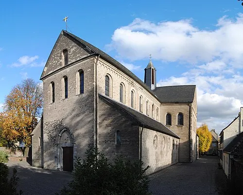 St. Suitbertus Attraction, Düsseldorf11 km SE
-
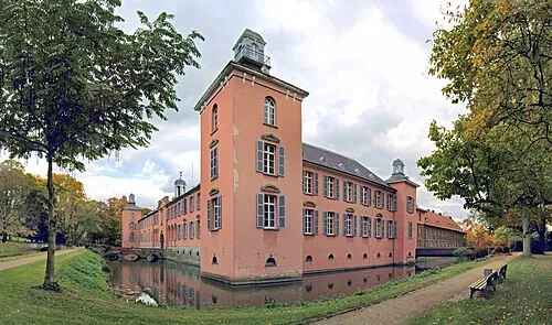 castle Kalkum Historic site, Düsseldorf13 km E
-
Mühlenberg Mountain, Kempen10 km NW
-
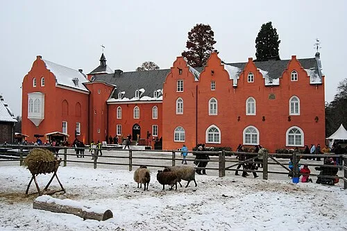 Schloß Bloemersheim Historic site, Rheurdt12 km NW
Sources & licences
Data last updated: