Daubach
Located in Landkreis Bad Kreuznach, Rhineland-Palatinate Coordinates: 49°51′00″ N 7°38′00″ E
- Population
- 227
- 227
- Elevation
- 376 m
- above sea level
- Local time
- UTC+01:00
- Europe/Berlin · UTC+01:00
- Places inside
- 1
- listed under Daubach
- Airports
- HHN Frankfurt-Hahn Airport29 km
- FRA Frankfurt Main Airport69 km
About Daubach
Daubach is a village. Location: Landkreis Bad Kreuznach, Rhineland-Palatinate. Population: 227. Elevation: 376 m. The best months to visit are June–August. The nearest airport is Frankfurt-Hahn Airport (29 km). Nearby sights include Wingertsberg and Göttelstein.
Photos of Daubach
-
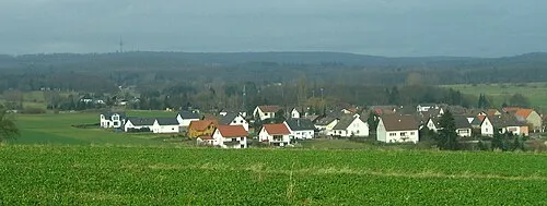
Ellerspring Markus Braun · Public domain -
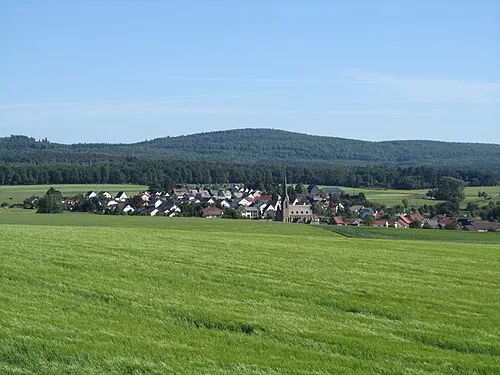
Alteburg Jörg Braukmann · CC BY-SA 3.0


Climate of Daubach
Best months for sightseeingBest months for sightseeing: June–August.
This month · November
A cold month
Day 7° · Night 2° · Rain 60 mm
- Hottest month
- July (day 22°)
- Coldest month
- January (night -2°)
- Wettest month
- May (71 mm)
- Driest month
- February (47 mm)
Bars: average monthly low and high temperature. Below: precipitation. Monthly averages for 1970–2000 at about 18 km resolution, adjusted for elevation. Highlighted months are mild and relatively dry. Source: WorldClim 2.1 (CC BY 4.0).
Show values as a table
| Month | Jan | Feb | Mar | Apr | May | Jun | Jul | Aug | Sep | Oct | Nov | Dec |
|---|---|---|---|---|---|---|---|---|---|---|---|---|
| Average high (°C) | 3° | 4° | 8° | 12° | 17° | 20° | 22° | 22° | 18° | 12° | 7° | 4° |
| Average low (°C) | -2° | -2° | 1° | 3° | 8° | 10° | 12° | 12° | 9° | 6° | 2° | 0° |
| Precipitation (mm) | 52 | 47 | 53 | 50 | 71 | 68 | 69 | 58 | 59 | 64 | 60 | 64 |
How to get to Daubach
The nearest airport is Frankfurt-Hahn Airport (HHN), 29 km to the west as the crow flies. The nearest large city is Mainz, 49 km to the east.
Airports
- Frankfurt-Hahn Airport (HHN) Frankfurt am Main (Lautzenhausen) 29 kmwest
- Frankfurt Main Airport (FRA) Frankfurt am Main 69 kmeast
- Mannheim-City Airport (MHG) Mannheim 76 kmsoutheast
Nearby large cities
- Mainz Population: 222.9K 49 kmeast
- Wiesbaden Population: 288.8K 51 kmnortheast
- Koblenz Population: 107.3K 56 kmnorth
- Ludwigshafen am Rhein Population: 163.2K 72 kmsoutheast
- Trier Population: 100.1K 72 kmwest
Straight-line distances; road distances are longer. Airport data: OurAirports.
Day trips from Daubach
Within 100 km: 883 historic and cultural sites, 4,121 natural sites, 875 lakes, rivers and coasts.
0–25 km301 places
- Zuckerberg Mountain 19 kmE
- Zimmerberg Mountain 19 kmNE
- Ziegelsberg Mountain 17 kmS
- Wildburghöhe Mountain 8 kmNW
25–60 km1,661 places
- Modau River 60 kmE
- Rüdesheimer Aue Island 26 kmNE
- Petersaue Island 49 kmNE
- Mariannenaue Island 37 kmNE
60–100 km3,917 places
- Sauer River 81 kmW
- Our River 96 kmW
- Syre River 85 kmW
- Ernz Noire River 94 kmW
Straight-line distances.
Places in Daubach
1 placeBar: population relative to the most populous place in this list.
Nearby attractions & nature
Everything nearby-
Wingertsberg Mountain, Bockenau3.1 km E
-
Göttelstein Mountain, Waldböckelheim4.2 km SE
-
Homberg Mountain, Sponheim4.3 km E
-
Karchrech Mountain, Bad Sobernheim4.8 km NW
-
Kronenberg Mountain, Sponheim5 km E
-
Hasenberg Mountain, Nußbaum5 km S
Sources & licences
Data last updated: