An den zwei Steinen
Located in Hellertshausen, Landkreis Birkenfeld Coordinates: 49°50′03″ N 7°13′33″ E
- Elevation
- 766 m
- above sea level
- Local time
- UTC+01:00
- Europe/Berlin · UTC+01:00
- Airports
- HHN Frankfurt-Hahn Airport13 km
- SCN Saarbrücken Airport69 km
About An den zwei Steinen
An den zwei Steinen is a mountain. Location: Hellertshausen, Landkreis Birkenfeld. Elevation: 766 m.
An den zwei Steinen is a mountain, 766.2 m above sea level (NHN), in the Idar Forest (part of the Hunsrück mountains) in the counties of Birkenfeld and Bernkastel-Wittlich in Rhineland-Palatinate, Germany. The wooded peak is the second-highest in Rhineland-Palatinate after the Erbeskopf (816.3 m), 15 kilometres to the southwest (with its southwestern spur, the Springenkopf, 784.2 m) in the Schwarzwälder Hochwald, and ahead of the Kahlheid (766.0 m), 12 kilometres southwest, also in the Idar Forest.
Source: Wikipedia · CC BY-SA 4.0
Photos of An den zwei Steinen
-
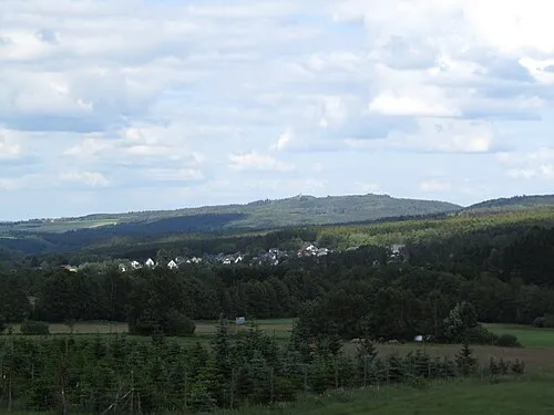
Wildenburger Kopf Jörg Braukmann · CC BY-SA 3.0

Climate of An den zwei Steinen
Best months for sightseeingBest months for sightseeing: June–August.
This month · November
A cold month
Day 4° · Night -1° · Rain 79 mm
- Hottest month
- August (day 19°)
- Coldest month
- February (night -4°)
- Wettest month
- December (91 mm)
- Driest month
- April (62 mm)
Bars: average monthly low and high temperature. Below: precipitation. Monthly averages for 1970–2000 at about 18 km resolution, adjusted for elevation. Highlighted months are mild and relatively dry. Source: WorldClim 2.1 (CC BY 4.0).
Show values as a table
| Month | Jan | Feb | Mar | Apr | May | Jun | Jul | Aug | Sep | Oct | Nov | Dec |
|---|---|---|---|---|---|---|---|---|---|---|---|---|
| Average high (°C) | 0° | 1° | 5° | 9° | 14° | 17° | 19° | 19° | 15° | 10° | 4° | 1° |
| Average low (°C) | -4° | -4° | -2° | 0° | 5° | 8° | 10° | 10° | 6° | 3° | -1° | -3° |
| Precipitation (mm) | 76 | 65 | 72 | 62 | 75 | 77 | 70 | 65 | 71 | 80 | 79 | 91 |
How to get to An den zwei Steinen
The nearest airport is Frankfurt-Hahn Airport (HHN), 13 km to the north as the crow flies. The nearest large city is Trier, 43 km to the west.
Airports
- Frankfurt-Hahn Airport (HHN) Frankfurt am Main (Lautzenhausen) 13 kmnorth
- Saarbrücken Airport (SCN) Saarbrücken 69 kmsouth
- Luxembourg-Findel International Airport (LUX) Luxembourg 77 kmwest
Nearby large cities
- Trier Population: 100.1K 43 kmwest
- Koblenz Population: 107.3K 63 kmnortheast
- Saarbrücken Population: 183K 69 kmsouth
- Mainz Population: 222.9K 77 kmeast
- Wiesbaden Population: 288.8K 78 kmeast
Straight-line distances; road distances are longer. Airport data: OurAirports.
Day trips from An den zwei Steinen
Within 100 km: 624 historic and cultural sites, 3,711 natural sites, 837 lakes, rivers and coasts.
0–25 km244 places
- Steinbachtalsperre Lake 6 kmS
- Usarkopf Mountain 9 kmSW
- Steinkopf Mountain 21 kmSW
- Schneeberg Mountain 18 kmS
25–60 km1,626 places
- Sauer River 52 kmW
- Syre River 56 kmW
- Rüdesheimer Aue Island 53 kmE
- Hatzenporter Werth Island 45 kmN
60–100 km3,302 places
- Château de Berg Historic site 82 kmW
- Steinkopf Mountain 85 kmNW
- Steiner Berg Mountain 96 kmNW
- Schartenknopf Mountain 81 kmNW
Straight-line distances.
Nearest towns and villages
-
 Bruchweiler Village, Landkreis Birkenfeld3.9 km S
-
 Stipshausen Village, Landkreis Birkenfeld4.5 km NE
-
Schauren Village, Schauren3.1 km S
-
Schauren Village, Landkreis Birkenfeld3.1 km S
-
 Kempfeld Village, Landkreis Birkenfeld5.1 km S
-
Bruchweiler Village, Bruchweiler4 km S
Nearby attractions & nature
Everything nearby-
Idarwald Natural site, Rhineland-Palatinate0.7 km W
-
Vierherrenwald Natural site, Rhineland-Palatinate0.9 km SE
-
Rother Rech Natural site, Rhineland-Palatinate1.5 km S
-
Steingerüttelkopf Mountain, Morbach4 km SW
-
Viergemeindewald Natural site, Rhineland-Palatinate3.6 km NE
-
Idarkopf Mountain, Stipshausen4.5 km NE
-
Halster Höhe Mountain, Kleinich4.7 km NW
-
Wildenburger Kopf Mountain, Veitsrodt6.8 km S
Sources & licences
Data last updated: · 2 independent sources