Landkreis Neuwied
Located in Rhineland-Palatinate, Germany Coordinates: 50°32′22″ N 7°28′41″ E
- Population
- 189,061
- 189.1K
- Elevation
- 388 m
- above sea level
- Local time
- UTC+01:00
- Europe/Berlin · UTC+01:00
- Places inside
- 62
- listed under Landkreis Neuwied
- Airports
- CGN Cologne Bonn Airport43 km
- HHN Frankfurt-Hahn Airport68 km
About Landkreis Neuwied
Landkreis Neuwied is a municipality. Location: Rhineland-Palatinate, Germany. Population: 189,061. Elevation: 388 m. The best months to visit are June–August. The nearest airport is Cologne Bonn Airport (43 km). Nearby sights include Dombach and Urbach.
Photos of Landkreis Neuwied
-
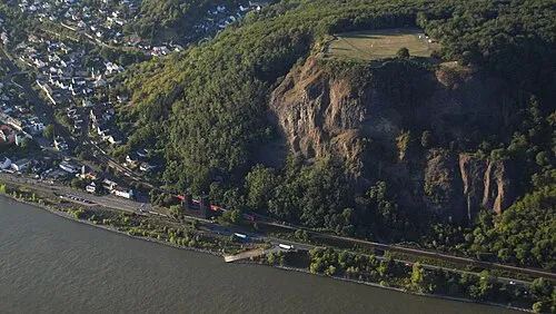
Erpeler Ley Wolkenkratzer · CC BY-SA 3.0 -
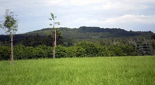
Asberg Leit · CC BY-SA 4.0 -
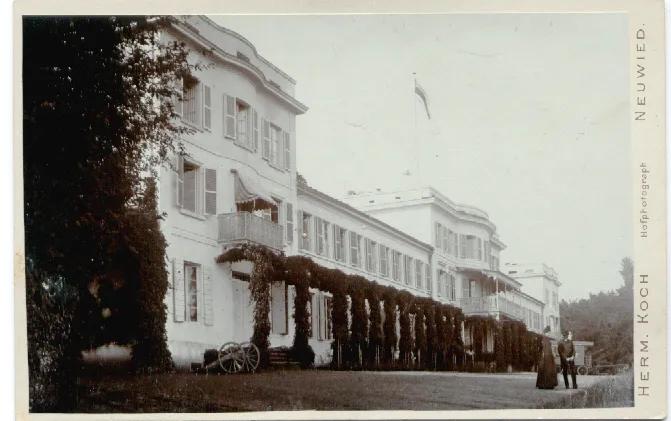
Schloß Monrepos Herman Koch · Public domain


Climate of Landkreis Neuwied
Best months for sightseeingBest months for sightseeing: June–August.
This month · November
A cold month
Day 7° · Night 1° · Rain 76 mm
- Hottest month
- July (day 22°)
- Coldest month
- February (night -3°)
- Wettest month
- December (85 mm)
- Driest month
- April (59 mm)
Bars: average monthly low and high temperature. Below: precipitation. Monthly averages for 1970–2000 at about 18 km resolution, adjusted for elevation. Highlighted months are mild and relatively dry. Source: WorldClim 2.1 (CC BY 4.0).
Show values as a table
| Month | Jan | Feb | Mar | Apr | May | Jun | Jul | Aug | Sep | Oct | Nov | Dec |
|---|---|---|---|---|---|---|---|---|---|---|---|---|
| Average high (°C) | 3° | 4° | 8° | 12° | 17° | 20° | 22° | 21° | 17° | 12° | 7° | 4° |
| Average low (°C) | -2° | -3° | 0° | 2° | 7° | 10° | 11° | 11° | 8° | 5° | 1° | -1° |
| Precipitation (mm) | 75 | 60 | 73 | 59 | 70 | 78 | 83 | 65 | 70 | 71 | 76 | 85 |
How to get to Landkreis Neuwied
The nearest airport is Cologne Bonn Airport (CGN), 43 km to the northwest as the crow flies. The nearest large city is Koblenz, 22 km to the south.
Airports
- Cologne Bonn Airport (CGN) Köln (Cologne) 43 kmnorthwest
- Frankfurt-Hahn Airport (HHN) Frankfurt am Main (Lautzenhausen) 68 kmsouth
- Frankfurt Main Airport (FRA) Frankfurt am Main 96 kmsoutheast
Nearby large cities
- Koblenz Population: 107.3K 22 kmsouth
- Bonn Population: 330.6K 35 kmnorthwest
- Siegen Population: 107.2K 54 kmnortheast
- Bergisch Gladbach Population: 106.2K 55 kmnorthwest
- Cologne Population: 1M 58 kmnorthwest
Straight-line distances; road distances are longer. Airport data: OurAirports.
Day trips from Landkreis Neuwied
Within 100 km: 745 historic and cultural sites, 4,018 natural sites, 932 lakes, rivers and coasts.
0–25 km376 places
- Urbach River 5 kmSE
- Laacher See Lake 20 kmSW
- Wald-See Lake 20 kmSW
- Rodder Maar Lake 22 kmW
25–60 km1,755 places
- Weibe River 47 kmNE
- Aar River 42 kmSE
- Kemper Werth Island 38 kmNW
- Hatzenporter Werth Island 35 kmS
60–100 km3,564 places
- Lac d'Eupen Lake 98 kmW
- Lac de Robertville Lake 97 kmW
- Schartenknopf Mountain 80 kmW
- Roderhöhe Mountain 88 kmW
Straight-line distances.
Landkreis Neuwied and similar cities
Side by side with cities of similar size in the same country: population, elevation and climate.
| Measure | Landkreis Neuwied | Potsdam | Saarbrücken | Kassel |
|---|---|---|---|---|
| Population | 189.1K | 184.8K | 183K | 197.2K |
| Elevation | 388 m | 34 m | 195 m | 164 m |
| Summer day (hottest month) | 22° | 24° | 24° | 23° |
| Winter night (coldest month) | -3° | -2° | -1° | -2° |
| Annual rainfall | 865 mm | 546 mm | 927 mm | 752 mm |
| Best months | Jun–Aug | May–Aug | Jun–Sep | Jun–Aug |
| Distance | — | 440 km | 149 km | 166 km |
Climate values are 1970–2000 monthly averages; straight-line distance.
Places in Landkreis Neuwied
62 places- 1 Neuwied 67.1K
- 2 Asbach 7.8K
- 3 Neustadt (Wied) 6.5K
- 4 Bad Hönningen 6.4K
- 5 Linz am Rhein 6.3K
- 6 Dierdorf 6.2K
- 7 Unkel 5.1K
- 8 Buchholz (Westerwald) 4.7K
- 9 Windhagen 4.6K
- 10 Rheinbreitbach 4.5K
- 11 Rheinbrohl 4.2K
- 12 Vettelschoß 3.7K
- 13 Sankt Katharinen 3.4K
- 14 Rengsdorf 3K
- 15 Erpel 2.6K
- 16 Puderbach 2.5K
- 17 Großmaischeid 2.3K
- 18 Breitscheid 2.3K
- 19 Raubach 2.1K
- 20 Straßenhaus 2K
- 21 Melsbach 2K
- 22 Waldbreitbach 1.9K
- 23 Leutesdorf 1.9K
- 24 Hausen (Wied) 1.8K
- 25 Leubsdorf 1.6K
- 26 Ehlscheid 1.6K
- 27 Niederbreitbach 1.5K
- 28 Dattenberg 1.5K
- 29 Urbach 1.5K
- 30 Roßbach 1.4K
- 31 Kasbach-Ohlenberg 1.4K
- 32 Anhausen 1.4K
- 33 Dürrholz 1.3K
- 34 Kleinmaischeid 1.3K
- 35 Steimel 1.3K
- 36 Dernbach 1.1K
- 37 Ockenfels 1.1K
- 38 Oberhonnefeld-Gierend 1.1K
- 39 Kurtscheid 1K
- 40 Bruchhausen 976
- 41 Bonefeld 938
- 42 Oberdreis 890
- 43 Hardert 840
- 44 Rüscheid 831
- 45 Hümmerich 821
- 46 Thalhausen 767
- 47 Rodenbach bei Puderbach 686
- 48 Oberraden 666
- 49 Döttesfeld 655
- 50 Hanroth 650
- 51 Linkenbach 630
- 52 Isenburg 579
- 53 Meinborn 573
- 54 Woldert 557
- 55 Niederhofen 482
- 56 Marienhausen 471
- 57 Niederwambach 459
- 58 Harschbach 433
- 59 Stebach 354
- 60 Hammerstein 351
Bar: population relative to the most populous place in this list.
Nearby attractions & nature
Everything nearby-
Dombach River, Rhineland-Palatinate4.6 km SW
-
Urbach River, Rhineland-Palatinate4.7 km SE
-
Forst Wied Natural site, Rhineland-Palatinate5.5 km SE
-
Nonnen Bach River, Rhineland-Palatinate5 km SW
-
Laubach River, Rhineland-Palatinate5 km S
-
Wallbach River, Rhineland-Palatinate5.2 km NW
-
Forst Neuwied Natural site, Rhineland-Palatinate6.6 km S
-
Masbach River, Rhineland-Palatinate6.1 km NW
Sources & licences
Data last updated: