- Population
- 236
- 236
- Elevation
- 552 m
- above sea level
- Local time
- UTC+01:00
- Europe/Berlin · UTC+01:00
- Places inside
- 1
- listed under Betteldorf
- Airports
- HHN Frankfurt-Hahn Airport50 km
- CGN Cologne Bonn Airport74 km
About Betteldorf
Betteldorf is a village. Location: Vulkaneifel, Rhineland-Palatinate. Population: 236. Elevation: 552 m.
Betteldorf is an Ortsgemeinde – a municipality belonging to a Verbandsgemeinde, a kind of collective municipality – in the Vulkaneifel district in Rhineland-Palatinate, Germany. It belongs to the Verbandsgemeinde of Daun, whose seat is in the like-named town.
Source: Wikipedia · CC BY-SA 4.0
Population of Betteldorf over time
| 1975 | 253 | |
|---|---|---|
| 2017 | 251 | |
| 2019 | 254 | |
| 2021 | 258 | |
| 2022 | 264 | |
| 2023 | 257 | |
| 2024 | 236 | |
| 2025 | 241 |
Censuses and official estimates; source: Wikidata.
Climate of Betteldorf
Best months for sightseeingBest months for sightseeing: June–August.
This month · November
A cold month
Day 6° · Night 1° · Rain 95 mm
- Hottest month
- July (day 21°)
- Coldest month
- February (night -3°)
- Wettest month
- December (107 mm)
- Driest month
- August (64 mm)
Bars: average monthly low and high temperature. Below: precipitation. Monthly averages for 1970–2000 at about 18 km resolution, adjusted for elevation. Highlighted months are mild and relatively dry. Source: WorldClim 2.1 (CC BY 4.0).
Show values as a table
| Month | Jan | Feb | Mar | Apr | May | Jun | Jul | Aug | Sep | Oct | Nov | Dec |
|---|---|---|---|---|---|---|---|---|---|---|---|---|
| Average high (°C) | 2° | 3° | 7° | 11° | 16° | 19° | 21° | 21° | 16° | 11° | 6° | 3° |
| Average low (°C) | -3° | -3° | 0° | 2° | 6° | 9° | 11° | 10° | 8° | 4° | 1° | -1° |
| Precipitation (mm) | 98 | 77 | 89 | 66 | 73 | 79 | 76 | 64 | 81 | 83 | 95 | 107 |
How to get to Betteldorf
The nearest airport is Frankfurt-Hahn Airport (HHN), 50 km to the southeast as the crow flies. The nearest large city is Trier, 56 km to the south.
Airports
- Frankfurt-Hahn Airport (HHN) Frankfurt am Main (Lautzenhausen) 50 kmsoutheast
- Cologne Bonn Airport (CGN) Köln (Cologne) 74 kmnorth
- Luxembourg-Findel International Airport (LUX) Luxembourg 79 kmsouthwest
Nearby large cities
- Trier Population: 100.1K 56 kmsouth
- Bonn Population: 330.6K 59 kmnortheast
- Koblenz Population: 107.3K 60 kmeast
- Aachen Population: 265.2K 75 kmnorthwest
- Cologne Population: 1M 77 kmnorth
Straight-line distances; road distances are longer. Airport data: OurAirports.
Day trips from Betteldorf
Within 100 km: 555 historic and cultural sites, 2,959 natural sites, 854 lakes, rivers and coasts.
0–25 km526 places
- Weinfelder Maar Lake 11 kmSE
- Pulvermaar Lake 18 kmSE
- Meerfelder Maar Lake 17 kmS
- Gemündener Maar Lake 10 kmSE
25–60 km1,511 places
- Lac de Robertville Lake 50 kmNW
- Steinkopf Mountain 41 kmW
- Steiner Berg Mountain 47 kmW
- Schartenknopf Mountain 27 kmW
60–100 km2,331 places
- Île du Moulin Island 89 kmNW
- Île Monsin Island 91 kmNW
- Île de Franche Garenne Island 91 kmNW
- Lac de la Gileppe Lake 66 kmNW
Straight-line distances.
Places in Betteldorf
1 placeBar: population relative to the most populous place in this list.
Nearby attractions & nature
Everything nearby-
Bremelchen Mountain, Hinterweiler0.7 km SE
-
Mühlenberg Mountain, Hohenfels-Essingen1.2 km NW
-
Feuer-Berg Mountain, Hohenfels-Essingen1.3 km SW
-
Hüwelt Mountain, Hinterweiler1.9 km SE
-
Kahlenberg Mountain, Oberehe-Stroheich2 km N
-
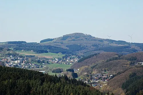 Ernstberg Mountain, Hinterweiler2.6 km SE
Sources & licences
Data last updated: · 2 independent sources