Westerwaldkreis
Located in Rhineland-Palatinate, Germany Coordinates: 50°31′20″ N 7°52′13″ E
- Population
- 207,803
- 207.8K
- Elevation
- 437 m
- above sea level
- Local time
- UTC+01:00
- Europe/Berlin · UTC+01:00
- Places inside
- 192
- listed under Westerwaldkreis
- Airports
- CGN Cologne Bonn Airport64 km
- FRA Frankfurt Main Airport74 km
About Westerwaldkreis
Westerwaldkreis is a municipality. Location: Rhineland-Palatinate, Germany. Population: 207,803. Elevation: 437 m. The best months to visit are June–August. The nearest airport is Cologne Bonn Airport (64 km). Nearby sights include Ober Wald and Dreifelder Weiher.
Photos of Westerwaldkreis
-
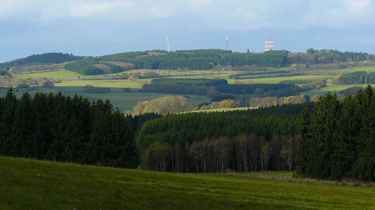
Salzburger Kopf Kurt + Else Dietrich · CC BY-SA 3.0 -
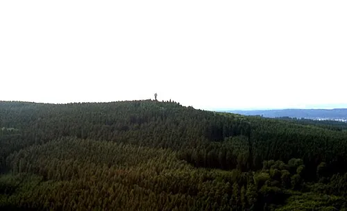
Köppel makemake · CC BY-SA 3.0 -
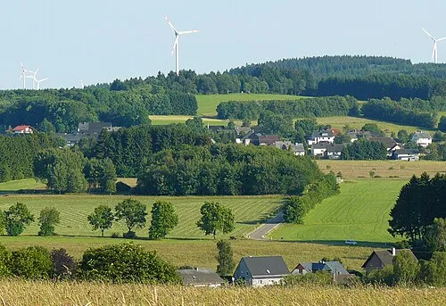
Ketzerstein Kurt + Else Dietrich · CC BY-SA 3.0 -
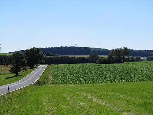
Helleberg Jörg Braukmann · CC BY 3.0 -
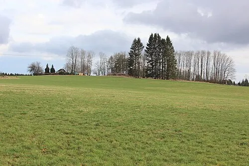
Ahlsberg LigaDue · CC BY-SA 4.0


Climate of Westerwaldkreis
Best months for sightseeingBest months for sightseeing: June–August.
This month · November
A cold month
Day 6° · Night 1° · Rain 88 mm
- Hottest month
- July (day 22°)
- Coldest month
- February (night -3°)
- Wettest month
- December (101 mm)
- Driest month
- April (62 mm)
Bars: average monthly low and high temperature. Below: precipitation. Monthly averages for 1970–2000 at about 18 km resolution, adjusted for elevation. Highlighted months are mild and relatively dry. Source: WorldClim 2.1 (CC BY 4.0).
Show values as a table
| Month | Jan | Feb | Mar | Apr | May | Jun | Jul | Aug | Sep | Oct | Nov | Dec |
|---|---|---|---|---|---|---|---|---|---|---|---|---|
| Average high (°C) | 2° | 4° | 8° | 12° | 17° | 20° | 22° | 22° | 17° | 12° | 6° | 4° |
| Average low (°C) | -3° | -3° | 0° | 2° | 6° | 10° | 11° | 11° | 8° | 4° | 1° | -1° |
| Precipitation (mm) | 89 | 70 | 84 | 62 | 69 | 77 | 80 | 66 | 74 | 80 | 88 | 101 |
How to get to Westerwaldkreis
The nearest airport is Cologne Bonn Airport (CGN), 64 km to the northwest as the crow flies. The nearest large city is Koblenz, 28 km to the southwest.
Airports
- Cologne Bonn Airport (CGN) Köln (Cologne) 64 kmnorthwest
- Frankfurt Main Airport (FRA) Frankfurt am Main 74 kmsoutheast
- Frankfurt-Hahn Airport (HHN) Frankfurt am Main (Lautzenhausen) 77 kmsouthwest
Nearby large cities
- Koblenz Population: 107.3K 28 kmsouthwest
- Siegen Population: 107.2K 41 kmnorth
- Wiesbaden Population: 288.8K 55 kmsoutheast
- Bonn Population: 330.6K 60 kmnorthwest
- Mainz Population: 222.9K 67 kmsoutheast
Straight-line distances; road distances are longer. Airport data: OurAirports.
Day trips from Westerwaldkreis
Within 100 km: 787 historic and cultural sites, 4,295 natural sites, 875 lakes, rivers and coasts.
0–25 km372 places
- Aar River 20 kmSE
- Urbach River 24 kmW
- Krombachtalsperre Lake 21 kmNE
- Dreifelder Weiher Lake 8 kmN
25–60 km2,008 places
- Weibe River 40 kmN
- Mariannenaue Island 59 kmS
- Königsklinger Aue Island 59 kmS
- Hatzenporter Werth Island 47 kmSW
60–100 km3,577 places
- Olef River 97 kmW
- Else River 79 kmN
- Ohe River 65 kmNE
- Modau River 89 kmSE
Straight-line distances.
Westerwaldkreis and similar cities
Side by side with cities of similar size in the same country: population, elevation and climate.
| Measure | Westerwaldkreis | Lübeck | Hagen | Rostock |
|---|---|---|---|---|
| Population | 207.8K | 212.2K | 199K | 198.3K |
| Elevation | 437 m | 16 m | 111 m | 18 m |
| Summer day (hottest month) | 22° | 22° | 23° | 22° |
| Winter night (coldest month) | -3° | -2° | -1° | -2° |
| Annual rainfall | 940 mm | 674 mm | 980 mm | 596 mm |
| Best months | Jun–Aug | Jun–Aug | Jun–Aug | Jun–Aug |
| Distance | — | 419 km | 97 km | 492 km |
Climate values are 1970–2000 monthly averages; straight-line distance.
Places in Westerwaldkreis
192 places- 61 Müschenbach 959
- 62 Rehe 953
- 63 Herschbach (Oberwesterwald) 949
- 64 Rothenbach 946
- 65 Wahlrod 917
- 66 Salz 878
- 67 Sessenhausen 865
- 68 Roßbach 856
- 69 Leuterod 853
- 70 Niederahr 840
- 71 Liebenscheid 837
- 72 Nisterau 834
- 73 Steinebach an der Wied 825
- 74 Irmtraut 806
- 75 Fehl-Ritzhausen 792
- 76 Hartenfels 789
- 77 Kroppach 789
- 78 Mündersbach 781
- 79 Deesen 775
- 80 Moschheim 762
- 81 Mudenbach 762
- 82 Steinefrenz 745
- 83 Stahlhofen 739
- 84 Breitenau 737
- 85 Niederroßbach 729
- 86 Höchstenbach 717
- 87 Freilingen 714
- 88 Horbach 703
- 89 Freirachdorf 699
- 90 Bannberscheid 696
- 91 Luckenbach 687
- 92 Willmenrod 675
- 93 Caan 669
- 94 Boden 668
- 95 Nomborn 664
- 96 Oberrod 663
- 97 Ailertchen 659
- 98 Stockum-Püschen 649
- 99 Alsbach 640
- 100 Atzelgift 639
- 101 Wittgert 636
- 102 Schenkelberg 632
- 103 Bellingen 628
- 104 Heilberscheid 628
- 105 Großseifen 624
- 106 Gehlert 613
- 107 Girkenroth 607
- 108 Kirburg 604
- 109 Kaden 591
- 110 Dreisbach 580
- 111 Vielbach 574
- 112 Neustadt/ Westerwald 569
- 113 Weroth 562
- 114 Neunkirchen 560
- 115 Weidenhahn 559
- 116 Berod bei Wallmerod 554
- 117 Oberahr 553
- 118 Borod 552
- 119 Wied 548
- 120 Gackenbach 545
Bar: population relative to the most populous place in this list.
Nearby attractions & nature
Everything nearby-
Ober Wald Natural site, Rhineland-Palatinate7.1 km W
-
Dreifelder Weiher Lake, Rhineland-Palatinate8.4 km N
-
Aubach River, Rhineland-Palatinate9.2 km S
-
Rauher Kopf Mountain, Dornburg10 km SE
-
Heilersberg Mountain, Dornburg10 km SE
-
Seebach River, Rhineland-Palatinate9.9 km NE
-
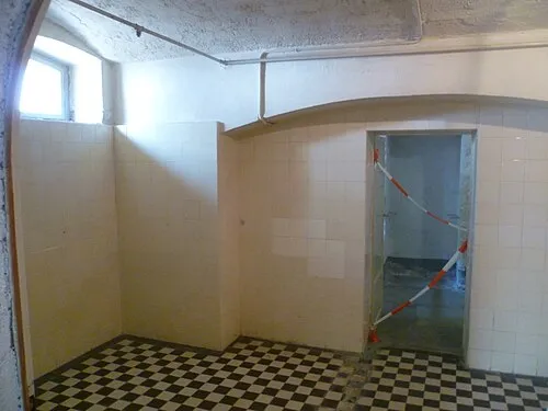 Hadamar Euthanasia Centre Historic site, Hadamar15 km SE
-
Dornburg Mountain, Dornburg11 km E
Sources & licences
Data last updated: