Westerwaldkreis
Located in Rhineland-Palatinate, Germany Coordinates: 50°31′20″ N 7°52′13″ E
- Population
- 207,803
- 207.8K
- Elevation
- 437 m
- above sea level
- Local time
- UTC+01:00
- Europe/Berlin · UTC+01:00
- Places inside
- 192
- listed under Westerwaldkreis
- Airports
- CGN Cologne Bonn Airport64 km
- FRA Frankfurt Main Airport74 km
About Westerwaldkreis
Westerwaldkreis is a municipality. Location: Rhineland-Palatinate, Germany. Population: 207,803. Elevation: 437 m. The best months to visit are June–August. The nearest airport is Cologne Bonn Airport (64 km). Nearby sights include Ober Wald and Dreifelder Weiher.
Photos of Westerwaldkreis
-
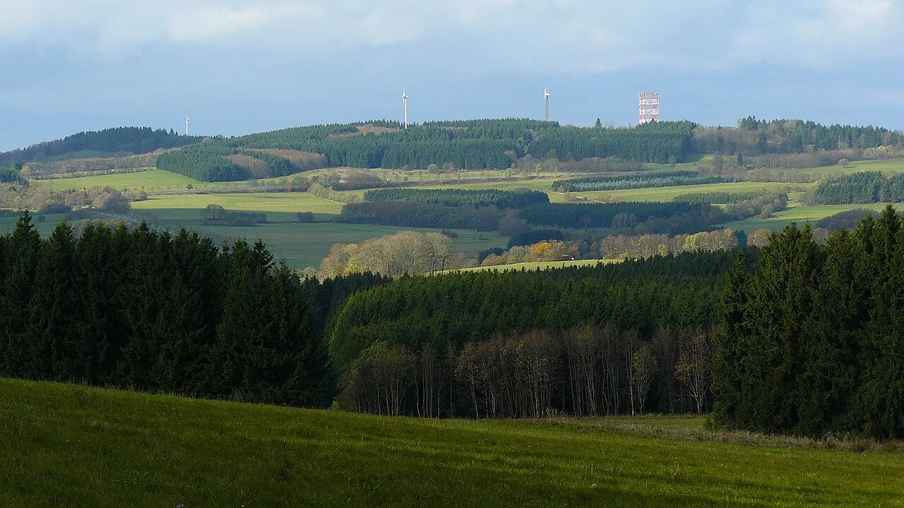
Salzburger Kopf Kurt + Else Dietrich · CC BY-SA 3.0 -
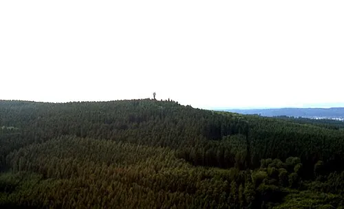
Köppel makemake · CC BY-SA 3.0 -
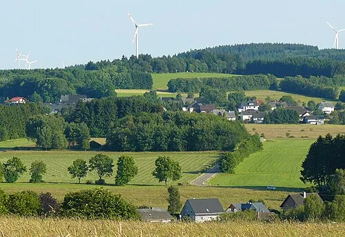
Ketzerstein Kurt + Else Dietrich · CC BY-SA 3.0 -
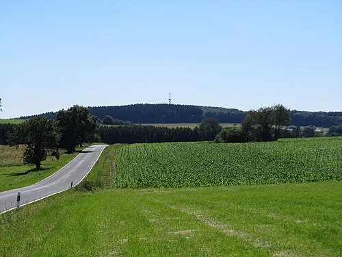
Helleberg Jörg Braukmann · CC BY 3.0 -
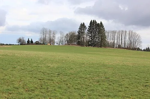
Ahlsberg LigaDue · CC BY-SA 4.0


Climate of Westerwaldkreis
Best months for sightseeingBest months for sightseeing: June–August.
This month · November
A cold month
Day 6° · Night 1° · Rain 88 mm
- Hottest month
- July (day 22°)
- Coldest month
- February (night -3°)
- Wettest month
- December (101 mm)
- Driest month
- April (62 mm)
Bars: average monthly low and high temperature. Below: precipitation. Monthly averages for 1970–2000 at about 18 km resolution, adjusted for elevation. Highlighted months are mild and relatively dry. Source: WorldClim 2.1 (CC BY 4.0).
Show values as a table
| Month | Jan | Feb | Mar | Apr | May | Jun | Jul | Aug | Sep | Oct | Nov | Dec |
|---|---|---|---|---|---|---|---|---|---|---|---|---|
| Average high (°C) | 2° | 4° | 8° | 12° | 17° | 20° | 22° | 22° | 17° | 12° | 6° | 4° |
| Average low (°C) | -3° | -3° | 0° | 2° | 6° | 10° | 11° | 11° | 8° | 4° | 1° | -1° |
| Precipitation (mm) | 89 | 70 | 84 | 62 | 69 | 77 | 80 | 66 | 74 | 80 | 88 | 101 |
How to get to Westerwaldkreis
The nearest airport is Cologne Bonn Airport (CGN), 64 km to the northwest as the crow flies. The nearest large city is Koblenz, 28 km to the southwest.
Airports
- Cologne Bonn Airport (CGN) Köln (Cologne) 64 kmnorthwest
- Frankfurt Main Airport (FRA) Frankfurt am Main 74 kmsoutheast
- Frankfurt-Hahn Airport (HHN) Frankfurt am Main (Lautzenhausen) 77 kmsouthwest
Nearby large cities
- Koblenz Population: 107.3K 28 kmsouthwest
- Siegen Population: 107.2K 41 kmnorth
- Wiesbaden Population: 288.8K 55 kmsoutheast
- Bonn Population: 330.6K 60 kmnorthwest
- Mainz Population: 222.9K 67 kmsoutheast
Straight-line distances; road distances are longer. Airport data: OurAirports.
Day trips from Westerwaldkreis
Within 100 km: 787 historic and cultural sites, 4,295 natural sites, 875 lakes, rivers and coasts.
0–25 km372 places
- Aar River 20 kmSE
- Urbach River 24 kmW
- Krombachtalsperre Lake 21 kmNE
- Dreifelder Weiher Lake 8 kmN
25–60 km2,008 places
- Weibe River 40 kmN
- Mariannenaue Island 59 kmS
- Königsklinger Aue Island 59 kmS
- Hatzenporter Werth Island 47 kmSW
60–100 km3,577 places
- Olef River 97 kmW
- Else River 79 kmN
- Ohe River 65 kmNE
- Modau River 89 kmSE
Straight-line distances.
Westerwaldkreis and similar cities
Side by side with cities of similar size in the same country: population, elevation and climate.
| Measure | Westerwaldkreis | Lübeck | Hagen | Rostock |
|---|---|---|---|---|
| Population | 207.8K | 212.2K | 199K | 198.3K |
| Elevation | 437 m | 16 m | 111 m | 18 m |
| Summer day (hottest month) | 22° | 22° | 23° | 22° |
| Winter night (coldest month) | -3° | -2° | -1° | -2° |
| Annual rainfall | 940 mm | 674 mm | 980 mm | 596 mm |
| Best months | Jun–Aug | Jun–Aug | Jun–Aug | Jun–Aug |
| Distance | — | 419 km | 97 km | 492 km |
Climate values are 1970–2000 monthly averages; straight-line distance.
Places in Westerwaldkreis
192 places- 121 Mörlen 542
- 122 Nordhofen 526
- 123 Sessenbach 517
- 124 Winnen 517
- 125 Untershausen 515
- 126 Hübingen 514
- 127 Berzhahn 504
- 128 Obererbach 503
- 129 Streithausen 498
- 130 Brandscheid 496
- 131 Rotenhain 492
- 132 Quirnbach 488
- 133 Daubach 478
- 134 Wölferlingen 472
- 135 Hundsdorf 468
- 136 Bilkheim 465
- 137 Rückeroth 465
- 138 Hergenroth 457
- 139 Hardt 456
- 140 Hahn bei Marienberg 455
- 141 Lautzenbrücken 448
- 142 Goddert 444
- 143 Stein-Neukirch 442
- 144 Merkelbach 441
- 145 Molsberg 430
- 146 Stockhausen-Illfurth 428
- 147 Limbach 412
- 148 Mörsbach 399
- 149 Hahn am See 397
- 150 Härtlingen 389
- 151 Oberhaid 389
- 152 Stahlhofen am Wiesensee 385
- 153 Zehnhausen bei Rennerod 376
- 154 Oberroßbach 359
- 155 Halbs 353
- 156 Elbingen 349
- 157 Wirscheid 347
- 158 Ettinghausen 339
- 159 Giesenhausen 332
- 160 Waldmühlen 317
- 161 Weltersburg 311
- 162 Nister-Möhrendorf 309
- 163 Krümmel 304
- 164 Lochum 294
- 165 Hüblingen 293
- 166 Ellenhausen 292
- 167 Enspel 285
- 168 Heimborn 284
- 169 Dreifelden 283
- 170 Willingen 280
- 171 Kundert 271
- 172 Kammerforst 265
- 173 Astert 260
- 174 Maroth 259
- 175 Marzhausen 255
- 176 Ewighausen 236
- 177 Winkelbach 233
- 178 Salzburg 231
- 179 Stein-Wingert 230
- 180 Bölsberg 228
Bar: population relative to the most populous place in this list.
Nearby attractions & nature
Everything nearby-
Ober Wald Natural site, Rhineland-Palatinate7.1 km W
-
Dreifelder Weiher Lake, Rhineland-Palatinate8.4 km N
-
Aubach River, Rhineland-Palatinate9.2 km S
-
Rauher Kopf Mountain, Dornburg10 km SE
-
Heilersberg Mountain, Dornburg10 km SE
-
Seebach River, Rhineland-Palatinate9.9 km NE
-
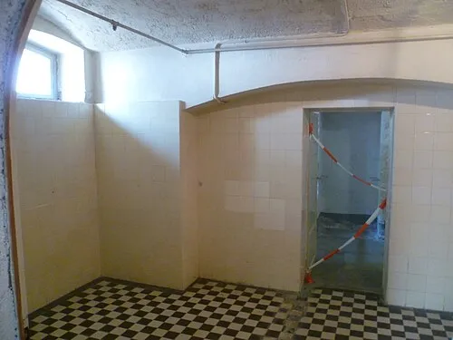 Hadamar Euthanasia Centre Historic site, Hadamar15 km SE
-
Dornburg Mountain, Dornburg11 km E
Sources & licences
Data last updated: