Rhineland-Palatinate
Local name: Rheinland-Pfalz
Located in Germany Coordinates: 49°40′00″ N 7°30′00″ E
- Population
- 4,093,903
- 4.1M
- Elevation
- 374 m
- above sea level
- Local time
- UTC+01:00
- Europe/Berlin · UTC+01:00
- Places inside
- 1,018
- listed under Rhineland-Palatinate
- Airports
- HHN Frankfurt-Hahn Airport36 km
- SCN Saarbrücken Airport58 km
About Rhineland-Palatinate
Rhineland-Palatinate is a region. Location: Germany. Population: 4,093,903.
Rhineland-Palatinate (German: Rheinland-Pfalz [ˌʁaɪnlant ˈpfalts] ; Palatine German: Rhoilond-Palz) is a landlocked state in western Germany. It covers 19,846 km2 (7,663 sq mi) and has about 4.05 million residents. It is the ninth largest and sixth most populous of the sixteen states. Mainz is the capital and largest city. Other cities are Ludwigshafen am Rhein, Koblenz, Trier, Kaiserslautern, Worms, and Neuwied.
Source: Wikipedia · CC BY-SA 4.0
Travel notes for Rhineland-Palatinate
From Wikivoyage
Rhineland-Palatinate (German: Rheinland-Pfalz) is a state in southwestern Germany, covering an area of 19,858 km² and home to around 4.1 million people. It is the largest wine-producing area in the country, containing 7 of the 13 official German wine regions, and is densely packed with historic castles, museums, and the vine-covered river valleys of the Rhine and Mosel.
Get in+
By plane:
Rhineland-Palatinate has only one commercial airport with scheduled passenger flights, located in Hahn. Branded Frankfurt-Hahn Airport (HHN IATA), it is primarily used by low-cost carriers. Despite its marketing name, the airport is not near Frankfurt, but rather remote in the Hunsrück low mountain range. Direct bus shuttles connect the airport to major cities in Rhineland-Palatinate and neighboring regions. The airport has no rail connection, and past plans to link it to the train network have been abandoned.
The actual Frankfurt Airport is in the neighbouring Land of Hesse and is Germany's busiest airport with connections all over Europe and the entire world. Direct high-speed and local trains connect the airport to Mainz and Koblenz, where you can change to regional trains and buses to further destinations. Mainz and Koblenz are also served by direct hourly regional trains from Cologne-Bonn Airport (CGN IATA) and Düsseldorf Airport (DUS IATA). Some high-speed ICE trains to Koblenz and Mainz also stop at DUS.
Some areas in western Rhineland-Palatinate (Trier, Bitburg) are within reach of Luxembourg Airport (LUX IATA).
By train:
If traveling into Germany by train, Rhineland-Palatinate is easily accessible via several major rail corridors. Frequent high-speed ICE and IC trains, as well as regional lines, connect Cologne and Frankfurt directly to Mainz and Koblenz along the scenic Rhine valley routes. From the south, direct long-distance trains from Stuttgart and Munich run via Mannheim into the southern Palatinate region, providing regular access to Ludwigshafen, Kaiserslautern, and Saarbrücken, with some international connections continuing on to Paris.
By boat:
Source: Wikivoyage · CC BY-SA 4.0 · abridged
Places bordering Rhineland-Palatinate
- North Rhine-Westphalia
- Hesse
- Baden-Wurttemberg
- Saarland
- Bas-Rhin
- Moselle
- Wallonia
- Grand Est
Twin towns and sister cities of Rhineland-Palatinate
- Bourgogne-Franche-Comté· France
- Opole Voivodeship· Poland
- Central Bohemia· Czechia
- South Carolina· United States
- Iwate· Japan
Source: Wikidata. Only places with a page on this site are shown.
Population of Rhineland-Palatinate over time
| 2013 | 3,994,000 | |
|---|---|---|
| 2014 | 4,011,582 | |
| 2018 | 4,084,844 | |
| 2022 | 4,094,169 |
Censuses and official estimates; source: Wikidata.
Climate of Rhineland-Palatinate
Best months for sightseeingBest months for sightseeing: June–August.
This month · November
A cold month
Day 6° · Night 1° · Rain 56 mm
- Hottest month
- July (day 22°)
- Coldest month
- February (night -2°)
- Wettest month
- May (62 mm)
- Driest month
- April (43 mm)
Bars: average monthly low and high temperature. Below: precipitation. Monthly averages for 1970–2000 at about 18 km resolution, adjusted for elevation. Highlighted months are mild and relatively dry. Source: WorldClim 2.1 (CC BY 4.0).
Show values as a table
| Month | Jan | Feb | Mar | Apr | May | Jun | Jul | Aug | Sep | Oct | Nov | Dec |
|---|---|---|---|---|---|---|---|---|---|---|---|---|
| Average high (°C) | 3° | 4° | 8° | 12° | 17° | 20° | 22° | 22° | 18° | 12° | 6° | 4° |
| Average low (°C) | -2° | -2° | 1° | 3° | 7° | 10° | 12° | 11° | 8° | 5° | 1° | -1° |
| Precipitation (mm) | 48 | 45 | 47 | 43 | 62 | 62 | 62 | 53 | 52 | 59 | 56 | 61 |
How to get to Rhineland-Palatinate
The nearest airport is Frankfurt-Hahn Airport (HHN), 36 km to the northwest as the crow flies. The nearest large city is Saarbrücken, 60 km to the southwest.
Airports
- Frankfurt-Hahn Airport (HHN) Frankfurt am Main (Lautzenhausen) 36 kmnorthwest
- Saarbrücken Airport (SCN) Saarbrücken 58 kmsouthwest
- Mannheim-City Airport (MHG) Mannheim 76 kmeast
Nearby large cities
- Saarbrücken Population: 183K 60 kmsouthwest
- Trier Population: 100.1K 63 kmwest
- Mainz Population: 222.9K 66 kmnortheast
- Wiesbaden Population: 288.8K 71 kmnortheast
- Ludwigshafen am Rhein Population: 163.2K 71 kmeast
Straight-line distances; road distances are longer. Airport data: OurAirports.
Places in Rhineland-Palatinate
1,018 placesCities & villages1
- Oberwindhagen · Village
Mountains & nature27
- Nassauer Wald · Natural site
- Nastätter Stadtwald · Natural site
- Natural Park Saar-Hunsrück · Natural site
- Naturpark Saar-Hunsrück · Natural site
- Naturschutzgebiet Bausenberg · Natural site
- Naturschutzgebiet Laacher See · Natural site
- Nenkers-Berg · Mountain
- Neuenahrer Wald · Natural site
- Neuwieder Stadtwald · Natural site
- Nickenicher Wald · Natural site
- Niederheimbacher Wald · Natural site
- Nieder Lahnsteiner Wald · Natural site
- Nitteler Wald · Natural site
- North Palatine Uplands · Mountain
- Oberer Buschur · Natural site
- Oberheimbacher Wald · Natural site
- Ober-Kunowald · Natural site
- Oberlahnsteiner Wald · Natural site
- Ober-Olmer Wald · Natural site
- Ober Wald · Natural site
- Ober Wald · Natural site
- Ochsenheck · Natural site
- Odersberg · Mountain
- Olzheimer Wald · Natural site
- Orenhofener Wald · Natural site
- Osburger Hochwald · Mountain
- Osterspaier Wald · Natural site
Lakes, rivers & coasts32
- Münzbach · River
- Mußbach · River
- Nahe · River
- Naßbach · River
- Neefer Bach · River
- Nettebach · River
- Neue Lauter · River
- Neu Graben · River
- Niederbach · River
- Niederwerth · Island
- Nims · River
- Nister · River
- Nitzbach · River
- Nohnerbach · River
- Nollenbach · River
- Nonnen Bach · River
- Nothbach · River
- Notzenbach · River
- Nußbach · River
- Oberbach · River
- Oberbach · River
- Oberwerth · Island
- Odenbach · River
- Oestelbach · River
- Ohmbach · River
- Ohm Bach · River
- Olker Bach · River
- Oos Bach · River
- Orschbach · River
- Osel Bach · River
- Otterbach · River
- Otter Bach · River
Largest cities and towns
-
Neuwied Village, Landkreis Neuwied67.1K
-
Germersheim Village, Landkreis Germersheim21.7K
-
Mayen Village, Landkreis Mayen-Koblenz19.7K
-
Alzey Village, Landkreis Alzey-Worms19.5K
-
Schifferstadt Village, Rhein-Pfalz-Kreis21.4K
-
Mainz Village, Kreisfreie Stadt Mainz224.7K
-
Ludwigshafen am Rhein Village, Kreisfreie Stadt Ludwigshafen am Rhein177.2K
-
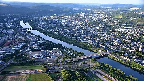 Trier City, Trier100.1K
Nature and heritage in Rhineland-Palatinate
Other regions in Germany
-
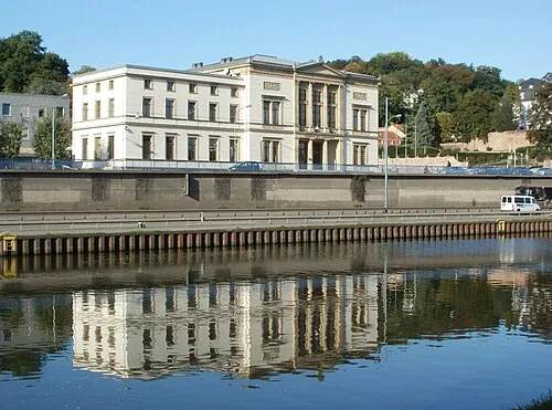 Saarland Region, Germany49 km SW
-
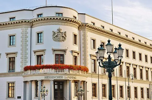 Hesse Region, Germany145 km NE
-
Regierungsbezirk Darmstadt District, Hesse97 km NE
-
Karlsruhe Region District, Baden-Wurttemberg113 km SE
-
Cologne District District, North Rhine-Westphalia132 km N
-
Regierungsbezirk Gießen District, Hesse146 km NE
Sources & licences
Data last updated: · 2 independent sources