Quellendorf
Located in Südliches Anhalt, Anhalt-Bitterfeld Coordinates: 51°44′57″ N 12°07′41″ E

- Population
- 1,033
- 1K
- Elevation
- 80 m
- above sea level
- Local time
- UTC+01:00
- Europe/Berlin · UTC+01:00
- Airports
- LEJ Leipzig/Halle Airport37 km
- BER Berlin Brandenburg Airport116 km
About Quellendorf
Quellendorf is a village. Location: Südliches Anhalt, Anhalt-Bitterfeld. Population: 1,033. Elevation: 80 m.
Quellendorf (German pronunciation: [ˈkvɛlənˌdɔʁf]) is a village and a former municipality in the district of Anhalt-Bitterfeld, in Saxony-Anhalt, Germany. Since 1 January 2010, it is part of the town Südliches Anhalt. In the 19th century the estate was the property of General Count Henckel von Donnersmarck who sold it to Field Marshal Count Leonhardt von Blumenthal after the Franco-Prussian War. The Field Marshal later transferred ownership to his son-in-law, Rudolf von Oettinger.
Source: Wikipedia · CC BY-SA 4.0
Photos of Quellendorf
-

Radler59 · CC BY-SA 3.0 -

M_H.DE · CC BY-SA 3.0 -

M_H.DE · CC BY-SA 3.0 -

Sicherlich · CC BY 3.0


Climate of Quellendorf
Best months for sightseeingBest months for sightseeing: June–September.
This month · November
A cold month
Day 7° · Night 2° · Rain 46 mm
- Hottest month
- August (day 24°)
- Coldest month
- January (night -2°)
- Wettest month
- July (73 mm)
- Driest month
- February (31 mm)
Bars: average monthly low and high temperature. Below: precipitation. Monthly averages for 1970–2000 at about 18 km resolution, adjusted for elevation. Highlighted months are mild and relatively dry. Source: WorldClim 2.1 (CC BY 4.0).
Show values as a table
| Month | Jan | Feb | Mar | Apr | May | Jun | Jul | Aug | Sep | Oct | Nov | Dec |
|---|---|---|---|---|---|---|---|---|---|---|---|---|
| Average high (°C) | 3° | 4° | 8° | 13° | 18° | 21° | 23° | 24° | 19° | 14° | 7° | 4° |
| Average low (°C) | -2° | -2° | 1° | 3° | 8° | 11° | 13° | 13° | 9° | 6° | 2° | -1° |
| Precipitation (mm) | 38 | 31 | 41 | 34 | 57 | 47 | 73 | 57 | 52 | 36 | 46 | 43 |
Other places to visit in this season: June July August September
How to get to Quellendorf
The nearest airport is Leipzig/Halle Airport (LEJ), 37 km to the south as the crow flies. The nearest large city is Halle, 31 km to the south.
Airports
- Leipzig/Halle Airport (LEJ) Schkeuditz 37 kmsouth
- Berlin Brandenburg Airport (BER) Berlin 116 kmnortheast
- Erfurt-Weimar Airport (ERF) Erfurt 118 kmsouthwest
Nearby large cities
- Halle Population: 237.9K 31 kmsouth
- Leipzig Population: 505K 49 kmsouth
- Magdeburg Population: 244.3K 55 kmnorthwest
- Potsdam Population: 184.8K 97 kmnortheast
- Gera Population: 104.7K 97 kmsouth
Straight-line distances; road distances are longer. Airport data: OurAirports.
Day trips from Quellendorf
Within 100 km: 516 historic and cultural sites, 1,987 natural sites, 706 lakes, rivers and coasts.
0–25 km129 places
- Steinsee Lake 17 kmNW
- Pfaffensee Lake 17 kmNW
- Pelze Lake 16 kmNE
- Löbben Lake 17 kmNE
25–60 km809 places
- Sarre River 59 kmNW
- Ehle River 58 kmNW
- Ehle River 45 kmNW
- Rabeninsel Island 34 kmS
60–100 km2,271 places
- Sprotte River 92 kmS
- Bere River 98 kmW
- Aue River 97 kmW
- Aue River 96 kmW
Straight-line distances.
Nearby attractions & nature
Everything nearby-
Forst Haideburg Natural site, Saxony-Anhalt6.1 km E
-
Vogtei Natural site, Saxony-Anhalt7.7 km S
-
Mosigkauer Heide Natural site, Saxony-Anhalt7.2 km E
-
Finkenberg Mountain, Raguhn-Jeßnitz9.7 km E
-
Brödel Graben River, Saxony-Anhalt7.4 km SE
-
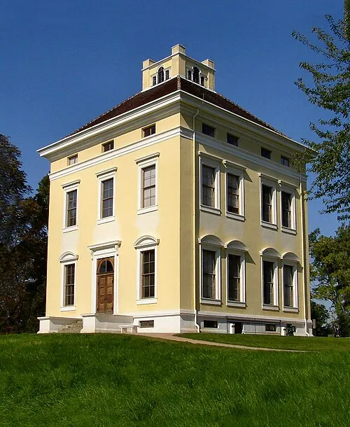 Louisium Historic site, Dessau-Roßlau15 km NE
Other cities and towns in Südliches Anhalt
-
 Reupzig Village, Südliches Anhalt4.5 km W
-
 Libehna Village, Südliches Anhalt6.1 km SW
-
 Großbadegast Village, Südliches Anhalt7.3 km W
-
 Riesdorf Village, Südliches Anhalt6.5 km S
-
 Prosigk Village, Südliches Anhalt7.5 km SW
-
 Weißandt-Gölzau Village, Südliches Anhalt9.5 km SW
Sources & licences
Data last updated: · 2 independent sources