NDB-Funkfeuer HOZ
Located in Annaburg, Landkreis Wittenberg Coordinates: 51°46′13″ N 13°05′52″ E
- Local time
- UTC+01:00
- Europe/Berlin · UTC+01:00
- Elevation
- 76 m
- above sea level
- Airports
- BER Berlin Brandenburg Airport71 km
- LEJ Leipzig/Halle Airport71 km
About NDB-Funkfeuer HOZ
NDB-Funkfeuer HOZ is a landmark. Location: Annaburg, Landkreis Wittenberg. The best months to visit are May–September. The nearest airport is Berlin Brandenburg Airport (71 km). Nearby sights include Mönchenhöfener Fichten and Schöne Aussicht.
Climate of NDB-Funkfeuer HOZ
Best months for sightseeingBest months for sightseeing: May–September.
This month · November
A cold month
Day 8° · Night 2° · Rain 42 mm
- Hottest month
- July (day 25°)
- Coldest month
- January (night -3°)
- Wettest month
- August (61 mm)
- Driest month
- February (31 mm)
Bars: average monthly low and high temperature. Below: precipitation. Monthly averages for 1970–2000 at about 18 km resolution, adjusted for elevation. Highlighted months are mild and relatively dry. Source: WorldClim 2.1 (CC BY 4.0).
Show values as a table
| Month | Jan | Feb | Mar | Apr | May | Jun | Jul | Aug | Sep | Oct | Nov | Dec |
|---|---|---|---|---|---|---|---|---|---|---|---|---|
| Average high (°C) | 3° | 5° | 9° | 15° | 20° | 23° | 25° | 25° | 19° | 14° | 8° | 4° |
| Average low (°C) | -3° | -2° | 0° | 3° | 8° | 11° | 13° | 13° | 9° | 5° | 2° | -2° |
| Precipitation (mm) | 36 | 31 | 35 | 38 | 54 | 60 | 56 | 61 | 47 | 41 | 42 | 43 |
Other places to visit in this season: May June July August September
How to get to NDB-Funkfeuer HOZ
The nearest airport is Berlin Brandenburg Airport (BER), 71 km to the northeast as the crow flies. The nearest large city is Leipzig, 70 km to the southwest.
Airports
- Berlin Brandenburg Airport (BER) Berlin 71 kmnortheast
- Leipzig/Halle Airport (LEJ) Schkeuditz 71 kmsouthwest
- Dresden Airport (DRS) Dresden 85 kmsoutheast
Nearby large cities
- Leipzig Population: 505K 70 kmsouthwest
- Potsdam Population: 184.8K 70 kmnorth
- Halle Population: 237.9K 84 kmwest
- Berlin Population: 3.4M 87 kmnorth
- Dresden Population: 564.9K 92 kmsoutheast
Straight-line distances; road distances are longer. Airport data: OurAirports.
Day trips from NDB-Funkfeuer HOZ
Within 100 km: 580 historic and cultural sites, 1,674 natural sites, 928 lakes, rivers and coasts.
0–25 km102 places
- Rohrteich Lake 24 kmE
- Langer Teich Lake 20 kmE
- Körbaer Teich Lake 22 kmE
- Großer Streng Lake 22 kmW
25–60 km687 places
- Meierei-See Lake 57 kmNE
- Zemminsee Lake 57 kmNE
- Wolziger See Lake 49 kmNE
- Vordersee Lake 44 kmN
60–100 km2,393 places
- Schlachtensee Lake 75 kmN
- Valentinswerder Island 89 kmN
- Scharfenberg Island 90 kmN
- Dahme River River 82 kmNE
Straight-line distances.
Nearby attractions & nature
Everything nearby-
Mönchenhöfener Fichten Natural site, Saxony-Anhalt1.4 km N
-
Schöne Aussicht Mountain, Annaburg4.5 km S
-
Annaburg Concentration Camp Historic site, Annaburg5.7 km SW
-
Drewischgraben River, Germany3.8 km SE
-
Forst Tiergarten Natural site, Saxony-Anhalt4.8 km SE
-
Mollgraben River, Germany5.6 km S
-
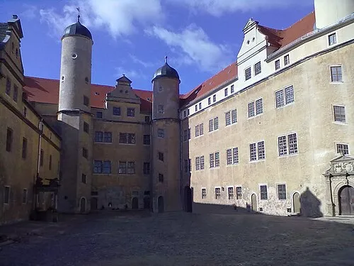 Early Camp Lichtenburg Historic site, Annaburg17 km SW
-
Diesthöhe Mountain, Jessen9.9 km NW
Nearest towns and villages
-
Löben Village, Annaburg1.5 km W
-
 Kremitz Village, Jessen1 km SE
-
Holzdorf Village, Jessen2.2 km NE
-
Mönchenhöfe Village, Jessen2.8 km NW
Sources & licences
Data last updated: