
- Elevation
- 118 m
- above sea level
- Local time
- UTC+01:00
- Europe/Berlin · UTC+01:00
- Airports
- LEJ Leipzig/Halle Airport12 km
- ERF Erfurt-Weimar Airport93 km
About Altranstädt
Altranstädt is a village. Location: Markranstädt, Landkreis Leipzig. Elevation: 118 m.
Altranstädt (German pronunciation: [ˈaltˌʁanʃtɛt]) is a village and former municipality in Saxony, Germany, now part of the town Markranstädt in the district of Leipzig. The village is historically famous for two treaties that were concluded there, the Treaty of Altranstädt (1706) and the Treaty of Altranstädt (1707). The 1706 treaty was a peace which Augustus II, king of Poland and elector of Saxony, was forced to ratify on 24 September 1706, with Charles XII of Sweden.
Source: Wikipedia · CC BY-SA 4.0
Photos of Altranstädt
-
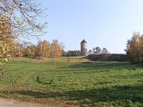
Wachberg Jwaller · CC BY-SA 3.0

Climate of Altranstädt
Best months for sightseeingBest months for sightseeing: May–September.
This month · November
A cold month
Day 8° · Night 2° · Rain 42 mm
- Hottest month
- August (day 24°)
- Coldest month
- January (night -2°)
- Wettest month
- July (69 mm)
- Driest month
- February (29 mm)
Bars: average monthly low and high temperature. Below: precipitation. Monthly averages for 1970–2000 at about 18 km resolution, adjusted for elevation. Highlighted months are mild and relatively dry. Source: WorldClim 2.1 (CC BY 4.0).
Show values as a table
| Month | Jan | Feb | Mar | Apr | May | Jun | Jul | Aug | Sep | Oct | Nov | Dec |
|---|---|---|---|---|---|---|---|---|---|---|---|---|
| Average high (°C) | 3° | 4° | 9° | 13° | 19° | 22° | 24° | 24° | 20° | 14° | 8° | 4° |
| Average low (°C) | -2° | -2° | 1° | 4° | 8° | 12° | 13° | 13° | 10° | 6° | 2° | 0° |
| Precipitation (mm) | 30 | 29 | 37 | 35 | 48 | 55 | 69 | 62 | 46 | 35 | 42 | 37 |
Other places to visit in this season: May June July August September
How to get to Altranstädt
The nearest airport is Leipzig/Halle Airport (LEJ), 12 km to the north as the crow flies. The nearest large city is Leipzig, 14 km to the east.
Airports
- Leipzig/Halle Airport (LEJ) Schkeuditz 12 kmnorth
- Erfurt-Weimar Airport (ERF) Erfurt 93 kmsouthwest
- Dresden Airport (DRS) Dresden 113 kmeast
Nearby large cities
- Leipzig Population: 505K 14 kmeast
- Halle Population: 237.9K 23 kmnorthwest
- Gera Population: 104.7K 49 kmsouth
- Jena Population: 104.7K 59 kmsouthwest
- Chemnitz Population: 247.2K 75 kmsoutheast
Straight-line distances; road distances are longer. Airport data: OurAirports.
Day trips from Altranstädt
Within 100 km: 526 historic and cultural sites, 2,171 natural sites, 637 lakes, rivers and coasts.
0–25 km164 places
- Rabeninsel Island 23 kmNW
- Hufeisensee Lake 20 kmNW
- Elsterbecken Lake 12 kmE
- Pleiße Stausee Lake 21 kmSE
25–60 km806 places
- Sprotte River 45 kmS
- Speicherbecken Witznitz Lake 29 kmSE
- Vogtlandsee Lake 25 kmNE
- Süßer See Lake 41 kmNW
60–100 km2,364 places
- Buchenwald concentration camp Historic site 73 kmSW
- Sarre River 94 kmNW
- Roda River 63 kmSW
- Roda River 64 kmSW
Straight-line distances.
Nearby attractions & nature
Everything nearby-
Fiklasberg Mountain, Markranstädt1.9 km W
-
St.-Laurentius-Kirche Attraction, Markranstädt3.4 km SE
-
Wachberg Mountain, Leipzig6.2 km NE
-
Kulkwitzer See Lake, Saxony5 km E
-
Kulkwitzer Lachen Lake, Saxony5.5 km SE
-
Burghausen-Rückmannsdorf (Leipzig), Dorfkirche Attraction, Leipzig6.1 km NE
Sources & licences
Data last updated: · 2 independent sources