- Elevation
- 129 m
- above sea level
- Local time
- UTC+01:00
- Europe/Berlin · UTC+01:00
- Airports
- DRS Dresden Airport50 km
- LEJ Leipzig/Halle Airport64 km
About Laas
Laas is a village. Location: Liebschützberg, Landkreis Nordsachsen. Elevation: 129 m. The best months to visit are May–September. The nearest airport is Dresden Airport (50 km). Nearby sights include Lattenberg and Dürrenberg.
Photos of Laas
-
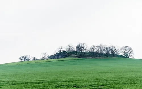
Tonberg Radler59 · CC BY-SA 4.0 -
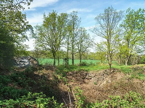
Großer Steinberg Radler59 · CC BY-SA 4.0


Climate of Laas
Best months for sightseeingBest months for sightseeing: May–September.
This month · November
A cold month
Day 8° · Night 2° · Rain 50 mm
- Hottest month
- July (day 24°)
- Coldest month
- January (night -4°)
- Wettest month
- July (68 mm)
- Driest month
- February (34 mm)
Bars: average monthly low and high temperature. Below: precipitation. Monthly averages for 1970–2000 at about 18 km resolution, adjusted for elevation. Highlighted months are mild and relatively dry. Source: WorldClim 2.1 (CC BY 4.0).
Show values as a table
| Month | Jan | Feb | Mar | Apr | May | Jun | Jul | Aug | Sep | Oct | Nov | Dec |
|---|---|---|---|---|---|---|---|---|---|---|---|---|
| Average high (°C) | 2° | 4° | 8° | 13° | 19° | 22° | 24° | 24° | 19° | 14° | 8° | 4° |
| Average low (°C) | -4° | -2° | 1° | 4° | 8° | 12° | 14° | 14° | 10° | 6° | 2° | -1° |
| Precipitation (mm) | 40 | 34 | 41 | 39 | 54 | 54 | 68 | 65 | 49 | 40 | 50 | 48 |
Other places to visit in this season: May June July August September
How to get to Laas
The nearest airport is Dresden Airport (DRS), 50 km to the southeast as the crow flies. The nearest large city is Leipzig, 54 km to the west.
Airports
- Dresden Airport (DRS) Dresden 50 kmsoutheast
- Leipzig/Halle Airport (LEJ) Schkeuditz 64 kmwest
- Berlin Brandenburg Airport (BER) Berlin 113 kmnorth
Nearby large cities
- Leipzig Population: 505K 54 kmwest
- Dresden Population: 564.9K 54 kmsoutheast
- Chemnitz Population: 247.2K 61 kmsouth
- Halle Population: 237.9K 82 kmwest
- Gera Population: 104.7K 92 kmsouthwest
Straight-line distances; road distances are longer. Airport data: OurAirports.
Day trips from Laas
Within 100 km: 437 historic and cultural sites, 1,914 natural sites, 640 lakes, rivers and coasts.
0–25 km157 places
- Toffelsteich Lake 19 kmE
- Neuer Teich Lake 22 kmE
- Langer Rodaer See Lake 21 kmSW
- Hoschteich Lake 20 kmE
25–60 km900 places
- Speicherbecken Witznitz Lake 53 kmSW
- Vogtlandsee Lake 50 kmW
- Vierteich Lake 40 kmE
- Stockteich Lake 51 kmNE
60–100 km1,934 places
- Erzgebirge Mountain 70 kmSE
- Pirna-Sonnenstein Mountain 73 kmSE
- Sprotte River 70 kmSW
- Rabeninsel Island 84 kmW
Straight-line distances.
Nearby attractions & nature
Everything nearby-
Lattenberg Mountain, Liebschützberg1.3 km E
-
Dürrenberg Mountain, Liebschützberg1.9 km SW
-
Großer Steinberg Mountain, Liebschützberg2.1 km SE
-
Hutberg Mountain, Liebschützberg2.2 km W
-
Birkenberg Mountain, Liebschützberg2.2 km W
-
Weinberg Mountain, Cavertitz4.5 km W
Other cities and towns in Liebschützberg

Sources & licences
Data last updated: