
- Population
- 18,894
- 18.9K
- Elevation
- 37 m
- above sea level
- Local time
- UTC+01:00
- Europe/Berlin · UTC+01:00
- Airports
- BER Berlin Brandenburg Airport12 km
- LEJ Leipzig/Halle Airport145 km
About Baumschulenweg
Baumschulenweg is a neighbourhood. Location: Berlin, Berlin, Stadt. Population: 18,894.
Baumschulenweg (German pronunciation: [ˈbaʊ̯mʃuːlənˌveːk] ) is a German locality (Ortsteil) within the Berlin borough (Bezirk) of Treptow-Köpenick. Until 2001 it was part of the former borough of Treptow. Its name means road (weg) of the plant nurseries (Baumschulen). It was named after the Späth nursery.
Source: Wikipedia · CC BY-SA 4.0
At a glance
- Area
- 4.8 km²
Source: Wikidata
Photos of Baumschulenweg
-

Baumgarteninsel Lotse · CC BY-SA 3.0 -
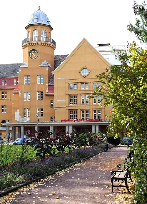
Theater an der Parkaue Christian Brachwitz · Public domain -
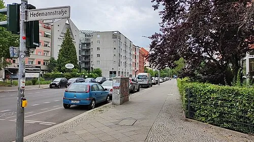
Early Camp Berlin-Kreuzberg (Hedemannstraße) Josi · CC BY-SA 4.0 -
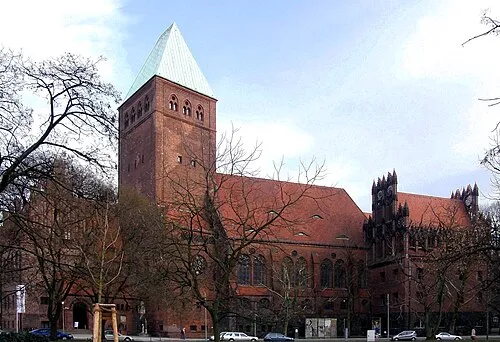
Märkisches Museum Axel Mauruszat · CC BY 3.0 de -
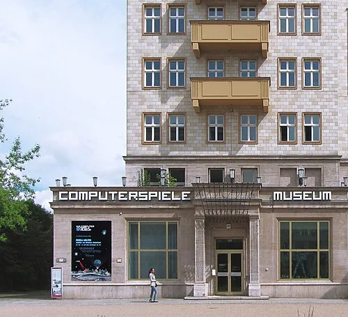
Computer Games Museum Matthias A. K. Zimmermann, Schweiz/Switzerland · CC BY-SA 3.0


Places bordering Baumschulenweg
- Plänterwald
- Niederschöneweide
- Johannisthal
- Oberschöneweide
- Britz
Climate of Baumschulenweg
Best months for sightseeingBest months for sightseeing: May–September.
This month · November
A cold month
Day 7° · Night 2° · Rain 43 mm
- Hottest month
- July (day 24°)
- Coldest month
- January (night -2°)
- Wettest month
- June (63 mm)
- Driest month
- February (34 mm)
Bars: average monthly low and high temperature. Below: precipitation. Monthly averages for 1970–2000 at about 18 km resolution, adjusted for elevation. Highlighted months are mild and relatively dry. Source: WorldClim 2.1 (CC BY 4.0).
Show values as a table
| Month | Jan | Feb | Mar | Apr | May | Jun | Jul | Aug | Sep | Oct | Nov | Dec |
|---|---|---|---|---|---|---|---|---|---|---|---|---|
| Average high (°C) | 3° | 4° | 8° | 13° | 19° | 22° | 24° | 24° | 19° | 13° | 7° | 4° |
| Average low (°C) | -2° | -2° | 1° | 4° | 9° | 12° | 14° | 13° | 10° | 5° | 2° | -1° |
| Precipitation (mm) | 40 | 34 | 39 | 38 | 54 | 63 | 57 | 55 | 42 | 37 | 43 | 53 |
Other places to visit in this season: May June July August September
How to get to Baumschulenweg
The nearest airport is Berlin Brandenburg Airport (BER), 12 km to the south as the crow flies. The nearest large city is Berlin, 8 km to the northwest.
Airports
- Berlin Brandenburg Airport (BER) Berlin 12 kmsouth
- Leipzig/Halle Airport (LEJ) Schkeuditz 145 kmsouthwest
- Dresden Airport (DRS) Dresden 149 kmsouth
Nearby large cities
- Berlin Population: 3.4M 8 kmnorthwest
- Potsdam Population: 184.8K 29 kmwest
- Magdeburg Population: 244.3K 132 kmwest
- Leipzig Population: 505K 147 kmsouthwest
- Halle Population: 237.9K 151 kmsouthwest
Straight-line distances; road distances are longer. Airport data: OurAirports.
Day trips from Baumschulenweg
Within 100 km: 491 historic and cultural sites, 1,735 natural sites, 1,609 lakes, rivers and coasts.
0–25 km442 places
- Schlachtensee Lake 18 kmW
- Valentinswerder Island 20 kmNW
- Scharfenberg Island 20 kmNW
- Dahme River River 6 kmE
25–60 km1,353 places
- Freundschaftsinsel Island 30 kmW
- Insel im Bützsee Island 57 kmNW
- Köhninge Island 55 kmW
- Ketziner Havelinseln Island 45 kmW
60–100 km2,040 places
- Lutzke River 95 kmSE
- Strandbad Beach 69 kmNE
- Mittelbruch Island 62 kmW
- Buhnenwerder Island 70 kmW
Straight-line distances.
Nearby attractions & nature
Everything nearby-
Spreepark Natural site, Berlin1.8 km N
-
Insel der Jugend Island, Berlin2.4 km N
-
Berlin-Oberschöneweide Concentration Camp Historic site, Berlin2 km E
-
Treptower Park Natural site, Berlin2.9 km NW
-
Berlin-Schöneweide Concentration Camp Historic site, Berlin2.8 km W
-
Berlin, Kreuzberg-Friedrichshain, Dorfkirche Stralau Attraction, Berlin2.8 km N
Other cities and towns in Berlin
-
 Gropiusstadt Neighbourhood, Berlin4.7 km S
-
 Friedrichshain Neighbourhood, Berlin5.9 km N
-
Britz Neighbourhood, Berlin4.3 km SW
-
 Rummelsburg Neighbourhood, Berlin4 km N
-
Friedrichsfelde Neighbourhood, Berlin4.7 km N
-
 Stralau Neighbourhood, Berlin3.5 km N
Sources & licences
Data last updated: · 2 independent sources