Arachova
Local name: Αράχωβα
Located in Distomo-Arachova-Antikyra, Nomós Voiotías Coordinates: 38°28′46″ N 22°35′01″ E

- Population
- 2,439
- 2.4K
- Elevation
- 941 m
- above sea level
- Local time
- UTC+02:00
- Europe/Athens · UTC+02:00
- Airports
- VOL Nea Anchialos National Airport84 km
- GPA Patras Araxos Agamemnon Airport108 km
About Arachova
Arachova is a village. Location: Distomo-Arachova-Antikyra, Nomós Voiotías. Population: 2,439. Elevation: 941 m.
Arachova (Greek: Αράχωβα, also Αράχοβα) is a mountain town and a former municipality in the western part of Boeotia. Since the 2011 local government reform it is a municipal unit, part of the municipality Distomo-Arachova-Antikyra. It is a tourist destination due to its location in the mountains, its traditions and its proximity to the town of Delphi. The town is a popular day or weekend trip destination from Attica and a gathering place for the rich and famous.
Source: Wikipedia · CC BY-SA 4.0
Population of Arachova over time
| 1991 | 2,494 | |
|---|---|---|
| 2001 | 3,071 | |
| 2011 | 2,657 | |
| 2021 | 2,322 |
Censuses and official estimates; source: Wikidata.
Climate of Arachova
Best months for sightseeingBest months for sightseeing: May–June, August–September.
This month · November
Outside the best season
Day 12° · Night 3° · Rain 94 mm
- Hottest month
- July (day 28°)
- Coldest month
- January (night -1°)
- Wettest month
- December (107 mm)
- Driest month
- July (18 mm)
Bars: average monthly low and high temperature. Below: precipitation. Monthly averages for 1970–2000 at about 18 km resolution, adjusted for elevation. Highlighted months are mild and relatively dry. Source: WorldClim 2.1 (CC BY 4.0).
Show values as a table
| Month | Jan | Feb | Mar | Apr | May | Jun | Jul | Aug | Sep | Oct | Nov | Dec |
|---|---|---|---|---|---|---|---|---|---|---|---|---|
| Average high (°C) | 7° | 7° | 10° | 15° | 20° | 26° | 28° | 27° | 24° | 18° | 12° | 8° |
| Average low (°C) | -1° | -1° | 1° | 4° | 8° | 12° | 14° | 14° | 11° | 7° | 3° | 1° |
| Precipitation (mm) | 85 | 83 | 74 | 56 | 40 | 24 | 18 | 21 | 30 | 73 | 94 | 107 |
Other places to visit in this season: May June August September
How to get to Arachova
The nearest airport is Nea Anchialos National Airport (VOL), 84 km to the north as the crow flies. The nearest large city is Piraeus, 111 km to the southeast.
Airports
- Nea Anchialos National Airport (VOL) Nea Anchialos 84 kmnorth
- Patras Araxos Agamemnon Airport (GPA) Patras 108 kmwest
- Skiathos Island National Airport (JSI) Skiathos 111 kmnortheast
Nearby large cities
- Piraeus Population: 163.7K 111 kmsoutheast
- Athens Population: 664K 114 kmsoutheast
- Çanakkale Population: 143.6K 379 kmnortheast
- Çiğli Population: 214.1K 391 kmeast
- Konak Population: 332.3K 394 kmeast
Straight-line distances; road distances are longer. Airport data: OurAirports.
Day trips from Arachova
Within 100 km: 18 historic and cultural sites, 4 natural sites, 12 lakes, rivers and coasts.
0–25 km2 places
- Ierá Moní Odigítrias Attraction 13 kmNE
- Hosios Loukas Attraction 17 kmSE
25–60 km6 places
- Moní Genesíou Theotókou Damástas Attraction 34 kmN
- Moní Antinítsis Attraction 60 kmN
- Makronísi Island 49 kmSE
- Ágios Nikolaos Island 50 kmNE
60–100 km26 places
- Moní Agíou Ierothéou Attraction 79 kmSE
- Moni Osiou David Attraction 73 kmNE
- Panagia Eleousa Attraction 66 kmN
- Nisída Vasilikó Island 99 kmW
Straight-line distances.
Nearby attractions & nature
Everything nearby-
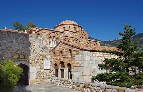 Hosios Loukas Attraction, Distomo-Arachova-Antikyra17 km SE
-
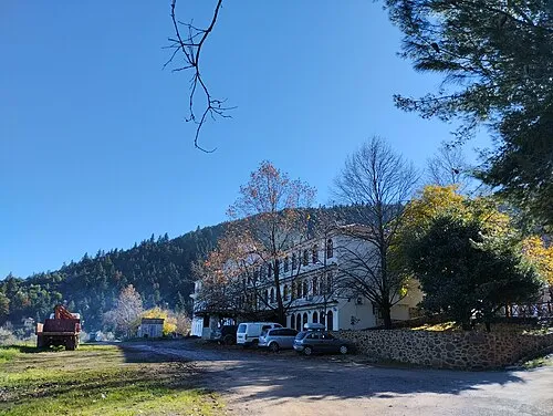 Ierá Moní Odigítrias Attraction, Amfikleia-Elateia13 km NE
Sources & licences
Data last updated: · 2 independent sources