Amfiklia
Local name: Αρχαία Αμφίκλεια
Located in Amfikleia-Elateia, Phthiotis Coordinates: 38°38′21″ N 22°35′30″ E
- Population
- 2,996
- 3K
- Elevation
- 389 m
- above sea level
- Local time
- UTC+02:00
- Europe/Athens · UTC+02:00
About Amfiklia
Amfiklia is a village. Location: Amfikleia-Elateia, Phthiotis. Population: 2,996. Elevation: 389 m.
Amphicleia or Amphikleia (Ancient Greek: Ἀμφίκλεια) or Amphicaea or Amphikaia (Ἀμφίκαια) was a Greek town in the north of ancient Phocis, distant 60 stadia from Lilaea, and 15 stadia from Tithronium. It was destroyed by the Persian army of Xerxes in his invasion of Greece (480 BCE). Although Herodotus calls it Amphicaea, following the most ancient traditions, the Amphictyonic League gave it the name of Amphicleia in their decree respecting rebuilding the town (346 BCE).
Read more on Wikipedia Text: Wikipedia contributors · CC BY-SA 4.0 · shortened
In comparison
- Most populous of 27 places in Amfikleia-Elateia
- Nearest larger town: Amfikleia-Elateia, 7 km E
Climate of Amfiklia
Best months for sightseeing: May, September–October.
| Month | Jan | Feb | Mar | Apr | May | Jun | Jul | Aug | Sep | Oct | Nov | Dec |
|---|---|---|---|---|---|---|---|---|---|---|---|---|
| Average high (°C) | 10° | 10° | 13° | 18° | 24° | 29° | 31° | 31° | 27° | 21° | 16° | 12° |
| Average low (°C) | 3° | 4° | 5° | 9° | 12° | 16° | 18° | 18° | 15° | 12° | 8° | 5° |
| Precipitation (mm) | 93 | 90 | 82 | 67 | 50 | 31 | 24 | 25 | 34 | 80 | 96 | 110 |
Monthly averages for 1970–2000 at about 18 km resolution, adjusted for elevation. Highlighted months are mild and relatively dry. Source: WorldClim 2.1 (CC BY 4.0).
Other places to visit in this season: May · September · October
Airports nearest to Amfiklia
- Nea Anchialos National Airport (VOL) Nea Anchialos 67 km
- Skiathos Island National Airport (JSI) Skiathos 99 km
- Patras Araxos Agamemnon Airport (GPA) Patras 115 km
Straight-line distance; airports with scheduled flights only. Source: OurAirports (public domain).
Nearby attractions & nature
Everything nearby-
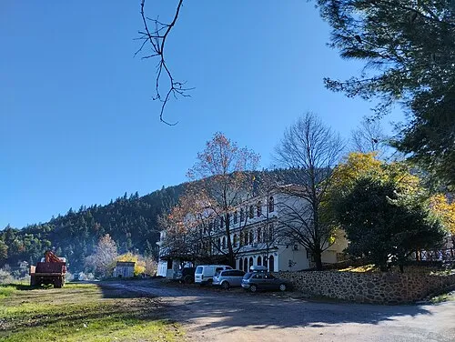 Ierá Moní Odigítrias Attraction, Amfikleia-Elateia10 km SE
-
Moní Genesíou Theotókou Damástas Attraction, Lamia18 km NW
Sources & licences
Data last updated: · 2 independent sources