Káto Anavrytó
Local name: Κάτω Αναβρυτό
Located in Megalopoli, Arcadia Coordinates: 37°20′03″ N 22°13′54″ E
- Population
- 31
- 31
- Elevation
- 632 m
- above sea level
- Local time
- UTC+02:00
- Europe/Athens · UTC+02:00
- Airports
- KLX Kalamata Airport35 km
- GPA Patras Araxos Agamemnon Airport115 km
About Káto Anavrytó
Káto Anavrytó is a village. Location: Megalopoli, Arcadia. Population: 31. Elevation: 632 m. The best months to visit are May–June, September–October. The nearest airport is Kalamata Airport (35 km). Nearby sights include Ierá Moní Agíou Nikoláou Kaltezón and Moni Ambelaki.
Population of Káto Anavrytó over time
| 2001 | 27 | |
|---|---|---|
| 2011 | 31 | |
| 2021 | 21 |
Censuses and official estimates; source: Wikidata.
Climate of Káto Anavrytó
Best months for sightseeingBest months for sightseeing: May–June, September–October.
This month · November
A wet month
Day 15° · Night 6° · Rain 120 mm
- Hottest month
- July (day 30°)
- Coldest month
- January (night 2°)
- Wettest month
- December (130 mm)
- Driest month
- June (17 mm)
Bars: average monthly low and high temperature. Below: precipitation. Monthly averages for 1970–2000 at about 18 km resolution, adjusted for elevation. Highlighted months are mild and relatively dry. Source: WorldClim 2.1 (CC BY 4.0).
Show values as a table
| Month | Jan | Feb | Mar | Apr | May | Jun | Jul | Aug | Sep | Oct | Nov | Dec |
|---|---|---|---|---|---|---|---|---|---|---|---|---|
| Average high (°C) | 10° | 10° | 13° | 17° | 22° | 27° | 30° | 30° | 26° | 20° | 15° | 11° |
| Average low (°C) | 2° | 2° | 3° | 6° | 10° | 13° | 16° | 16° | 13° | 9° | 6° | 3° |
| Precipitation (mm) | 111 | 100 | 78 | 64 | 35 | 17 | 18 | 21 | 26 | 76 | 120 | 130 |
Other places to visit in this season: May June September October
How to get to Káto Anavrytó
The nearest airport is Kalamata Airport (KLX), 35 km to the southwest as the crow flies. For international flights: Zakynthos International Airport "Dionysios Solomos" (ZTH) (128 km). The nearest large city is Piraeus, 142 km to the northeast.
Airports
- Kalamata Airport (KLX) Kalamata 35 kmsouthwest
- Patras Araxos Agamemnon Airport (GPA) Patras 115 kmnorthwest
- Zakynthos International Airport "Dionysios Solomos" (ZTH) Zakynthos 128 kmwest
Nearby large cities
- Piraeus Population: 163.7K 142 kmnortheast
- Athens Population: 664K 150 kmnortheast
Straight-line distances; road distances are longer. Airport data: OurAirports.
Day trips from Káto Anavrytó
Within 100 km: 24 historic and cultural sites, 2 natural sites, 22 lakes, rivers and coasts.
0–25 km3 places
- Ierá Moní Agíou Nikoláou Kaltezón Attraction 7 kmE
- Moni Ambelaki Attraction 7 kmS
- Ancient Theater of Megalopolis Historic site 13 kmNW
25–60 km21 places
- Moni Voulkanou Attraction 31 kmSW
- Moni Gardikiou Attraction 30 kmSW
- Moní Velanidiás Attraction 31 kmS
- Moni Dimiovis Attraction 33 kmS
60–100 km24 places
- Moní Agíon Pánton Attraction 83 kmE
- Tsapi Beach Beach 73 kmSW
- Kalamaki Beach Beach 71 kmSW
- Memi Beach Beach 67 kmSW
Straight-line distances.
Nearby attractions & nature
Everything nearby-
Ierá Moní Agíou Nikoláou Kaltezón Attraction, Tripoli6.7 km E
-
Moni Ambelaki Attraction, Megalopoli7.4 km S
-
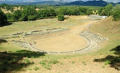 Ancient Theater of Megalopolis Historic site, Megalopoli13 km NW
Sources & licences
Data last updated: · 2 independent sources