- Elevation
- 7 m
- above sea level
- Local time
- UTC+02:00
- Europe/Athens · UTC+02:00
- Airports
- JMK Mykonos Island National Airport39 km
- ATH Athens Eleftherios Venizelos International Airport105 km
About Megas Gialos beach
Megas Gialos beach is a beach. Location: South Aegean, Greece. The best months to visit are May, September–October. The nearest airport is Mykonos Island National Airport (39 km). Nearby sights include Ampela beach and Komito beach.
Climate of Megas Gialos beach
Best months for sightseeingBest months for sightseeing: May, September–October.
This month · November
Outside the best season
Day 19° · Night 15° · Rain 60 mm
- Hottest month
- July (day 30°)
- Coldest month
- February (night 10°)
- Wettest month
- December (71 mm)
- Driest month
- July (2 mm)
Bars: average monthly low and high temperature. Below: precipitation. Monthly averages for 1970–2000 at about 18 km resolution, adjusted for elevation. Highlighted months are mild and relatively dry. Source: WorldClim 2.1 (CC BY 4.0).
Show values as a table
| Month | Jan | Feb | Mar | Apr | May | Jun | Jul | Aug | Sep | Oct | Nov | Dec |
|---|---|---|---|---|---|---|---|---|---|---|---|---|
| Average high (°C) | 14° | 14° | 16° | 19° | 23° | 28° | 30° | 30° | 26° | 23° | 19° | 15° |
| Average low (°C) | 10° | 10° | 12° | 14° | 18° | 23° | 25° | 25° | 22° | 19° | 15° | 12° |
| Precipitation (mm) | 68 | 61 | 51 | 23 | 12 | 4 | 2 | 3 | 6 | 40 | 60 | 71 |
How to get to Megas Gialos beach
The nearest airport is Mykonos Island National Airport (JMK), 39 km to the east as the crow flies. For international flights: Athens Eleftherios Venizelos International Airport (ATH) (105 km). The nearest large city is Athens, 124 km to the northwest.
Airports
- Mykonos Island National Airport (JMK) Mykonos 39 kmeast
- Athens Eleftherios Venizelos International Airport (ATH) Spata-Artemida 105 kmnorthwest
- Santorini International Airport (JTR) Santorini Island 120 kmsoutheast
Nearby large cities
- Athens Population: 664K 124 kmnorthwest
- Piraeus Population: 163.7K 128 kmnorthwest
- Konak Population: 332.3K 224 kmnortheast
- Karabağlar Population: 479.3K 225 kmnortheast
- Çiğli Population: 214.1K 227 kmnortheast
Straight-line distances; road distances are longer. Airport data: OurAirports.
Nearest towns and villages
-
Syros Municipality, Nomós Kykládon5.4 km N
-
Vari Village, Syros4.2 km NE
-
Poseidonia Village, Syros2.4 km NW
-
Áno Sýros Village, Syros8.2 km N
-
Platy Vouni Village, Syros11 km N
-
Tinos Municipality, Nomós Kykládon32 km NE
Nearby attractions & nature
Everything nearby-
Ampela beach Beach, Syros0.4 km SW
-
Komito beach Beach, South Aegean2.4 km W
-
Fetouri beach Beach, South Aegean2.5 km NW
-
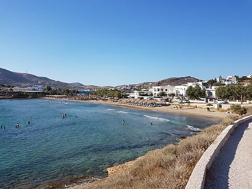 Agathopes Beach Beach, South Aegean2.6 km W
-
Axladi beach Beach, Syros3 km E
-
Foinikas beach Beach, South Aegean3.2 km NW
-
Vari beach Beach, Syros3.5 km E
-
Kokkina beach Beach, South Aegean3.9 km NW
More lakes, rivers and coasts in Greece
-
Armeos Beach Beach, Syros5.5 km NW
-
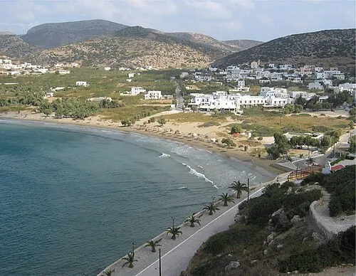 Galissas Beach Beach, Syros5.5 km NW
-
Azolimnos beach Beach, Syros6 km NE
-
Lotos beach Beach, Syros7.2 km N
-
Kimata beach Beach, Syros7.8 km NE
-
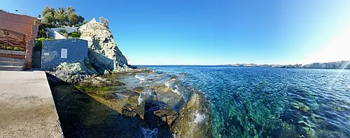 Asteria beach Beach, Syros8.2 km NE
Sources & licences
Data last updated: · 2 independent sources