Heraklia
Located in Naxos and Lesser Cyclades, Nomós Kykládon Coordinates: 36°50′15″ N 25°27′21″ E
- Population
- 148
- 148
- Elevation
- 157 m
- above sea level
- Local time
- UTC+02:00
- Europe/Athens · UTC+02:00
- Airports
- JTR Santorini International Airport49 km
- JMK Mykonos Island National Airport67 km
About Heraklia
Heraklia is a village. Location: Naxos and Lesser Cyclades, Nomós Kykládon. Population: 148. Elevation: 157 m. The best months to visit are May–June, August–October. The nearest airport is Santorini International Airport (49 km). Nearby sights include Agiassos beach and Nisída Megali Plaka.
Climate of Heraklia
Best months for sightseeingBest months for sightseeing: May–June, August–October.
This month · November
Outside the best season
Day 18° · Night 13° · Rain 65 mm
- Hottest month
- July (day 28°)
- Coldest month
- February (night 9°)
- Wettest month
- January (83 mm)
- Driest month
- July (1 mm)
Bars: average monthly low and high temperature. Below: precipitation. Monthly averages for 1970–2000 at about 18 km resolution, adjusted for elevation. Highlighted months are mild and relatively dry. Source: WorldClim 2.1 (CC BY 4.0).
Show values as a table
| Month | Jan | Feb | Mar | Apr | May | Jun | Jul | Aug | Sep | Oct | Nov | Dec |
|---|---|---|---|---|---|---|---|---|---|---|---|---|
| Average high (°C) | 13° | 14° | 15° | 18° | 22° | 26° | 28° | 28° | 25° | 22° | 18° | 15° |
| Average low (°C) | 9° | 9° | 10° | 12° | 16° | 20° | 22° | 22° | 20° | 17° | 13° | 11° |
| Precipitation (mm) | 83 | 73 | 59 | 25 | 12 | 4 | 1 | 3 | 7 | 45 | 65 | 79 |
Other places to visit in this season: May June August September October
How to get to Heraklia
The nearest airport is Santorini International Airport (JTR), 49 km to the south as the crow flies. The nearest large city is Athens, 199 km to the northwest.
Airports
- Santorini International Airport (JTR) Santorini Island 49 kmsouth
- Mykonos Island National Airport (JMK) Mykonos 67 kmnorth
- Kos International Airport "Ippokratis" (KGS) Kos Island 146 kmeast
Nearby large cities
- Athens Population: 664K 199 kmnorthwest
- Piraeus Population: 163.7K 202 kmnorthwest
- Konak Population: 332.3K 226 kmnortheast
- Karabağlar Population: 479.3K 226 kmnortheast
- Izmir Population: 2.9M 229 kmnortheast
Straight-line distances; road distances are longer. Airport data: OurAirports.
Day trips from Heraklia
Within 100 km: 10 historic and cultural sites, 1 natural site, 50 lakes, rivers and coasts.
0–25 km11 places
- Agiassos beach Beach 15 kmN
- Nisída Kopriá Island 23 kmNE
- Nisída Megali Plaka Island 16 kmE
- Parthenos Island 23 kmN
25–60 km16 places
- Cyclades Island 53 kmNW
- Santorini Island 48 kmS
- Moni Agiou Arseniou Attraction 37 kmNW
- Aghios Prokopios beach Beach 28 kmN
60–100 km34 places
- Nisída Lignó Island 89 kmE
- Panagia Vrisis Attraction 66 kmW
- Ampela beach Beach 77 kmNW
- Fetouri beach Beach 80 kmNW
Straight-line distances.
Nearby attractions & nature
Everything nearby-
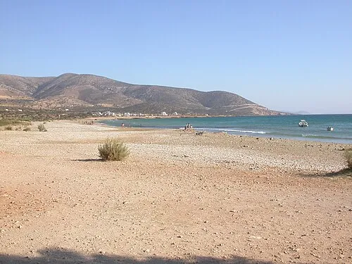 Agiassos beach Beach, Naxos and Lesser Cyclades15 km N
-
Nisída Megali Plaka Island, Naxos and Lesser Cyclades16 km E
-
Nisída Plakí Island, Naxos and Lesser Cyclades17 km E
-
Nisída Tsouloufi Island, Naxos and Lesser Cyclades15 km E
-
Nisída Lazaros Island, Naxos and Lesser Cyclades15 km E
-
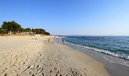 Kastraki beach Beach, Naxos and Lesser Cyclades20 km N
Sources & licences
Data last updated: