- Population
- 73,834
- 73.8K
- Elevation
- 241 m
- above sea level
- Local time
- UTC+01:00
- Europe/Budapest · UTC+01:00
- Airports
- BUD Budapest Liszt Ferenc International Airport66 km
- SLD Sliač Airport112 km
About Gyöngyösi Járás
Gyöngyösi Járás is a district. Location: Heves County, Hungary. Population: 73,834. The best months to visit are May–September. The nearest airport is Budapest Liszt Ferenc International Airport (66 km). Nearby sights include Gyöngyös Ghetto and Sombokor.
Climate of Gyöngyösi Járás
Best months for sightseeingBest months for sightseeing: May–September.
This month · November
A cold month
Day 7° · Night 0° · Rain 45 mm
- Hottest month
- July (day 27°)
- Coldest month
- January (night -5°)
- Wettest month
- June (64 mm)
- Driest month
- January (25 mm)
Bars: average monthly low and high temperature. Below: precipitation. Monthly averages for 1970–2000 at about 18 km resolution, adjusted for elevation. Highlighted months are mild and relatively dry. Source: WorldClim 2.1 (CC BY 4.0).
Show values as a table
| Month | Jan | Feb | Mar | Apr | May | Jun | Jul | Aug | Sep | Oct | Nov | Dec |
|---|---|---|---|---|---|---|---|---|---|---|---|---|
| Average high (°C) | 1° | 4° | 10° | 16° | 22° | 25° | 27° | 26° | 21° | 15° | 7° | 2° |
| Average low (°C) | -5° | -4° | 0° | 4° | 9° | 13° | 14° | 14° | 10° | 5° | 0° | -3° |
| Precipitation (mm) | 25 | 25 | 26 | 44 | 62 | 64 | 57 | 51 | 46 | 37 | 45 | 33 |
Other places to visit in this season: May June July August September
How to get to Gyöngyösi Járás
The nearest airport is Budapest Liszt Ferenc International Airport (BUD), 66 km to the southwest as the crow flies. The nearest large city is Miskolc, 71 km to the northeast.
Airports
- Budapest Liszt Ferenc International Airport (BUD) Budapest 66 kmsouthwest
- Sliač Airport (SLD) Sliač 112 kmnorthwest
- Debrecen International Airport (DEB) Debrecen 129 kmeast
Nearby large cities
- Miskolc Population: 154.5K 71 kmnortheast
- Kecskemét Population: 109.8K 100 kmsouth
- Debrecen Population: 202.4K 129 kmeast
- Nyíregyháza Population: 117.7K 133 kmeast
- Székesfehérvár Population: 101.6K 134 kmsouthwest
Straight-line distances; road distances are longer. Airport data: OurAirports.
Day trips from Gyöngyösi Járás
Within 100 km: 62 historic and cultural sites, 34 natural sites, 2 lakes, rivers and coasts.
0–25 km10 places
- Szederjes Mountain 16 kmNE
- Gyöngyös Ghetto Historic site 2 kmSW
- Sombokor Mountain 10 kmN
- Remete-tető Mountain 18 kmNE
25–60 km27 places
- Szána-bérc Mountain 50 kmNE
- Nagyhalom Mountain 44 kmS
- Bolnoka Mountain 54 kmSW
- Jászberény Ghetto Historic site 32 kmS
60–100 km61 places
- Margaret Island Island 74 kmSW
- Sziklafal Mountain 84 kmW
- Iharos Mountain 91 kmSW
- Budafok Ghetto Historic site 81 kmSW
Straight-line distances.
Nearby attractions & nature
Everything nearby-
Gyöngyös Ghetto Historic site, Heves County2.4 km SW
-
Sombokor Mountain, Heves County10 km N
-
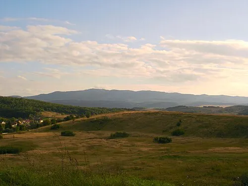 Mátra Mountain, Hungary10 km N
-
Szederjes Mountain, Heves County16 km NE
-
Remete-tető Mountain, Heves County18 km NE
-
Lajszka Mountain, Nógrád megye18 km N
Sources & licences
Data last updated: