Kunszentmárton Ghetto
Located in Jász-Nagykun-Szolnok, Hungary Coordinates: 46°50′00″ N 20°17′00″ E
- Local time
- UTC+01:00
- Europe/Budapest · UTC+01:00
- Elevation
- 83 m
- above sea level
- Airports
- BUD Budapest Liszt Ferenc International Airport102 km
- ARW Arad International Airport105 km
About Kunszentmárton Ghetto
Kunszentmárton Ghetto is a historic site. Location: Jász-Nagykun-Szolnok, Hungary. The best months to visit are May–June, September. The nearest airport is Budapest Liszt Ferenc International Airport (102 km). Nearby sights include Tiszaföldvár Ghetto and Csongrád Ghetto.
Climate of Kunszentmárton Ghetto
Best months for sightseeingBest months for sightseeing: May–June, September.
This month · November
A cold month
Day 8° · Night 1° · Rain 43 mm
- Hottest month
- July (day 28°)
- Coldest month
- January (night -4°)
- Wettest month
- June (63 mm)
- Driest month
- February (28 mm)
Bars: average monthly low and high temperature. Below: precipitation. Monthly averages for 1970–2000 at about 18 km resolution, adjusted for elevation. Highlighted months are mild and relatively dry. Source: WorldClim 2.1 (CC BY 4.0).
Show values as a table
| Month | Jan | Feb | Mar | Apr | May | Jun | Jul | Aug | Sep | Oct | Nov | Dec |
|---|---|---|---|---|---|---|---|---|---|---|---|---|
| Average high (°C) | 2° | 5° | 11° | 16° | 22° | 25° | 28° | 28° | 23° | 17° | 8° | 3° |
| Average low (°C) | -4° | -3° | 1° | 5° | 10° | 13° | 15° | 14° | 10° | 5° | 1° | -2° |
| Precipitation (mm) | 30 | 28 | 28 | 40 | 53 | 63 | 54 | 53 | 45 | 35 | 43 | 43 |
How to get to Kunszentmárton Ghetto
The nearest airport is Budapest Liszt Ferenc International Airport (BUD), 102 km to the northwest as the crow flies. The nearest large city is Kecskemét, 46 km to the west.
Airports
- Budapest Liszt Ferenc International Airport (BUD) Budapest 102 kmnorthwest
- Arad International Airport (ARW) Arad 105 kmsoutheast
- Debrecen International Airport (DEB) Debrecen 125 kmnortheast
Nearby large cities
- Kecskemét Population: 109.8K 46 kmwest
- Szeged Population: 160.8K 65 kmsouth
- Arad Population: 169.1K 107 kmsoutheast
- Oradea Population: 183.1K 127 kmeast
- Debrecen Population: 202.4K 128 kmnortheast
Straight-line distances; road distances are longer. Airport data: OurAirports.
Day trips from Kunszentmárton Ghetto
Within 100 km: 45 historic and cultural sites, 8 natural sites.
0–25 km4 places
- Csongrád Ghetto Historic site 18 kmSW
- Szentes Ghetto Historic site 20 kmS
- Szarvas Ghetto Historic site 21 kmE
- Tiszaföldvár Ghetto Historic site 17 kmN
25–60 km20 places
- Kistelek Ghetto Historic site 47 kmSW
- Vaszkó-halom Mountain 38 kmE
- Endrőd Ghetto Historic site 40 kmE
- Gyoma Ghetto Historic site 44 kmE
60–100 km29 places
- Mezőkovácsháza Ghetto Historic site 68 kmSE
- Berencsik Mountain 61 kmNW
- Gyula Ghetto Historic site 79 kmE
- Nagykáta Ghetto Historic site 76 kmNW
Straight-line distances.
Nearby attractions & nature
Everything nearby-
Tiszaföldvár Ghetto Historic site, Jász-Nagykun-Szolnok17 km N
-
Csongrád Ghetto Historic site, Csongrád megye18 km SW
-
Szentes Ghetto Historic site, Csongrád megye20 km S
-
Szarvas Ghetto Historic site, Bekes County21 km E
Nearest towns and villages
-
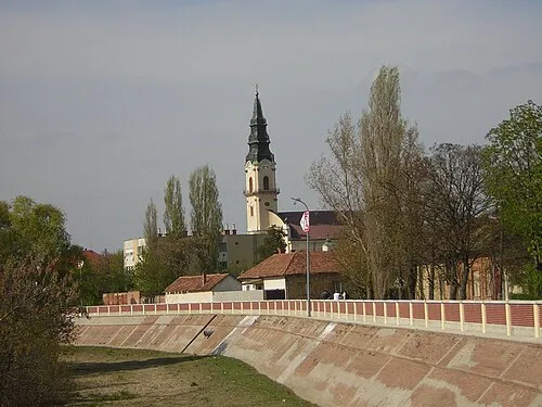 Kunszentmárton City, Jász-Nagykun-Szolnok0.8 km NE
-
Szelevény Village, Jász-Nagykun-Szolnok7 km SW
-
Cserkeszőlő Village, Jász-Nagykun-Szolnok8.1 km NW
-
Öcsöd Village, Jász-Nagykun-Szolnok12 km NE
Sources & licences
Data last updated: · 2 independent sources