- Elevation
- 155 m
- above sea level
- Local time
- UTC+00:00
- Europe/Dublin · UTC+00:00
- Airports
- ORK Cork International Airport104 km
- SNN Shannon Airport106 km
About Screhan
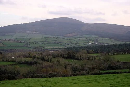
Screhan is a mountain. Location: County Kilkenny, Leinster. Elevation: 155 m. The best months to visit are June–September. The nearest airport is Cork International Airport (104 km). Nearby sights include Carricknagappul and Faranaree Hill.
Climate of Screhan
Best months for sightseeingBest months for sightseeing: June–September.
This month · November
A wet month
Day 10° · Night 3° · Rain 105 mm
- Hottest month
- July (day 19°)
- Coldest month
- January (night 2°)
- Wettest month
- January (116 mm)
- Driest month
- July (62 mm)
Bars: average monthly low and high temperature. Below: precipitation. Monthly averages for 1970–2000 at about 18 km resolution, adjusted for elevation. Highlighted months are mild and relatively dry. Source: WorldClim 2.1 (CC BY 4.0).
Show values as a table
| Month | Jan | Feb | Mar | Apr | May | Jun | Jul | Aug | Sep | Oct | Nov | Dec |
|---|---|---|---|---|---|---|---|---|---|---|---|---|
| Average high (°C) | 7° | 8° | 10° | 12° | 15° | 17° | 19° | 19° | 17° | 13° | 10° | 8° |
| Average low (°C) | 2° | 2° | 3° | 4° | 6° | 9° | 11° | 10° | 8° | 6° | 3° | 2° |
| Precipitation (mm) | 116 | 95 | 83 | 65 | 72 | 64 | 62 | 87 | 85 | 111 | 105 | 113 |
Other places to visit in this season: June July August September
How to get to Screhan
The nearest airport is Cork International Airport (ORK), 104 km to the southwest as the crow flies. The nearest large city is Limerick, 85 km to the west.
Airports
- Cork International Airport (ORK) Cork 104 kmsouthwest
- Shannon Airport (SNN) Shannon 106 kmwest
- Dublin Airport (DUB) Dublin 129 kmnortheast
Nearby large cities
- Limerick Population: 102.3K 85 kmwest
- Cork Population: 224K 99 kmsouthwest
- Dublin Population: 1M 121 kmnortheast
- Belfast Population: 348K 254 kmnorth
- Swansea Population: 300.4K 256 kmeast
Straight-line distances; road distances are longer. Airport data: OurAirports.
Nearest towns and villages
-
Coolaghflags Village, County Kilkenny1.5 km NE
-
Callan Village, County Kilkenny6 km N
-
Kilmaganny Village, County Kilkenny5.8 km SE
-
Killamery Village, County Kilkenny3.6 km SW
-
Windgap Village, County Kilkenny3.3 km S
-
Poulacapple Village, County Tipperary3 km W
Nearby attractions & nature
Everything nearby-
Carricknagappul Mountain, County Kilkenny3.4 km S
-
Faranaree Hill Mountain, County Kilkenny3.7 km SW
-
Carrigmaclea Mountain, County Tipperary7.6 km SW
-
Carrignagapple Mountain, County Tipperary9.6 km SW
-
Kilmacaliver Hill Mountain, County Kilkenny9.9 km S
-
Carriganog Hill Mountain, County Kilkenny10 km S
-
Carrigadoon Hill Mountain, County Tipperary8.9 km S
-
Carricktriss Gorse Mountain, County Kilkenny12 km SE
More nature in Ireland
-
Ballykeefe Wood Natural site, County Kilkenny13 km N
-
Corbally Hill Mountain, County Kilkenny16 km SE
-
Boggan Mountain, County Kilkenny21 km N
-
 Brandon Hill Mountain, County Kilkenny29 km E
-
Corbally Wood Natural site, County Kilkenny16 km SE
-
Drumshane Hill Mountain, County Kilkenny23 km N
Sources & licences
Data last updated: