- Local time
- UTC+00:00
- Europe/Dublin · UTC+00:00
- Elevation
- 16 m
- above sea level
- Airports
- DUB Dublin Airport64 km
- BFS Belfast International Airport74 km
About Oriel Park
Oriel Park is a landmark. Location: County Louth, Leinster.
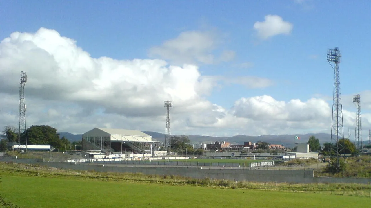
Oriel Park is a UEFA Category 2 football stadium located on the Carrickmacross Road in Dundalk, Ireland. The stadium is the home ground of Dundalk Football Club and is owned and operated by the club on land that has been leased from the Casey Family Trust since 1936. The ground has a capacity of 3,100 for European matches (i.e. 3,100 seats) and 4,500 for domestic games (i.e. with the remainder standing).
Source: Wikipedia · CC BY-SA 4.0
At a glance
- Built
- 1919
- Opened
- 1919
Source: Wikidata
Climate of Oriel Park
Best months for sightseeingBest months for sightseeing: June–September.
This month · November
A wet month
Day 10° · Night 4° · Rain 104 mm
- Hottest month
- July (day 20°)
- Coldest month
- January (night 2°)
- Wettest month
- January (111 mm)
- Driest month
- April (62 mm)
Bars: average monthly low and high temperature. Below: precipitation. Monthly averages for 1970–2000 at about 18 km resolution, adjusted for elevation. Highlighted months are mild and relatively dry. Source: WorldClim 2.1 (CC BY 4.0).
Show values as a table
| Month | Jan | Feb | Mar | Apr | May | Jun | Jul | Aug | Sep | Oct | Nov | Dec |
|---|---|---|---|---|---|---|---|---|---|---|---|---|
| Average high (°C) | 7° | 8° | 10° | 12° | 15° | 18° | 20° | 19° | 17° | 14° | 10° | 8° |
| Average low (°C) | 2° | 2° | 3° | 4° | 6° | 9° | 11° | 11° | 9° | 7° | 4° | 2° |
| Precipitation (mm) | 111 | 83 | 86 | 62 | 67 | 69 | 66 | 86 | 82 | 100 | 104 | 105 |
Other places to visit in this season: June July August September
How to get to Oriel Park
The nearest airport is Dublin Airport (DUB), 64 km to the south as the crow flies. The nearest large city is Belfast, 74 km to the northeast.
Airports
- Dublin Airport (DUB) Dublin 64 kmsouth
- Belfast International Airport (BFS) Belfast 74 kmnorth
- George Best Belfast City Airport (BHD) Belfast 77 kmnortheast
Nearby large cities
- Belfast Population: 348K 74 kmnortheast
- Dublin Population: 1M 75 kmsouth
- Limerick Population: 102.3K 209 kmsouthwest
- Blackpool Population: 145K 222 kmeast
- Birkenhead Population: 325.3K 235 kmeast
Straight-line distances; road distances are longer. Airport data: OurAirports.
Day trips from Oriel Park
Within 100 km: 219 historic and cultural sites, 376 natural sites, 546 lakes, rivers and coasts.
0–25 km86 places
- White Island Island 24 kmNW
- Black Island Island 24 kmNW
- Lough Ross Lake 18 kmNW
- Camlough Reservoir Lake 17 kmN
25–60 km361 places
- Rockabill Island 52 kmSE
- Pollboy Bridge Landmark 42 kmSW
- Reedy Flat Island 58 kmN
- Skerries Islands Island 51 kmSE
60–100 km694 places
- Sandymount Strand Beach 76 kmS
- Portmarnock Beach Beach 68 kmS
- Reagh Island Island 76 kmNE
- Rams Island Island 66 kmN
Straight-line distances.
Nearby attractions & nature
Everything nearby-
Castletown River, United Kingdom1.1 km E
-
Dundalk Stadium Landmark, County Louth3.3 km NE
-
Kilcurry River River, United Kingdom3.2 km N
-
Stephenstown Pond Nature Park Natural site, County Louth4.9 km SW
-
Cortial Lough Lake, County Louth5.6 km W
-
Cull Water River, United Kingdom4.2 km N
-
Moiry Castle Historic site, Newry Mourne and Down8 km N
-
Flurry River, United Kingdom4.4 km NE
Nearest towns and villages
-
Dundalk City, County Louth0.1 km N
-
Blackrock Town, County Louth5.1 km SE
-
Knockbridge Village, County Louth5.4 km SW
-
Littlemill Village, County Louth2.2 km SW
More sights in County Louth
-
 Hunky Dorys Park Landmark, County Louth31 km S
-
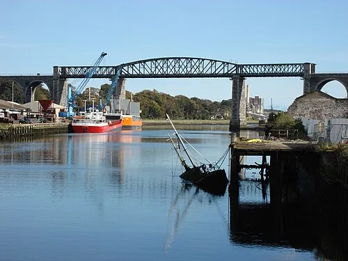 Boyne Viaduct Landmark, County Louth32 km S
-
Barmeath Castle Historic site, County Louth19 km S
-
Mellifont Abbey Historic site, County Louth28 km S
Sources & licences
Data last updated: · 2 independent sources