- Elevation
- 59 m
- above sea level
- Local time
- UTC+00:00
- Europe/Dublin · UTC+00:00
- Airports
- ORK Cork International Airport90 km
- SNN Shannon Airport114 km
About Whitestown Cross Roads
Whitestown Cross Roads is a village. Location: Waterford, Munster. Elevation: 59 m. The best months to visit are June–August. The nearest airport is Cork International Airport (90 km). Nearby sights include De La Poer Tower and Donnell's Hill.
Photos of Whitestown Cross Roads
-
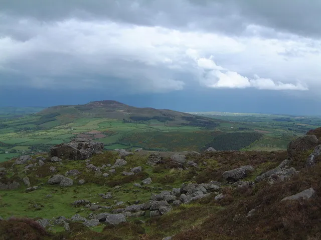
Croughaun Hill Peter Taylor · CC BY-SA 2.0 -
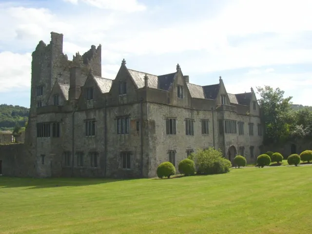
Ormonde Castle Humphrey Bolton · CC BY-SA 2.0


Climate of Whitestown Cross Roads
Best months for sightseeingBest months for sightseeing: June–August.
This month · November
A wet month
Day 10° · Night 4° · Rain 107 mm
- Hottest month
- July (day 20°)
- Coldest month
- January (night 2°)
- Wettest month
- January (120 mm)
- Driest month
- July (61 mm)
Bars: average monthly low and high temperature. Below: precipitation. Monthly averages for 1970–2000 at about 18 km resolution, adjusted for elevation. Highlighted months are mild and relatively dry. Source: WorldClim 2.1 (CC BY 4.0).
Show values as a table
| Month | Jan | Feb | Mar | Apr | May | Jun | Jul | Aug | Sep | Oct | Nov | Dec |
|---|---|---|---|---|---|---|---|---|---|---|---|---|
| Average high (°C) | 8° | 8° | 10° | 13° | 15° | 18° | 20° | 20° | 17° | 14° | 10° | 8° |
| Average low (°C) | 2° | 2° | 3° | 5° | 7° | 10° | 12° | 11° | 9° | 7° | 4° | 3° |
| Precipitation (mm) | 120 | 98 | 82 | 64 | 73 | 63 | 61 | 85 | 86 | 113 | 107 | 117 |
How to get to Whitestown Cross Roads
The nearest airport is Cork International Airport (ORK), 90 km to the southwest as the crow flies. The nearest large city is Cork, 85 km to the southwest.
Airports
- Cork International Airport (ORK) Cork 90 kmsouthwest
- Shannon Airport (SNN) Shannon 114 kmnorthwest
- Kerry Airport (KIR) Farranfore 146 kmwest
Nearby large cities
- Cork Population: 224K 85 kmsouthwest
- Limerick Population: 102.3K 94 kmnorthwest
- Dublin Population: 1M 140 kmnortheast
- Swansea Population: 300.4K 248 kmeast
- Belfast Population: 348K 276 kmnorth
Straight-line distances; road distances are longer. Airport data: OurAirports.
Day trips from Whitestown Cross Roads
Within 100 km: 215 historic and cultural sites, 639 natural sites, 353 lakes, rivers and coasts.
0–25 km119 places
- Gull Island Island 18 kmS
- Sheep Island Island 21 kmSE
- Coumshingaun Lough Lake 10 kmW
- Lough Coumfea Lake 15 kmW
25–60 km370 places
- Saltee Islands Island 57 kmE
- Keeragh Islands Island 46 kmE
- Capel Island Island 55 kmSW
- Cull Island Island 52 kmE
60–100 km718 places
- Curracloe Beach Beach 71 kmE
- Sovereign Islands Island 99 kmSW
- Saint Thomas Island Island 95 kmNW
- Rocky Island Island 80 kmSW
Straight-line distances.
Nearby attractions & nature
Everything nearby-
De La Poer Tower Landmark, Waterford4.3 km NE
-
Donnell's Hill Mountain, Waterford4.1 km E
-
Glenhouse Wood Natural site, Munster5.5 km E
-
Ormonde Castle Historic site, County Tipperary7.3 km N
-
Brownswood Natural site, Munster5.9 km NE
-
Croughaun Hill Mountain, Waterford5 km SW
Other cities and towns in Waterford
-
Kilmacthomas Village, Waterford8.6 km S
-
 Kilmeadan Village, Waterford11 km SE
-
Robertstown Village, Waterford4.2 km S
-
 Rathgormack Village, Waterford7.8 km W
-
Piquet’s Cross Roads Village, Waterford4.8 km N
-
Guilcagh Cross Roads Village, Waterford4.8 km SE
Sources & licences
Data last updated: