Castel di Sasso
Located in Province of Caserta, Campania Coordinates: 41°11′33″ N 14°16′40″ E
- Population
- 1,133
- 1.1K
- Elevation
- 202 m
- above sea level
- Local time
- UTC+01:00
- Europe/Rome · UTC+01:00
- Places inside
- 12
- listed under Castel di Sasso
- Airports
- NAP Naples International Airport34 km
- QSR Salerno Costa d'Amalfi Airport83 km
About Castel di Sasso
Castel di Sasso is a municipality. Location: Province of Caserta, Campania. Population: 1,133. Elevation: 202 m. The best months to visit are May–July, September–October. The nearest airport is Naples International Airport (34 km). Nearby sights include Monte S. Croce and Monte Grande.
Climate of Castel di Sasso
Best months for sightseeingBest months for sightseeing: May–July, September–October.
This month · November
A wet month
Day 15° · Night 7° · Rain 122 mm
- Hottest month
- August (day 29°)
- Coldest month
- January (night 3°)
- Wettest month
- November (122 mm)
- Driest month
- July (28 mm)
Bars: average monthly low and high temperature. Below: precipitation. Monthly averages for 1970–2000 at about 18 km resolution, adjusted for elevation. Highlighted months are mild and relatively dry. Source: WorldClim 2.1 (CC BY 4.0).
Show values as a table
| Month | Jan | Feb | Mar | Apr | May | Jun | Jul | Aug | Sep | Oct | Nov | Dec |
|---|---|---|---|---|---|---|---|---|---|---|---|---|
| Average high (°C) | 11° | 11° | 14° | 16° | 21° | 25° | 28° | 29° | 25° | 20° | 15° | 12° |
| Average low (°C) | 3° | 3° | 5° | 8° | 12° | 16° | 18° | 18° | 15° | 12° | 7° | 4° |
| Precipitation (mm) | 86 | 73 | 68 | 73 | 51 | 33 | 28 | 45 | 73 | 101 | 122 | 95 |
Other places to visit in this season: May June July September October
How to get to Castel di Sasso
The nearest airport is Naples International Airport (NAP), 34 km to the south as the crow flies. The nearest large city is Split, 313 km to the northeast.
Airports
- Naples International Airport (NAP) Napoli 34 kmsouth
- Salerno Costa d'Amalfi Airport (QSR) Salerno 83 kmsoutheast
- Foggia Gino Lisa Airport (FOG) Foggia (FG) 109 kmeast
Nearby large cities
- Split Population: 149.8K 313 kmnortheast
Straight-line distances; road distances are longer. Airport data: OurAirports.
Day trips from Castel di Sasso
Within 100 km: 70 historic and cultural sites, 190 natural sites, 42 lakes, rivers and coasts.
0–25 km13 places
- Serra di Vallelonga Mountain 25 kmN
- Monte Sant'Angeli Mountain 15 kmN
- Monte San Nicola Mountain 19 kmNW
- Monte Raspato Mountain 25 kmN
25–60 km112 places
- Colle Umberto Mountain 42 kmS
- Valle Covatta Natural site 57 kmNE
- Spiaggia dei Sassolini Beach 49 kmW
- S.L.O Rodolfo beach Beach 35 kmSW
60–100 km177 places
- Vallone Grande Natural site 76 kmNE
- Sombrero Beach 87 kmW
- La Bussola Beach 99 kmW
- Spiaggia delle Bambole Beach 67 kmW
Straight-line distances.
Places in Castel di Sasso
12 places- 1 Castel di Sasso 1.2K
- 2 Strangolagalli 150
- 3 Cisterna 88
- 4 Prea 78
- 5 Sasso 54
- 6 Maranisi 53
- 7 Arbusto 42
- 8 Morrone 41
- 9 San Marco 30
- 10 Ferrucci 21
- 11 Buonomini 19
- 12 Espignole 10
Bar: population relative to the most populous place in this list.
Nearby attractions & nature
Everything nearby-
Monte S. Croce Mountain, Piana di Monte Verna4.3 km E
-
Monte Grande Mountain, Piana di Monte Verna4.7 km E
-
Castelluccio Mountain, Caiazzo4.8 km E
-
Monte Provolaro Mountain, Dragoni8.3 km N
-
 Capua Cathedral Attraction, Capua11 km SW
-
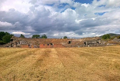 Cales Historic site, Calvi Risorta12 km W
-
Valle Rave Natural site, Campania14 km N
-
Monte Sant'Angeli Mountain, Pietravairano15 km N
Sources & licences
Data last updated: