- Population
- 5,352
- 5.4K
- Elevation
- 544 m
- above sea level
- Local time
- UTC+01:00
- Europe/Rome · UTC+01:00
- Places inside
- 11
- listed under Padula
- Airports
- QSR Salerno Costa d'Amalfi Airport70 km
- FOG Foggia Gino Lisa Airport122 km
About Padula
Padula is a municipality. Location: Province of Salerno, Campania. Population: 5,352. Elevation: 544 m. The best months to visit are May–September. The nearest airport is Salerno Costa d'Amalfi Airport (70 km). Nearby sights include Concattedrale di Marsico Nuovo and Monte Volturino.
Photos of Padula
-
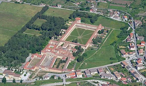
Certosa di Padula Carsten Steger · CC BY-SA 4.0

Climate of Padula
Best months for sightseeingBest months for sightseeing: May–September.
This month · November
Outside the best season
Day 13° · Night 7° · Rain 98 mm
- Hottest month
- August (day 27°)
- Coldest month
- January (night 3°)
- Wettest month
- November (98 mm)
- Driest month
- July (23 mm)
Bars: average monthly low and high temperature. Below: precipitation. Monthly averages for 1970–2000 at about 18 km resolution, adjusted for elevation. Highlighted months are mild and relatively dry. Source: WorldClim 2.1 (CC BY 4.0).
Show values as a table
| Month | Jan | Feb | Mar | Apr | May | Jun | Jul | Aug | Sep | Oct | Nov | Dec |
|---|---|---|---|---|---|---|---|---|---|---|---|---|
| Average high (°C) | 8° | 9° | 12° | 15° | 20° | 24° | 27° | 27° | 23° | 18° | 13° | 10° |
| Average low (°C) | 3° | 3° | 5° | 7° | 11° | 15° | 18° | 18° | 15° | 11° | 7° | 4° |
| Precipitation (mm) | 77 | 77 | 67 | 73 | 48 | 31 | 23 | 34 | 58 | 83 | 98 | 90 |
Other places to visit in this season: May June July August September
How to get to Padula
The nearest airport is Salerno Costa d'Amalfi Airport (QSR), 70 km to the northwest as the crow flies. For international flights: Bari Karol Wojtyła International Airport (BRI) (129 km). The nearest large city is Split, 358 km to the north.
Airports
- Salerno Costa d'Amalfi Airport (QSR) Salerno 70 kmnorthwest
- Foggia Gino Lisa Airport (FOG) Foggia (FG) 122 kmnorth
- Bari Karol Wojtyła International Airport (BRI) Bari 129 kmnortheast
Nearby large cities
- Split Population: 149.8K 358 kmnorth
Straight-line distances; road distances are longer. Airport data: OurAirports.
Day trips from Padula
Within 100 km: 17 historic and cultural sites, 77 natural sites, 19 lakes, rivers and coasts.
0–25 km9 places
- Monte Volturino Mountain 16 kmNE
- Monte Castagnareto Mountain 25 kmSE
- Appennino Meridionale Mountain 22 kmNW
- Monte Rotondo Mountain 17 kmS
25–60 km40 places
- Monte del Papa Mountain 27 kmSE
- Spiaggia Agropoli Beach 56 kmW
- Spiaggia Lido Linora Beach 56 kmW
- Spiaggia Lido Raggio Verde Beach 58 kmW
60–100 km64 places
- SoundRise Beach Beach 88 kmE
- Spiaggia di Magazzeno Beach 74 kmNW
- Spiaggia di Torre Picentina Beach 77 kmNW
- Spiaggia di Spineta Beach 70 kmW
Straight-line distances.
Places in Padula
11 places- 1 Padula 2.7K
- 2 Volta Cammino 390
- 3 Sterpone 296
- 4 San Giacomo 215
- 5 Ascolese 203
- 6 Contrada Carrarola 153
- 7 Contrada Noce del Conte 131
- 8 Contrada Cicirelli 92
- 9 Contrada Fiumicello 82
- 10 Contrada Fontanelle 36
Bar: population relative to the most populous place in this list.
Heritage & sights1
- Certosa di Padula · Attraction
Nearby attractions & nature
Everything nearby-
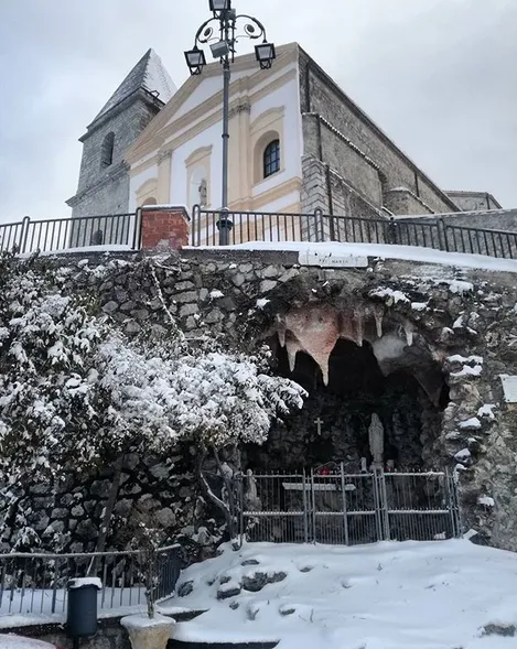 Concattedrale di Marsico Nuovo Attraction, Marsico Nuovo12 km NE
-
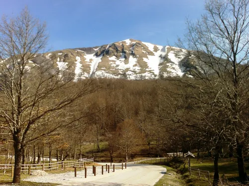 Monte Volturino Mountain, Marsicovetere16 km NE
-
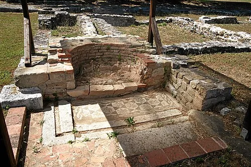 Grumentum Historic site, Grumento Nova22 km E
-
Monte Rotondo Mountain, Casaletto Spartano17 km S
-
Monte Castagnareto Mountain, Lagonegro25 km SE
-
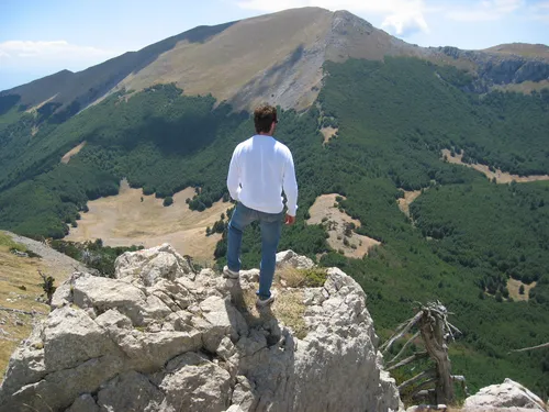 Appennino Meridionale Mountain, Campania22 km NW
-
Valle Sciarapatamo Natural site, Campania25 km SW
-
Valle Soprana Natural site, Campania25 km W
Sources & licences
Data last updated: