Anguillara Sabazia
Located in Province of Rome, Lazio Coordinates: 42°05′15″ N 12°16′36″ E
- Population
- 19,459
- 19.5K
- Elevation
- 194 m
- above sea level
- Local time
- UTC+01:00
- Europe/Rome · UTC+01:00
- Places inside
- 8
- listed under Anguillara Sabazia
- Airports
- FCO Rome–Fiumicino Leonardo da Vinci International Airport31 km
- CIA Ciampino–G. B. Pastine International Airport42 km
About Anguillara Sabazia
Anguillara Sabazia is a municipality. Location: Province of Rome, Lazio. Population: 19,459. Elevation: 194 m. The best months to visit are May–June, September–October. The nearest airport is Rome–Fiumicino Leonardo da Vinci International Airport (31 km). Nearby sights include Monti Sabatini and Monte di Rocca Romana.
Climate of Anguillara Sabazia
Best months for sightseeingBest months for sightseeing: May–June, September–October.
This month · November
Outside the best season
Day 15° · Night 8° · Rain 30 mm
- Hottest month
- July (day 29°)
- Coldest month
- January (night 4°)
- Wettest month
- October (30 mm)
- Driest month
- July (4 mm)
Bars: average monthly low and high temperature. Below: precipitation. Monthly averages for 1970–2000 at about 18 km resolution, adjusted for elevation. Highlighted months are mild and relatively dry. Source: WorldClim 2.1 (CC BY 4.0).
Show values as a table
| Month | Jan | Feb | Mar | Apr | May | Jun | Jul | Aug | Sep | Oct | Nov | Dec |
|---|---|---|---|---|---|---|---|---|---|---|---|---|
| Average high (°C) | 11° | 11° | 14° | 17° | 22° | 26° | 29° | 29° | 25° | 20° | 15° | 12° |
| Average low (°C) | 4° | 4° | 6° | 7° | 12° | 16° | 18° | 19° | 16° | 12° | 8° | 5° |
| Precipitation (mm) | 23 | 21 | 18 | 20 | 14 | 10 | 4 | 11 | 21 | 30 | 30 | 25 |
Other places to visit in this season: May June September October
How to get to Anguillara Sabazia
The nearest airport is Rome–Fiumicino Leonardo da Vinci International Airport (FCO), 31 km to the south as the crow flies. The nearest large city is Split, 375 km to the northeast.
Airports
- Rome–Fiumicino Leonardo da Vinci International Airport (FCO) Rome 31 kmsouth
- Ciampino–G. B. Pastine International Airport (CIA) Rome 42 kmsoutheast
- Perugia San Francesco d'Assisi – Umbria International Airport (PEG) Perugia (PG) 114 kmnorth
Nearby large cities
- Split Population: 149.8K 375 kmnortheast
- Rijeka Population: 108K 400 kmnortheast
Straight-line distances; road distances are longer. Airport data: OurAirports.
Day trips from Anguillara Sabazia
Within 100 km: 123 historic and cultural sites, 165 natural sites, 32 lakes, rivers and coasts.
0–25 km15 places
- Campo di Mare Beach 24 kmSW
- Balneare la Baia Beach Beach 23 kmSW
- Spiaggia di Passo Oscuro Beach 23 kmSW
- Monte Piscina Mountain 25 kmE
25–60 km142 places
- Valle Cerrese Natural site 44 kmNE
- Boca Do Mar Beach 45 kmW
- Spiaggia di Rio Torto Beach 56 kmS
- Spiaggia Torvaianica Beach 53 kmS
60–100 km163 places
- Ultima Spiaggia Beach 76 kmNW
- Siaggia delle graticciare Beach 74 kmNW
- Riva del Marchese Beach 94 kmW
- La capannuccia Beach 90 kmNW
Straight-line distances.
Places in Anguillara Sabazia
8 places- 1 Anguillara Sabazia 14.1K
- 2 Ponton dell'Elce 1.7K
- 3 Vigna di Valle 189
- 4 Barattoli 72
- 5 Falconeto 46
- 6 Albucceto 45
- 7 I Grossi 40
- 8 La Riccia 33
Bar: population relative to the most populous place in this list.
Nearby attractions & nature
Everything nearby-
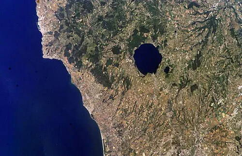 Monti Sabatini Mountain, Lazio9.1 km N
-
Monte di Rocca Romana Mountain, Sutri11 km N
-
Valle della Breccia Natural site, Lazio9.2 km SE
-
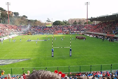 Stadio Flaminio Landmark, Municipio Roma II24 km SE
-
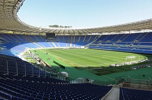 Stadio Olimpico Landmark, Municipio Roma XV23 km SE
-
Valle Covaro Natural site, Lazio13 km N
-
Valle Petrana Natural site, Lazio16 km N
-
Valle dei Salici Natural site, Lazio17 km N
Sources & licences
Data last updated: